")
")
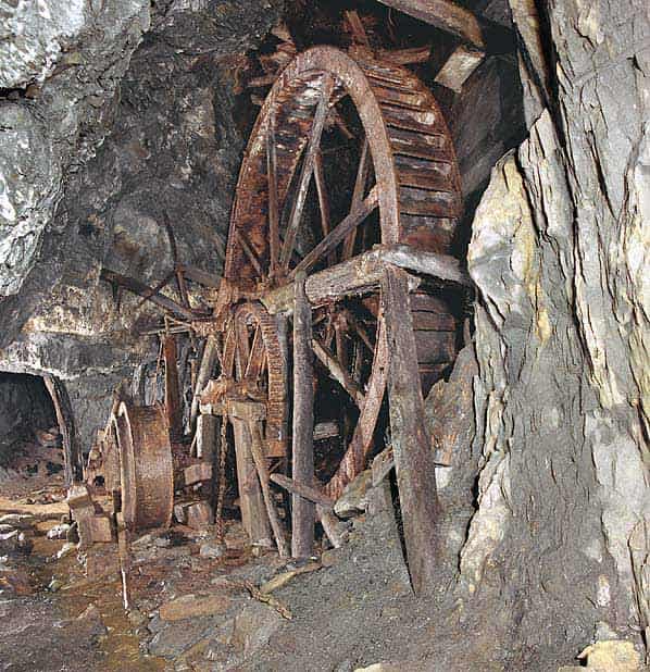
Ystrad Einon Copper mine worked a NE-SW lode which is unusual in mid-Wales and is largely restricted to the Dovey estuary. Development of the mine below adit level did not start until the late 19th century with the sinking of a winze to the 12 fathom level in 1871. A 16' diameter underground waterwheel was installed for pumping and lifting; this allowed the mine to be deepened by another 12 fathoms.
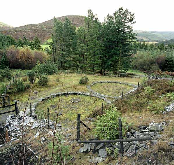
The mine continued to expand with a new engine shaft down to 30 fathoms and on the surface a 1.5 mile leat was constructed to bring water to a new 22.5 foot diameter waterwheel for pumping and winding and a smaller wheel for driving a stone breaker and crushing rolls. A third waterwheel drove two 20' diameter buddles and a six compartment jigger.
Although the new plant was ready for use in 1877 full production didn’t start till 1891 once the ore reserves had been established. The reserves were, however, to prove disappointing and by 1897 only 9 tons of lead ore, 10 tons of blende (zinc) and 45 tons of copper ore had been mined.
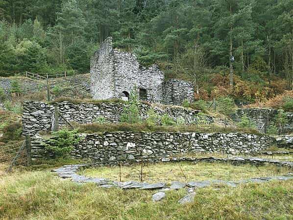
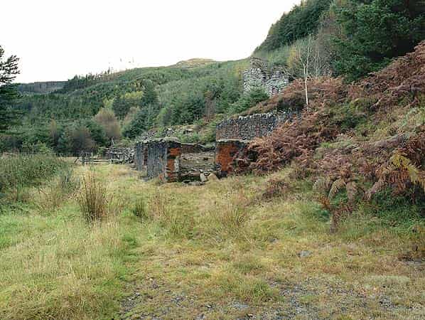
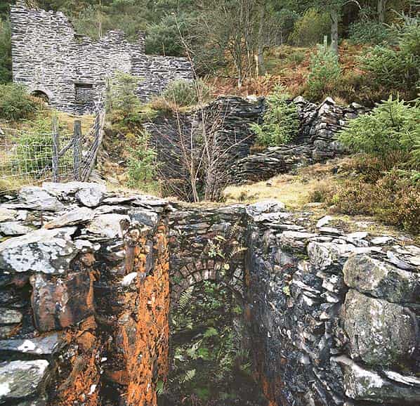
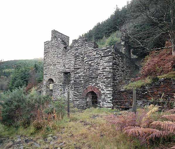
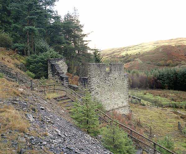
The remains of the mine are located on the edge of a conifer plantation on the south side of Cwm Einon (Artists Valley), at the end of a steep and narrow minor road running 1.5 miles from the A487 at Furnace Bridge. The most prominent feature is the stone crusher house with a large waterwheel pit on the north side. Below the crusher house there is a second wheel pit and the two buddle circles. Alongside are the walls of the jigger building. The remaining buildings are surrounded by fencing with a modern stairway up to the crusher house. The stairway continues above the crusher to the new engine shaft which has been capped with a substantial steel grille.
The whole area has been landscaped to allow public access but the work appears to be unfinished with the fencing extending across the bottom of the steps to prevent them being used. A report published by the Welsh Mines Society is critical of the limited restoration stating “the crusher house has been pointed with little regard for the manner in which its walls were constructed, large amounts of spoil have been un-necessarily removed from around the house and a large number of substantial fences erected without regard to the site layout. The whole presenting an appearance which relates neither to the site when working nor in decay.” The whole site is a scheduled ancient monument.
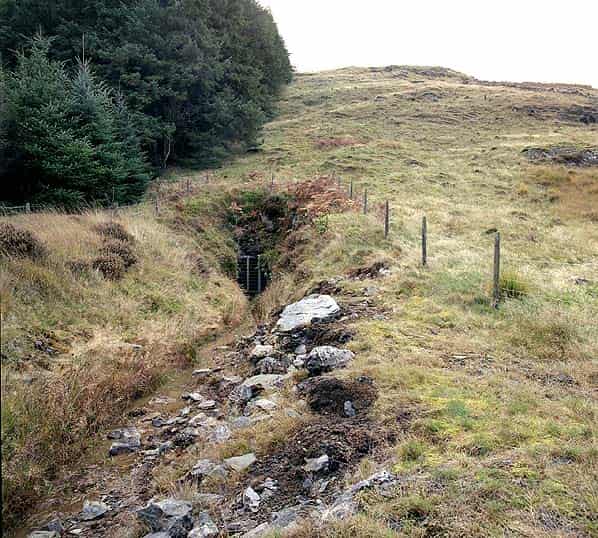
There are two accessible adits, both have been gated but are not locked. The first adit is 70 yards north of the crusher house at the top of a substantial spoil tip; there is a little water in the entrance. After a short distance the level turns to the right into a small stope. It is possible to climb down into the stope but further progress is blocked by falls.
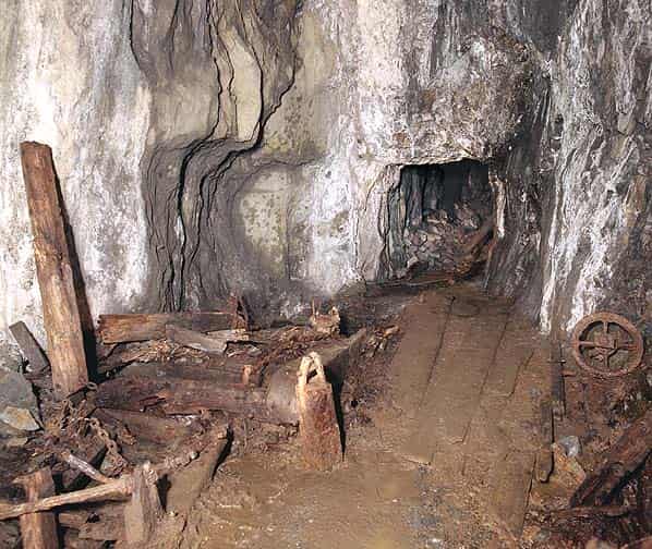
The main adit is accessed along a path running north from below the crusher house. It’s located at the end of a shallow cutting excavated into the hillside and there is no obvious spoil tip. After a short distance there is a ‘T’ junction where the16' diameter overshot waterwheel is located.
This is one of only two underground waterwheels surviving and accessible at any abandoned mine in the UK, the other being at the base of Brewery Shaft a Nenthead in Cumbria. (There are two other underground waterwheels at mining museums but neither is original. One is at Morwellham Quay in Devon and the other is in the Park Level at the North of England Lead Mining Museum at Killhope, Co. Durham. Here the wheel has been installed in a new chamber excavated from the surface by the museum. Once the wheel had been installed the chamber was covered over to resemble a genuine mine)
The flooded winding and pumping shaft is a few yards to one side of the wheel with a rusty pipe still protruding out of the water.
Care should be taken here not to fall into the shaft. Beyond the shaft the level continues for a short distance.
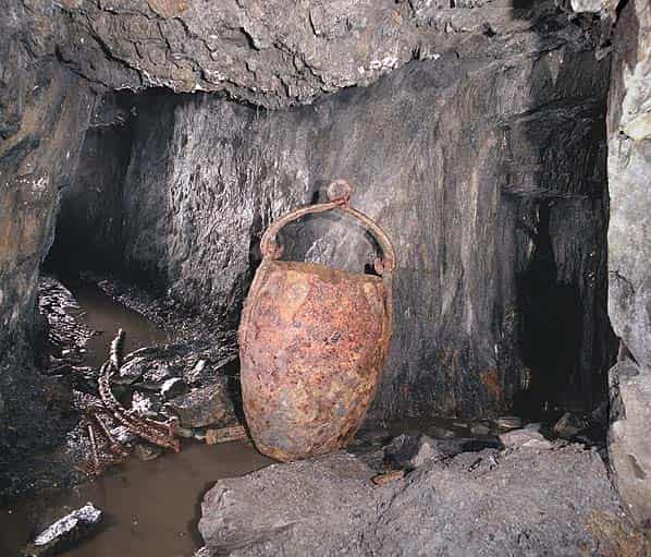
Back at the ‘T’ junction the level runs south to the new engine shaft which is open to daylight 80 feet above. Care should be taken approaching the shaft as the level passes through a flooded stope and it is necessary to walk on wooden boards to one side. At the base of the shaft there is a 10 foot climb up to a higher level where a large rusty kibble stands at a crossroads. The level is blocked left and right after a short distance but straight ahead it continues several hundred yards to a collapse. However extreme caution is required here as there is a flooded and partially boarded shaft in the floor which cannot be seen as there are several inches of water over the floor at this point.
Sources:
- The Old Metal Mines of Mid-Wales Part 3 by David Bick ISBN 0 9592040 4 8