[Source: Nick Catford]
Uxbridge Belmont Road Station: Gallery 1
1903 - 1905 old11.jpg) Belmont Road station under construction, probably during 1903. While the main building and canopy appear to be complete, the platforms were still unfinished at this stage and the Up platform building has yet to appear. Planking for wheelbarrows can be seen and on the trackbed and what appears to be contractors track strewn with the sort of junk once typically found laying around building sites. A steam crane, or steam navvy, can just be discerned at work in the background left of centre with another such machine visible in the goods yard to the right.
Photo from John Mann collection 
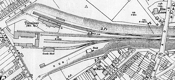
1936 Ordnance Survey map
1914 1:2,500 OS map showing the layout of Belmont Road station and goods yard ten years after opening. The main station building is on the down side with a smaller waiting room opposite. Note a flight of steps from Belmont Road to the station approach road. There are 6 parallel sidings; the northernmost siding runs into Alfred Button & Cos warehouse at its west end while the southernmost parallel siding passes through a goods shed. A 7th siding runs diagonally across the goods yard to serve the station coal yard. One of the coal merchants has a shed at the far end. A signal box is seen at the London end of the down platform.
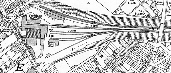 1936 OS map. Little has changed since the earlier map. The track layout remains the same but Alfred Button and Co's warehouse to the west of the goods yard has been enlarged. A crane (CR) is now identified between two of the sidings and a weighbridge (WM) and office is shown at the entrance to the goods yard.
old1.jpg)
To say Metropolitan Railway E Class 0-4-4T No. 1 was dolled-up as she arrived at Belmont Road, complete with bowler-hatted 'brass' on the footplate, could be described as an understatement. This was a ceremonial first train on Thursday 30 June 1904 with the official opening to the public being on Monday 4 July 1904. Occupants of the train and others attended a banquet in a marquee alongside the station. Ostensibly electrified from the outset, trains were steamed hauled for the first six months while electrical equipment was commissioned. The point rodding tells us the positive current rails were positioned alongside the platform. This practice was later changed for safety reasons, placing the positive rails in the 'six foot'. The E class comprised seven members, No. 1 and Nos. 77 - 82 built between 1896 and 1901. No. 1 was built in 1898 and was a replacement for 4-4-0T No. 1 which had been written off following an accident. The reason she took the number '1' was, it is thought, a piece of clever accountancy; officially the original, damaged, No. 1 was repaired but in practice was replaced by the E Class 0-4-4T. This practice was not unknown and by no means unique to the Metropolitan Railway. Metropolitan No. 1 went on to become London Transport No. L44 and she survives in preservation. Although worked by the Metropolitan at the outset, the line was still the Harrow & Uxbridge Railway. This company was vested in the Metropolitan Railway on 1 July 1905. The two vehicles in the centre of the train appear to be 'Jubilee Stock' Brake Seconds and if so were nearing the end of the lives with the Metropolitan Railway. Some were sold to other, minor, railways including the Weston, Clevedon & Portishead Light Railway and one of these, albeit an all First vehicle, which ended up as a grounded body has survived into preservation and been restored.The other four vehicles are rebodied 'rigid' 8-wheelers, originally slab-sided and notoriously unpleasant to travel in unless one could afford the marginally better First Class. The bodies of the rebuilds were notable for having square-topped doors, in other words they lacked the round topped doors so characteristic of other Metropolitan stock. Upon withdrawal some of these vehicles, slab sided and rebodied, also found their way to various light railways including in France, while others entered the engineering fleet. The final pair in passenger service with what became London Transport spent their last years on the Brill branch where they remained until the line closed in 1935.
Copyright photo from John Alsop collection old16.jpg) It has been suggested this photograph was taken at Uxbridge but this is doubtful. There are no current rails present so if it were Uxbridge it would have been within the goods yard, but, from examining the track layout on various maps and noting the scrub in the background, nothing fits. The only place which does fit geographically is the southernmost siding in the goods yard, the problem with this being the locomotive is facing the wrong way and there was no means of turning at Belmont Road. One possibility is the sidings at Neasden, close to what is now the North Circular Road bridge, but this cannot be confirmed. No. 1 was one of three class members built at Neasden, the remaining four being built by Messrs. Hawthorn, Leslie & Co. She is seen here fitted with condensing gear (the pipe between smokebox and water tank) which took exhaust steam back to the tanks where it was condensed. This reduced the number of stops to take on water, or at least it did in theory as engine men tended to take on water whenever the opportunity arose, but its main purpose was to reduce the amount of steam exhausted into tunnels and 'cut and cover' sections. The problem was condensing gear did nothing, nor could it, to reduce smoke from the firebox. Following electrification, steam locomotives still worked through the central London sections on engineering trains but electrification effectively rendered condensing gear redundant and it was eventually removed. As can be seen, some considerable effort had gone into dressing up No. 1 for the ceremonial train of 30 June 1904. Even the tank and bunker lining, plus the running plate, have been picked out with what were presumably small flowers yet the splashers were left untouched.
Photo from Jim Lake collection old12.jpg) The ceremonial first train of 30 June 1904 is seen here at Ruislip, this photograph being included because of the event rather than the location. Both the Metropolitan and Metropolitan District Railways were fond of large destination boards and indeed the former's early batch of electric locomotives, the 'Camel Backs', carried enormous roller blinds extending the full width of the locomotives. This would have been a good idea in the dimly lit, compared to today, smoky stations of the time assuming waiting passengers could read - inability to read and write was still very common at the time. If a photograph from this same spot were taken today, the photographer would be standing beneath the station footbridge but at opening the footbridge was further west, behind the camera.
Photo from John Mann collection old15.jpg) Local guests pose on the platform at Uxbridge for the photographer before joining a special train to Harrow where they would join the official first train into Uxbridge. The gentleman with the stick is Colonel Cox with the vicar of Uxbridge, The Rev. T. W. Jones, to the right. Other people included Alfred Button, the grocer; H. W. Woodbridge, the solicitor and the local M.P. Sir Dixon Hartland, as we ll as A. H. Tarleton of Breakspears House, Harefield, and a number or farmers and landowners.
Photo from Jim Lake collection old13.jpg)
This view reputedly shows the first electric train to arrive at Belmont Road. Among the plethora of staff present, the gentleman standing in the middle of the three on the trackbed looks like an engineer. Along with the four men on the motor car (there is a fourth standing inside the second doorway) the impression is of a test or training run and not of a train in passenger service. The train is in its original and short lived 'gate stock' form, the gated verandahs being visible along the train. This practice was expensive and inefficient, requiring 'gatemen' to be positioned along the train. The procedure when departing a station was for each gateman to signal the guard at the rear to inform him the gates were closed. These signals were passed along the train, one gateman at a time, and when the rearmost gateman signalled the guard that all gates were closed the guard could then give the starting signal to the driver. Gatemen were not popular with passengers and often received abuse, especially at busy times. The Metropolitan converted these trains to the form seen elsewhere between 1906 and 1911 but gate stock survived rather longer on the tube lines. A similar story also applied to the early District electric stock. Trains with air doors required, of course, just a guard and no gatemen. A curious twist to the story is that with guards on air door stock opening and closing all doors along a train they were paid a compensatory 'gateman's allowance' which remained until as late as 1985, the year after London Transport was broken up and London Underground Ltd. was created.
Photo from Miss L. Tugwell Click here for Uxbridge Belmont Road Station: Gallery 2
c1904 - April 1934
 Home Page Home Page
|
 Notes: From the late 1870s both the Metropolitan and Metropolitan District Railways expressed an interest to serve Uxbridge but although these early schemes failed to materialise the Metropolitan persisted. The Harrow and Uxbridge Railway Company was established in 1897 under the auspices of the Harrow and Uxbridge Railway Act 1897
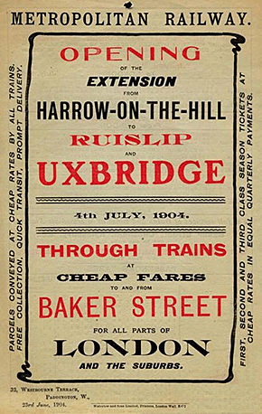
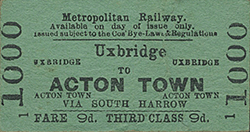
 The line was sanctioned for opening and the ceremonial first train ran between Baker Street and Uxbridge on Thursday 30th June 1904, hauled by 0-4-4T No. 1. The locomotive was bedecked with flags, and evergreens, and left no doubt that the opening was regarded as a very special occasion. On arrival, the invited guests transferred to a large marquee outside the terminus, and sat down to a celebratory banquet. Regular services began a few days later on 4 July.
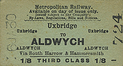 The station was provided with run-round facilities, and a signal box, which housed thirty-five working levers and five spare, was located just beyond the ramp at the London end of the down platform. The station entrance was accessed by means of a sloping approach road with an arched sign over the road announcing 'Metropolitan Railway’. Steps were also provided from Belmont Road. Passengers wishing to reach the up side did so by using a transverse section of platform which lay immediately beyond the buffer stops. In contrast to the fine main building, which was constructed of brick, the shelter serving the up line was much smaller and was built almost entirely from wood.
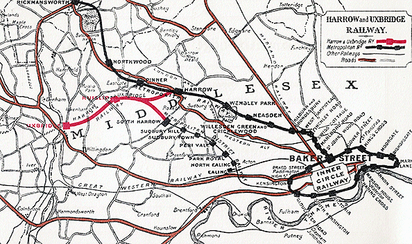
 Although initially worked by steam, the Act of 1899 included powers for electrification. By the time of opening, the conductor rails were already in place both in the station and the northernmost siding in the goods yard, presumably for use as a stabling siding. From the end of November 1904, electric trains began operating between Neasden and Uxbridge for staff training purposes, and public service commenced on 1 January 1905. For the first few months both Uxbridge and Ruislip stations were illuminated by oil lamps, but electric lighting had been installed from the outset, and was eventually brought into use once the current was switched on. In addition to the passenger terminus, Uxbridge was also provided with a seven-acre goods yard, which comprised five parallel sidings, one of which passed through a brick goods shed with a goods office at one end, and a sixth siding running diagonally across the yard serving a coal yard. A second shed was sited at the end of this siding with a canopy over the end of the siding. A crane stood between the sidings. Road access to the goods yard was at the junction of Belmont Road and York Road; a weighbridge and office stood at the entrance to the yard. With the proposed establishment of a new cattle market at Uxbridge it was hoped that the line would transport cattle from the prosperous South Buckinghamshire area.
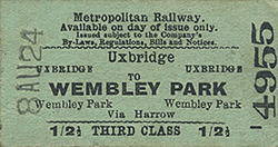
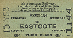
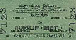
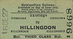
 At the opening, the only intermediate station on the branch was at Ruislip which was provided with a very similar building to that at Uxbridge. Additional stations were opened at Ickenham (1905), Eastcote and Rayners Lane (1906), Ruislip Manor (1912), West Harrow (1913) and Hillingdon (1923). The company was absorbed into the Metropolitan Railway in 1906, following legislation in Parliament. See
 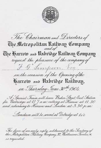 Although a connection was laid between the branch and the Metropolitan District Railway at Rayners Lane in 1904, no regular trains were introduced over it until 1st March 1910 when an extension of the District line from South Harrow to connect with the Metropolitan Railway at Rayners Lane was opened, enabling District line trains to serve stations between Rayners Lane and Uxbridge. After the introduction of shared operation one platform at Belmont Road station was used by each line. The MDR then continued to serve Uxbridge until 23rd October 1933, when the service was taken over by the Piccadilly Line.
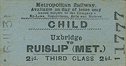 The signal box closed on 3 December 1938 and the new station opened on 4 December 1938, and the original terminus was closed, although traffic continued to use the goods yard until 1 May 1939. The track was subsequently lifted, but the station continued to stand, and was later used by the wholesale grocery business of Alfred Button. Alfred Button & Co became part of the Booker Group (a subsidiary of Tesco) in 1956 but they continued to trade as Alfred Button and Co, eventually becoming Booker Belmont. By 1969 the station building had been demolished and the remaining warehouse was also used by Budgen who had opened a store in the High Street. Alfred Button & Co, Booker Belmont and Budgen were all part of the Booker Group. The warehouse complex was demolished around 1985, and the area was levelled to provide a car park for Sainsbury's supermarket which was then under construction. Click