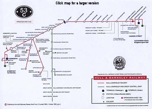
Notes: The Hull & Barnsley and Great Central Joint Railway (H&B/GCJt) was a third line which arrived late on the scene and was intended to serve new collieries in the belt of country between Doncaster and Goole. Unlike the two lines mentioned above, this line failed to open for passenger traffic even though several stations were constructed for the purpose.
Bentley, Bullcroft and Yorkshire Main collieries opened near Doncaster shortly before World War I and the Hull & Barnsley Railway was keen to serve them, abandoning its plan for a line further west, which had been authorised in 1902, and replacing it with a 21-mile line from Aire Junction on its ‘main line’ to Braithwell, where it would join the Rotherham, Maltby & Laughton Railway. As early as 1899 the Earl of Mexborough had resolved to develop coal mining on his estate near Pollington, north of Doncaster, close to the route that the H&B/GCJt was to follow.
The H&B/GCJt route conspicuously avoided population centres, its northern section traversing the sparsely inhabited flatland east of the East Coast main line. Such was the optimism that mining would spread into this agricultural area north of Doncaster that the Great Central Railway enthusiastically took a financial share in the project – as it was intent on excluding the North Eastern Railway from the project - and the authorising Act of 1909 granted running powers over differing sections of the route to the Great Northern, Lancashire & Yorkshire and Midland railways, but also the North Eastern; the Midland even advanced £250,000 to the H&B to ensure that the project went ahead and received running powers over the whole line. The ‘foreign’ company running powers would never be exercised.
Construction of the railway was delayed by unusually wet weather between autumn 1911 and spring 1913 which caused landslips in cuttings. Furthermore, legal wrangling with the Aire & Calder Navigation concerning a lifting bridge over the waterway delayed progress as did a shortage of ‘navvies’ when men left to seek better-paid agricultural work. The outbreak of World War 1 was also to delay completion of the line as shortages of construction materials were encountered and workers left to offer themselves for military service.
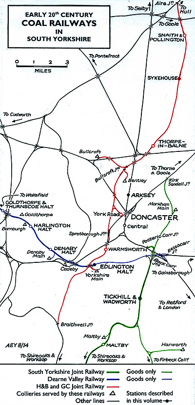 The double-track line eventually opened to mineral traffic on 1 May 1916. As it was intended to provide passenger trains too, platforms were constructed at Snaith & Pollington, Sykehouse and Thorpe-in-Balne in the hope of serving colliery villages (which were never to be built) and a passenger terminus was partially constructed at York Road in Doncaster. A further station was planned at Warmsworth, west of Doncaster; Tuffrey (South Yorkshire railway stations, 2011) states although the station was shown on signalling diagrams it was not constructed. The double-track line eventually opened to mineral traffic on 1 May 1916. As it was intended to provide passenger trains too, platforms were constructed at Snaith & Pollington, Sykehouse and Thorpe-in-Balne in the hope of serving colliery villages (which were never to be built) and a passenger terminus was partially constructed at York Road in Doncaster. A further station was planned at Warmsworth, west of Doncaster; Tuffrey (South Yorkshire railway stations, 2011) states although the station was shown on signalling diagrams it was not constructed.
Although plans for exploratory boreholes at Sykehouse and Pollington were made, and collieries opened in the flatlands at Hatfield (1916) and Thorne (1924) served by the Great Central, the northern ten miles of the H&B/GCJt remained a quiet, rural area, significantly lacking potential passengers. In the words of George Dow, the biographer of the Great Central Railway: ‘its five stations never echoed to the voices of passengers simply because there were not enough of them to justify a service. Its route largely duplicated that of other companies and in any country blessed with a logical outlook on railway development it would never have been built.' Had passenger trains called at the three northern stations, the placing of the Doncaster terminus some way from the town centre would have been inconvenient. Hinchliffe is less critical than Dow of the project, recognising that the Joint Line turned out to be ‘something of a white elephant’ but that ‘it was not as ill-considered a scheme as was later implied’.
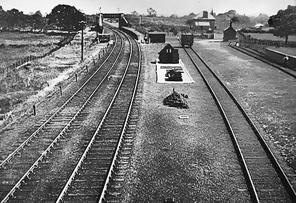
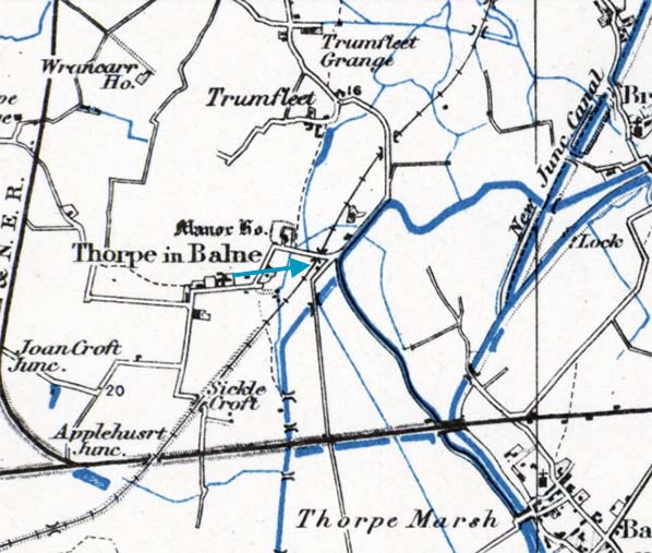
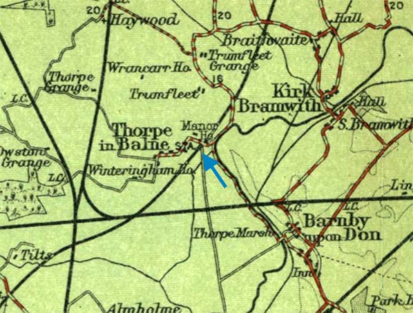
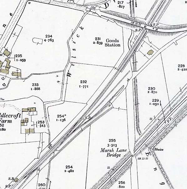
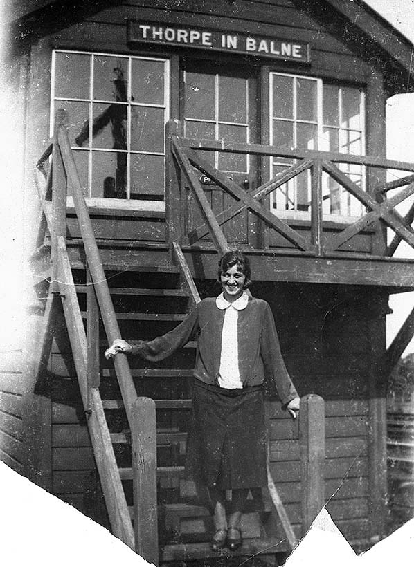
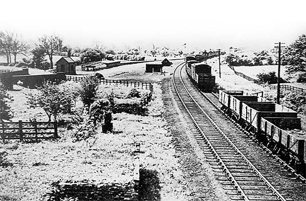
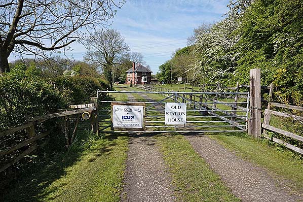
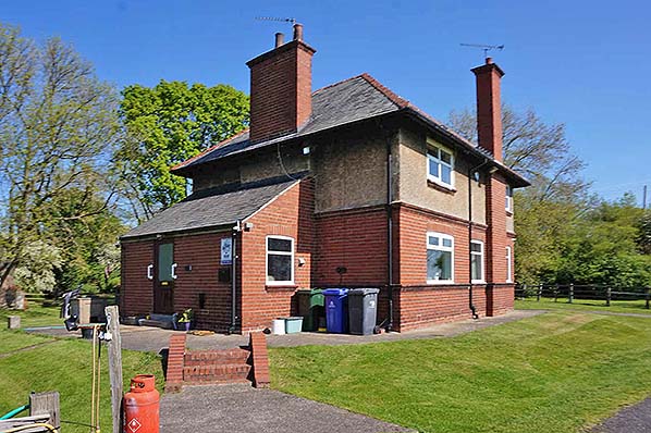
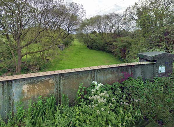
Thorpe-in-Balne station had facing platforms on the double track, accompanied by a timber signal box. No buildings were ever constructed on the platforms. Thorpe-in-Balne and the other H&B/GCJt stations all handled goods traffic. At Thorpe-in-Balne the goods yard was on the Up side of the double track, south of the platforms, and the station house was to the east of the Up platform.
It quickly became clear that the H&B/GCJt Railway was failing to carry the expected quantity of traffic and from 1942 sections of one line were used for wagon storage. South of Warmsworth the line fell derelict, the sleepers rotted and trees sprang up between the rails – although it was not officially closed until 1969. Further north, goods services continued, however the stretch from Bullcroft Junction through Thorpe-in-Balne to Aire Junction closed entirely on 20 October 1958. The platforms at Thorpe-in-Balne were demolished in the early 1960s and the tracks were removed, but the station house remained. Elsewhere on the line, from 1961 until 1970 a short section was reinstated to serve the new Thorpe Marsh power station. North of Doncaster (York Road) the line was abandoned in September 1970 and the last remnant of the H&B/GCJt, serving York Road from Sprotborough Junction, closed on 30 September 1979. The only passenger train known to have travelled on the H&B/GCJt was the DMU-operated ‘Doncaster Decoy’ railtour which visited the remaining parts of the line and its colliery branches on 5 October 1968, long after the stretch through Thorpe-in-Balne had been abandoned.
Shortly before the entire H&B/GCJt was closed, a huge coal mining venture in the concealed coalfield near Doncaster was announced - several miles north-west of the abortive Pollington and Sykehouse scheme - with the development of the Selby ‘super-pit’. This ambitious project required the diversion of the East Coast main line and promised a bright future, but it was all over by 2004.
See also Sykehouse
BIBLIOGRAPHY
- Barnett, Arthur L. The railways of the South Yorkshire coalfield (RCTS, 1984)
- Chapman, Stephen The Hull & Barnsley Railway (Bellcode 1999)
- Clinker, C. R. Register of closed passenger stations and goods depots (Avon Anglia, 1978)
- Cook, R. A. and Hoole, Ken North Eastern Railway historical maps (RCHS, 2nd edition 1991)
- Croughton, Godfrey, Kidner, R. W. and Young, Alan Private and Untimetabled stations (Oakwood Press, 1982)
- Dow, George Great Central Railway: vol 3 (Ian Allan, 1965)
- Hinchliffe, Brian (Ed) The Hull & Barnsley Railway: vol 2 (Turntable Publications, 1980)
- Hoole, Ken (Ed) The Hull & Barnsley Railway: vol 1 (David & Charles 1972)
- Hoole, Ken A regional history of the railways of Great Britain: vol 4 The North East (David & Charles, 2nd edition, 1974)
- Hurst, Geoffrey Register of closed railways 1948-1991(Milepost Publications, 1992)
- Joy, David A regional history of the railways of Great Britain: vol 8 South & West Yorkshire (David & Charles, 2nd edition, 1984)
- Quick, Michael Railway passenger stations in Great Britain: a chronology (RCHS, 2009) also online updates via RCHS website
- Tuffrey, Peter Yorkshire railway stations (Amberley, 2011)
- Young, Alan Lost stations of Yorkshire: The West Riding (Silver Link, 2015)
|


 Home Page