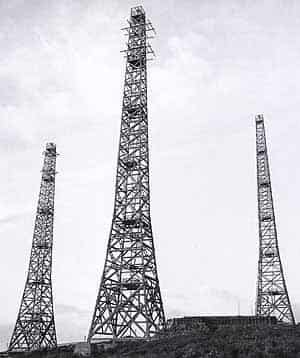
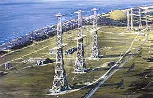
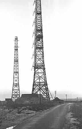
Following repairs to the station RAF Ventnor was fully operational in early November 1940. As radar was still in the development stage a number of improvements were made to the station and equipment including an increase in the transmitter power to 1 megawatt fed into a curtain array slung between two of the 365 foot towers, this was in service from May 1941.
The first electronic calculator was installed on 23rd June 1940 with a second one being added in April 1941.
The calculators, designed and built at the Post Office Research Station at Dollis Hill, converted the angular information obtained from the Goniometer (a direction finder that determines the angular direction of incoming radio signals) and range into map co-ordinates. The calculator could be described as the 1940 version of the central processing unit in a present day computer.
Because of its vulnerable position the reserve station for Southbourne CH, which was sited at St. Lawrence on the Isle of Wight was redesignated as an Emergency Alternative reserve for Ventnor.
By September 1941 Ventnor was being used for experimental Gee navigational transmissions with transmitters and receivers installed in wooden huts close to their respective radar technical blocks.
Towards the end of 1941 the Air Ministry began a programme to jam German early warning radars deployed along the French coast. The Mandrel jamming system had been developed and prototype ground stations were established at Dover, Hastings, Ventnor and Kimmeridge. Six transmitters were installed at each site producing a jamming barrage over the entire 118 - 128 MHz band used by the German Fraya radars. The Ventnor ground station was a mobile installation with transportable aerials aimed at the Cherbourg Peninsula. This was completed and operational in November 1942. New improved consoles were installed in May 1942.
An experimental Type 273 Mk V installation was established at Ventnor in February 1942. This was capable of detecting very low flying aircraft effectively and could also detect surface craft at long range with much greater reliability than Chain Home Low. This radar became know as the Ventnor HPT and was eventually redesignated as the AMES Type 53.
In March 1942 a microwave height finding Type 13 radar was installed and in the spring of 1943 the station received a mobile Type 14.
This was capable of detecting low flying aircraft during daylight hours and long range surface detection at night.
With the development of German V weapons the ‘Bodyline’ watch was established at all south coast Chain Home stations by 31st July 1943 and in September 1943 the station received new Cathode Ray Direction Finding equipment. Previously aircraft had been detected by an operator using a direction finding radio and aerial system to obtain a null [no signal] from which the direction could be calculated using a compass bearing.
A vast improvement on this was the application of electronic principles using a cathode ray tube as a more accurate measuring device.
The ‘Bodyline’ watch was stood down on 5th March 1944 as the deployment of the V weapons didn’t appear to be imminent but it was reinstated following the arrival of the first V1 flying bomb on 13th June 1944 shortly followed by the V2 rocket on 25th June 1944; the watch was renamed ‘Crossbow’ and remained in place until 9th August 1944.
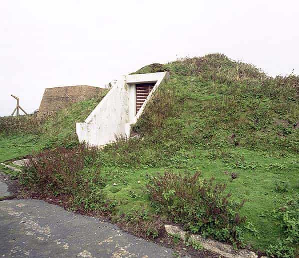
A new height finding radar system known as Variable Elevation Beam was developed in 1941 giving accurate heights without the need for excessive calibration. A prototype VEB was installed at Ventnor with a small mounded technical block built beneath one of the receiver masts; this was linked to seven mechanically tilting aerials mounted at intervals above one another on the mast. The seven aerials were pivoted and ganged together and were all elevated by a mechanical actuating cam. The VEB was completed by June 1943 and remained in use until September 1944.
A Type16 Fighter Detection radar was completed in the summer of 1943, this was designed to have accurate height finding up to a range of 150 miles. It failed to achieve acceptable accuracy and an additional ‘nodding’ Type 24 height finder was added in March 1944. The two radars were used to protect fighter aircraft bombing the V-weapon sites on the Continent.
During the D-Day invasion, the Isle of Wight was in the middle of the assembly area at the start of the assault and the Type 53 radar was taken close to saturation with an air umbrella of 500 aircraft protecting 1,600 plus craft in a vast diamond formation. Within weeks of the invasion the station was beginning to run down. In March 1945 the Chain Home (Type 1) and Fighter Direction (Type 16) radars were non operational and placed in care and maintenance.
The Type 41 surface watching radar was retained for a short period until the closure of the Naval plotting room at Portsmouth on 1st July 1945. Fighter Command required that the Type 24 (long range height finder) and Types 52 and 53 radars should be kept operational and by November 1947 Ventnor was one of only twenty six radar stations still functioning in the UK. The Type 2 Chain Home Low radar (Boniface Down) was also still in use at this time. In 1950 the station was chosen to participate in the ROTOR radar programme.
RAF VENTNOR TODAY
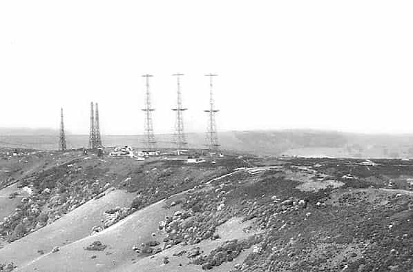
As the ROTOR station utilised the same technical site most of the WW2 buildings were demolished during the 1950’s. In November 1947, the Channel Island mail plane crashed into one of the 240 foot receiver towers and the remaining section of the tower was later demolished. The remaining six towers were finally pulled down in 1957.
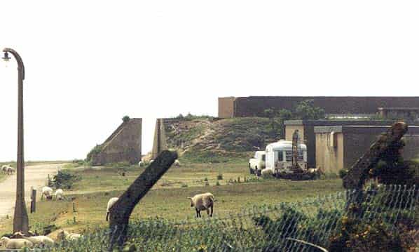
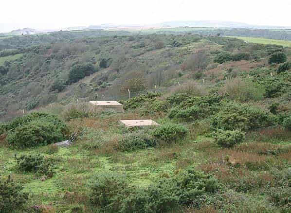
The ROTOR station used a slightly smaller compound and the western end which included the receiver block was sold to the GPO who erected a new mast on the site. They didn’t however use the receiver block and the two entrances into the brick building were sealed. Following the closure of the ROTOR station in the late 1950’s the site was handed over to the Civil Aviation Authority who still maintain a radio station there today. The transmitter block was still standing until at least 1997 but this has now been removed and the same fate awaits the remaining redundant CAA buildings and the ROTOR Type 80 modulator building. The two buried reserves close to the southern boundary have been backfilled but the position of one of them is clearly visible with a ‘shadow’ left by the four concrete feet of one of the 120' aerial towers.
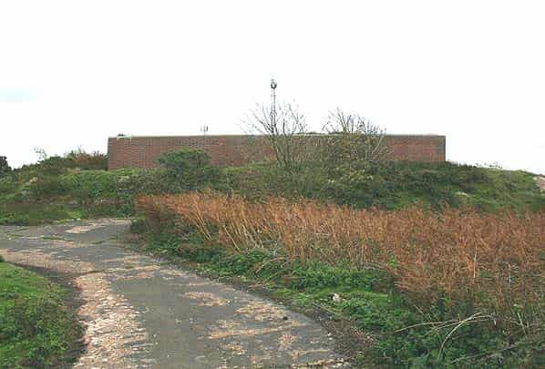
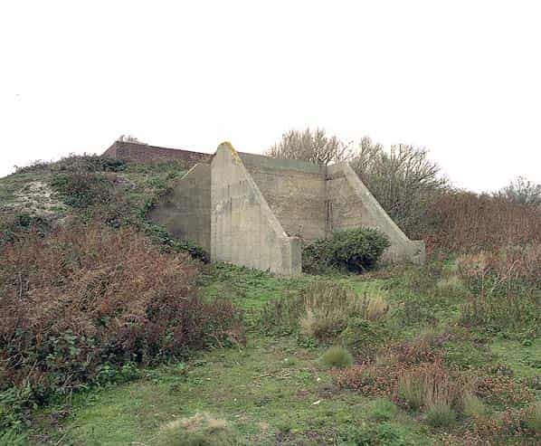
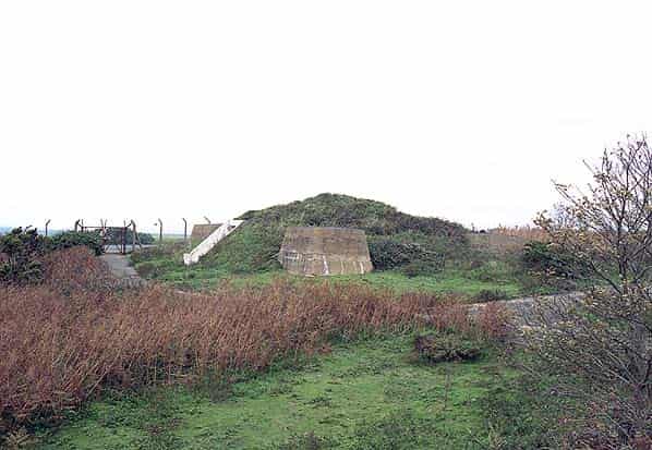
The BT compound at the western end of the site is now redundant and was offered for sale in late 2003. The site is heavily overgrown but the bases of the four receiver towers can still be found in the undergrowth. The Chain Home receiver block is still intact as is a smaller mounded bunker alongside between the legs of one of the receiver masts, this housed the Variable Elevation Beam equipment.
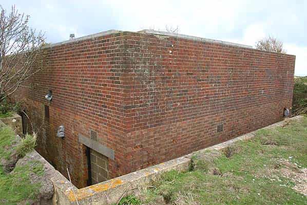
The ‘A’ type protected receiver building still stands in good condition and is typical of those built for east coast Chain Home stations. The receiver building itself is 60' X 27' (slightly shorter than the demolished transmitter building) and of brick and concrete construction with earth traverses around the building. There are two openings though the traverses giving access to an open walkway around the building. There is a 5' 6" layer of shingle on the roof to disperse blast.
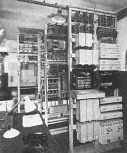
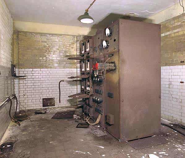
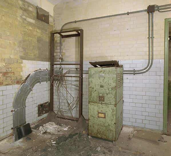
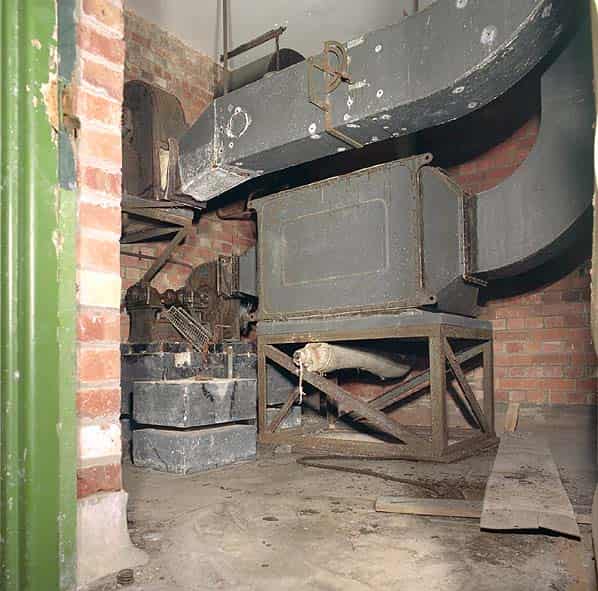
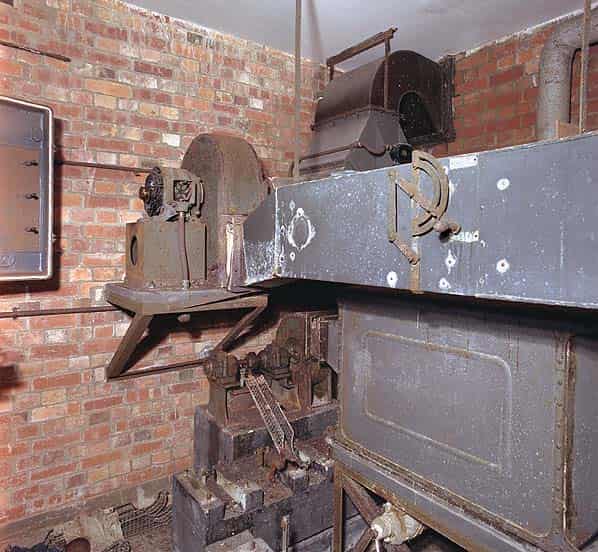
Both entrance doorways have been bricked up but a hole has been knocked through the brickwork to give access to the inside of the building. Internally the building is divided into a number of rooms comprising a lobby, air conditioning plant room, private branch exchange (PBX), latrine, transformer cubicle, sub-station, workshop and the main receiver room. The building was equipped with a duplicate pair of Chain Home RF8 (originally RF5) receivers.
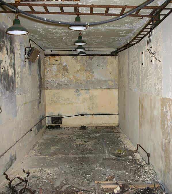
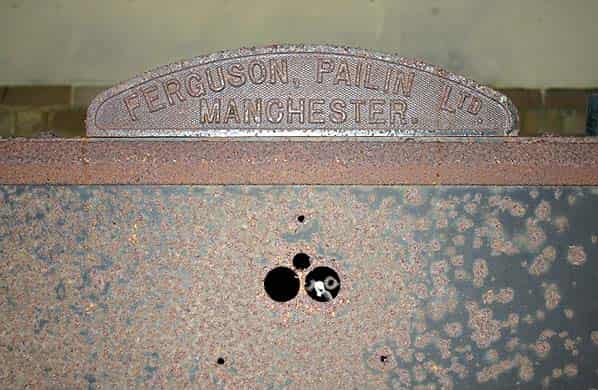
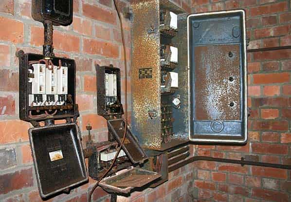
Surprisingly some of the equipment still remains in place. The PBX and receiver room have been stripped but still retain electrical wiring racks suspended from the ceiling. At the far end of the building the receiver power distribution equipment is still in place this consists of three floor standing electrical cabinets. Externally they appear complete with dials and knobs still in place but much of the inside has been ripped out. There is also a large floor standing battery charger. The ventilation plant room is also largely intact with its filter unit, fan and metal trunking running into each of the rooms. BT say it may be possible to remove any of the remaining equipment for preservation prior to sale.
Most of the rooms have a solid floor although there is a deep slot in the floor of the receiver room. The wooden flooring in the spine corridor has been largely removed making progress through the bunker difficult.
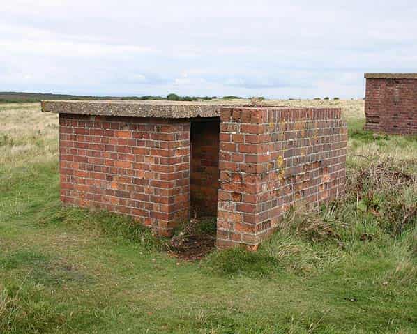
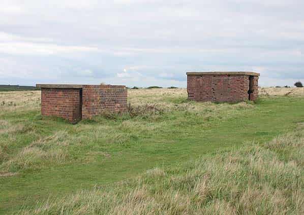
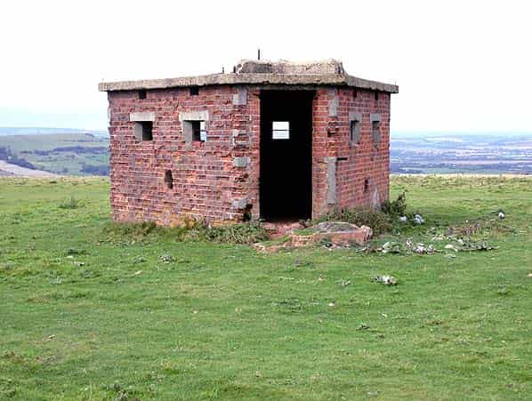
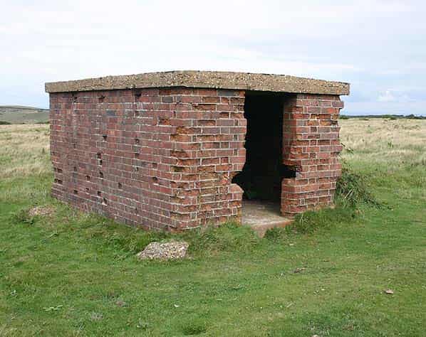
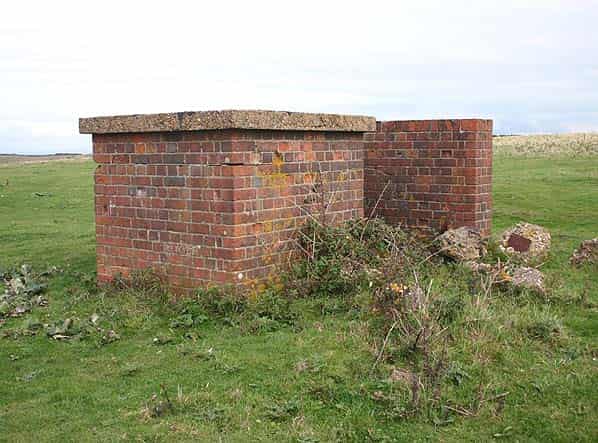
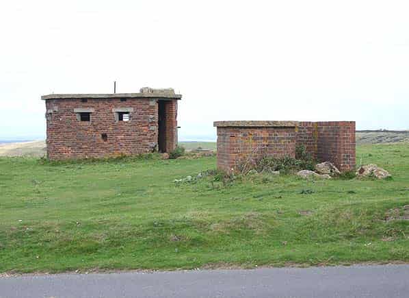
The domestic camp was on the opposite side of the road that passes to the north of the site. This is now open ground. Four small buildings still remain. One appears to be a non standard design pillbox; the purpose of the other buildings is unknown.
Sources:
- Bob Jenner
- Ian Brown
- ‘Radar on the Isle of Wight’ by Squadron Leader Mike Dean, Published privately in 1994 by Historical Radar Archive