")
On 13th August 1836 the Edinburgh Leith and Newhaven Railway Act received Royal Assent allowing a line to be built from Canal Street in the centre of Edinburgh to Trinity, on the Firth of Forth. Its construction was beset by problems and was delayed for several years because of financial difficulties and objections from local residents who did not want a gas-lit tunnel underneath their homes. The railways engineers were Thomas Grainger and John Miller who had previously worked on many of Scotland’s early railways.
The Edinburgh, Leith and Newhaven Railway Company opened their horse drawn railway on 31st August 1842, providing a direct link from Canonmills, on the north side of the Edinburgh city centre to Newhaven Station near Newhaven harbour, just west of Leith. Canonmills Station was later renamed Scotland Street. A new station called Trinity replaced the former Newhaven station both of which overlooked Newhaven Chain Pier on the Firth of Forth, a popular location for early morning bathing in the 19th century.
On 19th February 1846 the line was extended westwards to Granton Harbour where ferries had been operating from Duke of Buccleuch’s Granton Pier to Fife since May 1838 and a branch was built to the busy docks at the Port of Leith. The terminus of the Leith branch was at Citadel Station with an intermediate stop at Bonnington. Connecting lines were later also added to Abbeyhill and Piershill to the south. At this time the company was renamed the Edinburgh, Leith and Granton Railway.
In 1847 the line was further extended southwards to allow services to operate right into the heart of the city. This involved driving a substantial tunnel from Canonmills, under Scotland Street, Dublin Street and St Andrew Square to a new terminus at Canal Street immediately to the north of North Bridge (Later Waverley) station and at right angles to it. Canal Street was later renamed Princes Street. At the same time locomotives were introduced north of Scotland Street replacing the horses.
The tunnel measures 1000yds in length, 24ft in width, and 24ft in height with a gradient of 1-in-27 towards the north. The roof of the tunnel is just below street level at Scotland Street, but is 49 feet deep at St. Andrew Street and 37 feet deep under Princes Street. In order to cope with the steep gradient, cable haulage was required, with a stationary winding engine at Canal Street. Passenger carriages proceeding downhill were steadied by brake trucks, while those heading uphill were hauled by an endless rope, which ran under rollers beneath the rails and was powered by the engine at Canal St. Station.
A second shorter tunnel on the north side of Cannonmills took the line under Rodney Street and Broughton Road.
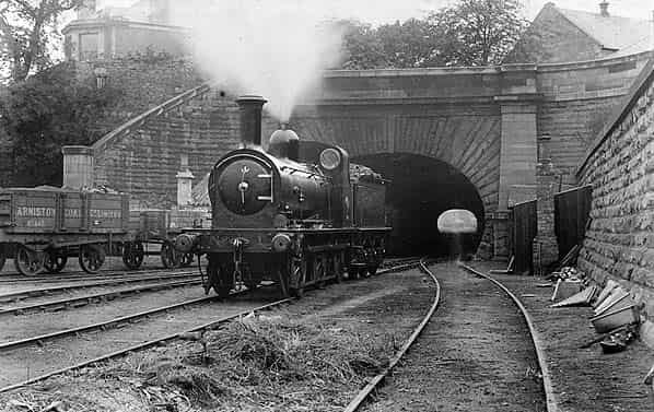
Robert Louis Stephenson wrote of the tunnel, “The tunnel to the Scotland Street Station, the sight of the trains shooting out of its dark maw with the two guards upon the brake, the thought of its length and the many ponderous edifices and open thoroughfares above, were certainly of paramount impressiveness to a young mind.
It was a subterranean passage, although of a larger bore than we were accustomed to in Ainsworth’s novels and these two words, ‘subterranean passage,’ were in themselves an irresistible attraction and seemed to bring us nearer in spirit to the heroes we loved and the black rascals we secretly aspired to imitate.”
On 27th July 1847, the Edinburgh, Leith and Granton Railway was purchased by the Edinburgh & Northern Railway who introduced the worlds first railway ferry on 3rd February 1850, with goods wagons running onto the ferry crossing the Firth of Forth where they continued northwards on a new line to Burntisland in Fife. Soon afterwards the line became part of the Edinburgh & Northern route to Dundee, connecting with ferries over the Tay with ownership passing to the Edinburgh, Perth and Dundee Railway.
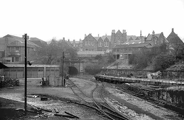
In 1862 the line was absorbed into the North British Railway who built a new line to Abbeyhill and Trinity allowing trains from Trinity to be diverted into Edinburgh Waverley (renamed from North Bridge in 1866) from 22nd May 1868. On this date, both Scotland Street and Princes Street closed to passengers. Scotland Street remained in use as a goods and coal depot, accessed only from the north.
In 1923, the North British Railway became part of the London & North Eastern Railway. The LNER were quick to close loss making lines withdrawing passenger services between Edinburgh Waverley - Granton Harbour on 2nd November 1925 despite local protests.
During WW2 the tunnel was used as an air raid shelter serving parts of Central Edinburgh. The LNER also used the tunnel as its wartime emergency headquarters, building a series of brick and wooden buildings in the northern end. Because of the natural protection afforded by the tunnel it was eminently suitable to house a protected control centre comprising a traffic office with centralized traffic control.
The traffic controller had telephone links to all signal cabins, goods yards and major stations and offices. There are no facilities for remote operation of signals etc., orders being given from office to signal cabins; military liaison staff would also be present.
Scotland Street tunnel was one of 10 hardened emergency control centres built by the LNER during WW2, others were at:
- Knebworth - In the goods yard north east of station; this was demolished and replaced by a new bunker in the 1950’s. This in turn was demolished in the 1980’s and the site is now lost under housing.
- Bawtry - In the goods yard north west of station; this was demolished c. 2002 and the site is now lost under housing.
- Gerards Cross - located on the north side of the line about quarter of a mile west of the station in a deep cutting. The building was demolished many years ago
- Shenfield - East of station between the Colchester and Southend lines. The building was used by British Railways as offices until 1968. The building was sold to the present owners in 1972 and for some years was used as their company headquarters but is now leased out as offices. The building has been maintained in good condition with the blast shutters over the windows being restored. Internally the building has been modernised but externally there are few changes altered except a 2nd storey has been added on top of the slab roof. The picket post survives at entrance
- East Leake - In the goods yard north east of station, the site is now lost under housing.
- York - Built into city wall and later used as a headquarters by British Railways Board.
- The bunker is still intact and used as a store but the only external evidence is a door in a bank.
- Norwich - Position unknown, assumed demolished.
- Metheringham - In the goods yards adjacent to the station. The brick building is still extant.
- Ipswich - Just east of Ipswich tunnel portal by the southbound platform. The building had been demolished by 1997 and the site is now a car park.
- Godley Junction -. Located on the north side of station on the Woodhead line next to engineers depot. The whole area was cleared in 1980’s.
All the protected control centres were dispersals for normal peacetime traffic offices, i.e. Liverpool Street moved to Shenfield, Kings Cross moved to Knebworth and Edinburgh Waverley moved to the Scotland Street tunnel etc.
A country mansion, The Hoo, at Whitwell (near Hitchin, Hertfordshire), served as the wartime headquarters for the Chief General Manager of the LNER. The house which was used by the British Railways Board as offices and a training centre until 1968 was demolished in the 1980’s and replaced by apartment blocks.
After the war, the railway control centre in Scotland Street tunnel was kept on care and maintenance. Some of the WW2 railway controls had their communications refurbished in about 1951/52 and it seems likely that this would have happened at Scotland Street, as it would have been considered a priority site.
In the 1950’s, the British Railways Board planned a network of new Emergency Control Centres, but only 4 out of the proposed 30 were built with the rest of the bunkers shelved in 1956. Those built were at Burntisland, Brickett Wood, Knebworth and Huyton Junction.
The Burntisland Control Centre was under construction in 1956/7, replacing Scotland Street. Although built, it was never fully commissioned and in 1957 work on the whole project was abruptly stopped and the British Railways Board set up a series of mobile controls instead. The building at Burntisland is a 40' X 120' flat roofed single storey blockhouse; it is still extant and now houses a diving shop.
Scotland Street Yard continued to operate as a coal depot and one track was retained at the north end of the for storing railway wagons. The coal depot closed in 1967 and the track was lifted shortly afterwards.
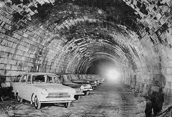
In the 1970’s the tunnel was used for growing mushrooms and Cochranes Garages Ltd leased the north end to store vehicles. It was also used as a location for monitoring natural radiation
A number of schemes for using the tunnel have been mooted since the 1970’s, including a new emergency centre for Edinburgh City Councils, which was quickly rejected in the early 1980’s. In the 1990’s there was a proposal to site a giant boiler inside the tunnel to generate power for the city centre and in recent years there have been proposals to use the tunnel as an underground car park and to reopen it for a new light railway or busses.
Scotland Street Tunnel Today
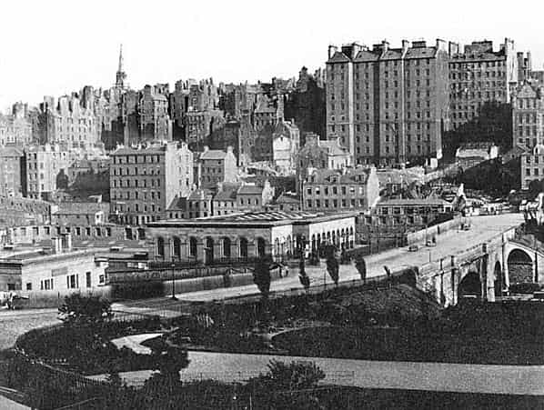
The site of Canal Street Station (NT258739) is now lost under Waverley Market. The station had curving platforms from the north to the west and a junction was later formed with the new lines running east-west through Waverley station which faced west.
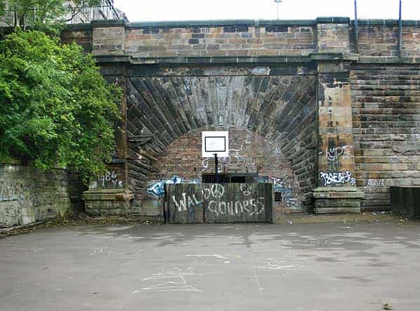
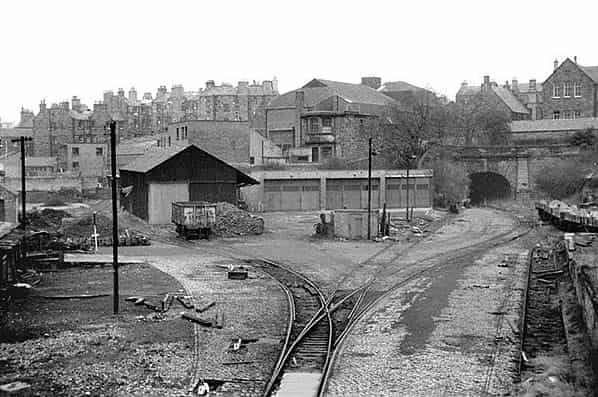
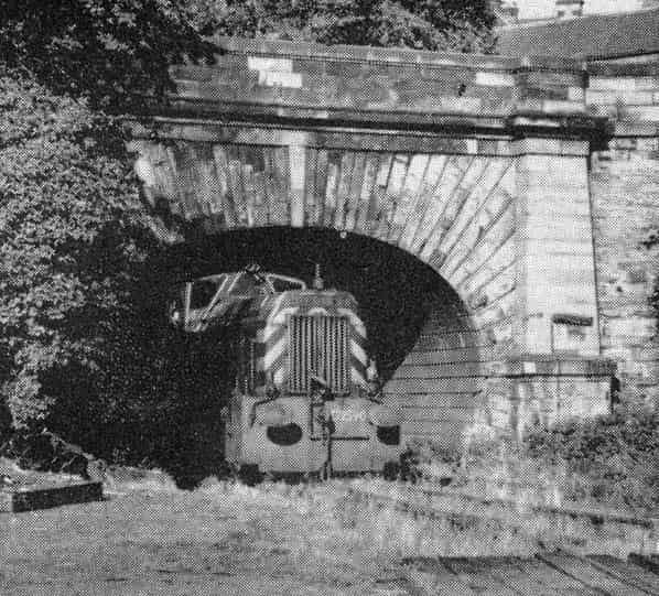
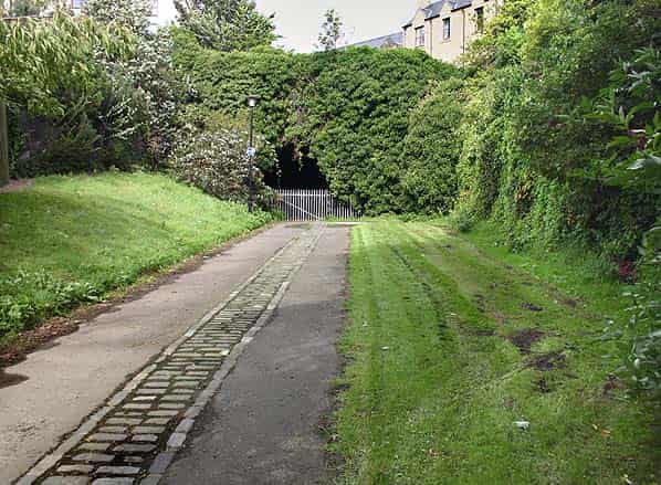
The site of Scotland Street Station (NT254747) goods yard is a playground and the platform area has been leveled and made into parkland. The portals of the two tunnels at either end of the station can still be very clearly seen flanking either side of the playground.
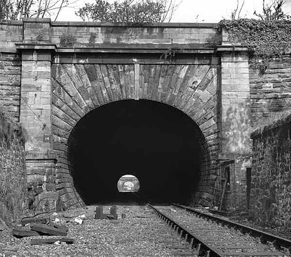
The impressive stone built south portal of Scotland Street tunnel is in good condition. It has been bricked up, probably during WW2 with a gate for access, this is securely locked. There is some evidence of ventilation plant just inside the tunnel portal behind the brickwork.
When the tunnel was visited by members of the Grampian Speleological Group in July 2001, there was about 18" of water just inside the portal but the tunnel was dry when visited by members of Subterranea Britannica in October 2006.
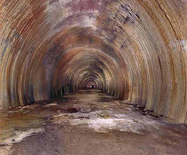
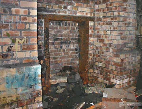
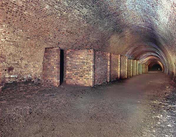
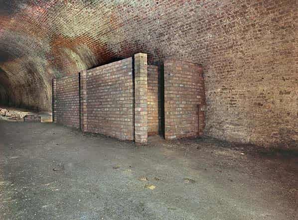
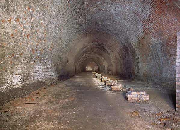
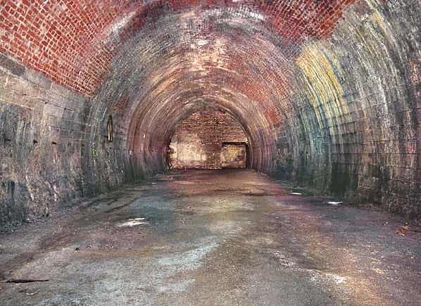
The tunnel is u-shaped in section initially sand stone lined but then brick lined running at an incline all the way to Waverley. There are a number of walls built across the tunnel with a square doorway in the centre, no evidence of wooden doors remain.
The middle section of the tunnel is wet with water running down the walls and long straw stalactites hanging from the roof with further calcium carbonate (flowstone) deposits covering the walls and floor caused by actively running water.
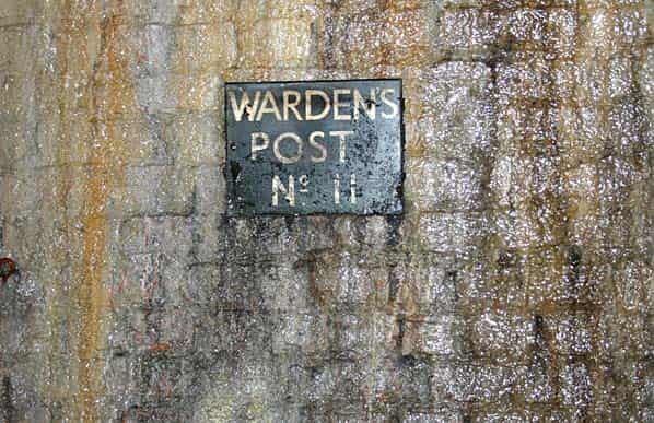
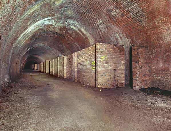
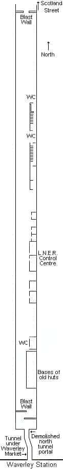
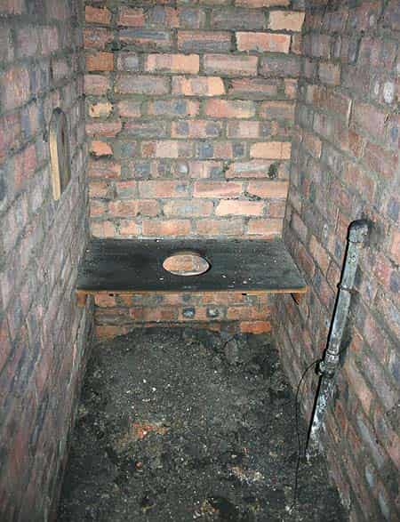
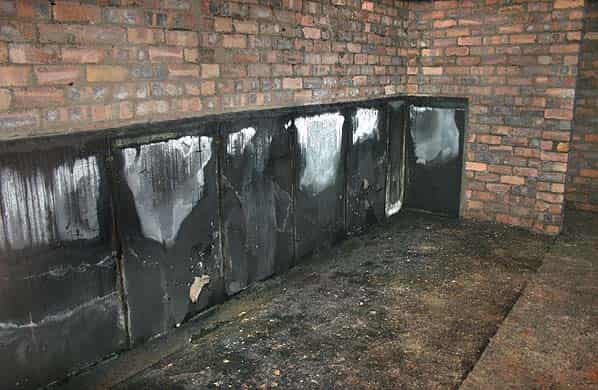
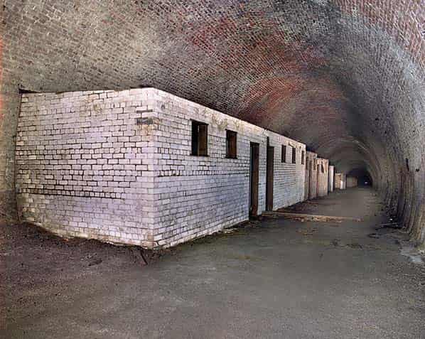
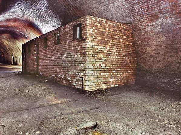
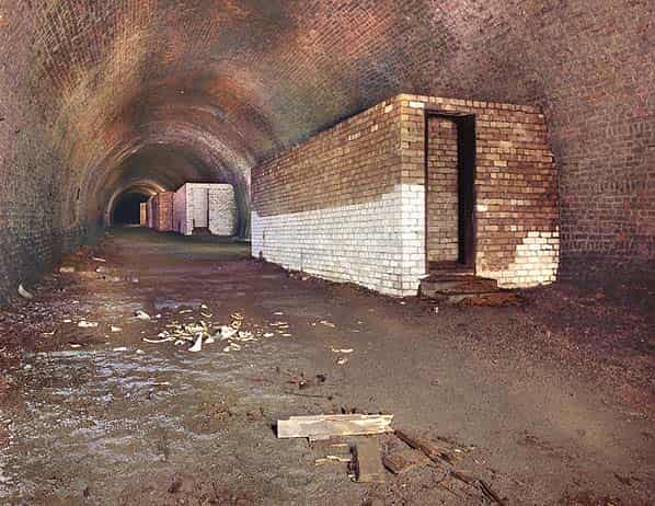
At the southern end of the tunnel, a number of brick buildings survive. The first buildings encountered along the west side are toilet blocks, presumably male and female which were built when the tunnel was used as an air raid shelter, these include urinals and longs lines of cubicles some still retaining wooden seats with an oval hole under which would have been a chemical toilet (Elsan). On the opposite wall there are two wooden signs indicating ‘Warden’s Post No. 10’ and ‘Warden’s Post No. 11’.
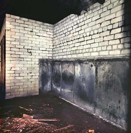
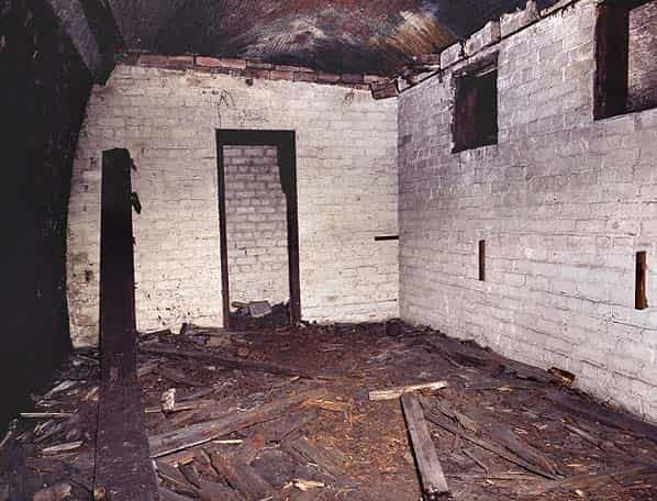
Beyond the toilet blocks there are a number of larger brick buildings some divided into rooms. These were the offices for the railway control centre. All the buildings have been stripped of any fixtures and fittings although one room still contains a sink. Beyond the buildings are the bases of a number of wooden huts which have been demolished or have rotted away.
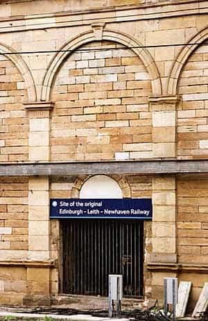
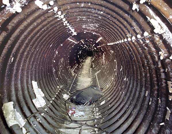
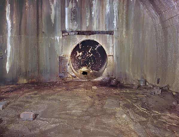
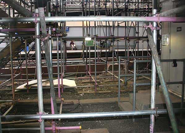
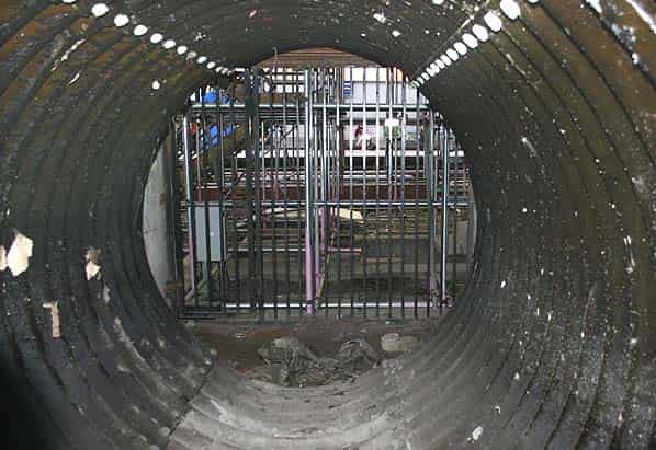
Beyond a staggered blast wall the tunnel has been blocked. This would have been close to the southern portal of the tunnel which was lost during the construction of Waverley Market.Access and ventilation has been maintained through this area along a corrugated iron tube underneath Waverley Market which was built on the site of Canal Street Station. This runs for about 50 yards through a dog leg to a gate in the wall opposite Platform 19 of Waverley Station. Above the gate the inscription ‘Site of the original Edinburgh - Leith - Newhaven Railway’ can be seen from the platform.
The southern portal of the tunnel under Rodney Street at the opposite end of the children’s playground is open but there are railings up to head height to prevent access. A third tunnel on the Edinburgh - Leith line also exists at under East Trinity Road.
Sources:
- Keith Ward
- Royal Commission on the Ancient & Historical Monuments of Scotland (Canmore)
- EdinPhoto web site with thanks to Peter Stubbs for allowing the reproduction of photographs.
- Grampian Speleological Group Newsletter Number 109, 13th July 2001
- Edinburgh Evening News, 2nd September 2006
- RailScot web site
- Mark Hows
- Heriot Watt University web site
- Tickets from Michael Stewart