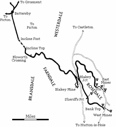
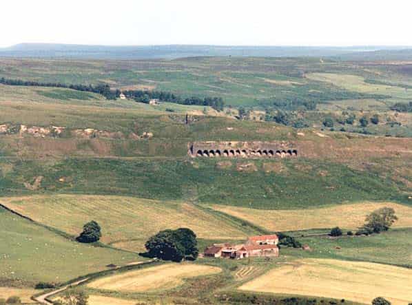
Rosedale is a deep valley extending nearly eight miles south from the main west-east watershed of The North Yorkshire Moors. It has a single isolated village called Rosedale Abbey whose livelihood depends on farming and tourists, but for a brief period in the 19th & early 20th Century it was a scene of a flourishing mining industry.
So valuable was the ironstone discovered on its hillsides that a 20 mile standard gauge railway was built over the watershed to transport this mineral wealth to ironworks in County Durham.
Although medieval bloomeries have been discovered in the area, modern ironstone workings began in the dale side of Rosedale near Hollins Farm about a mile south of Rosedale Abbey in 1856 when a 60 year lease on 8000 acres of land was given to George Leeman (deputy Chairman of the North Eastern Railway), Isaac Hartas (an iron founder of Wrelton) and Alexander Clunes Sheriff (traffic manager of The North Eastern Railway).
The three partners formed The Rosedale Mining Company. At first the ore was taken by road to Pickering and then by rail via Malton and Pilmoor to various ironworks including the Derwent Works at Consett.
In 1858 The North Yorkshire and Cleveland Railway extended its line from Stokesley to Kildale with stations at Ingleby, Battersby and Kildale. Ingleby Junction (map ref NZ 589073) became Battersby Junction in 1878 and then just Battersby in 1893. The station is still open to passengers on the Middlesbrough to Whitby service.
Soon after the opening, The NY & CR was absorbed by the N.E.R. At Battersby there were extensive sidings and a 3 road engine shed with a turntable. The shed was built in 1875/6 but was closed in 1895. There were also two rows of about 30 cottages which survive and are still inhabited.
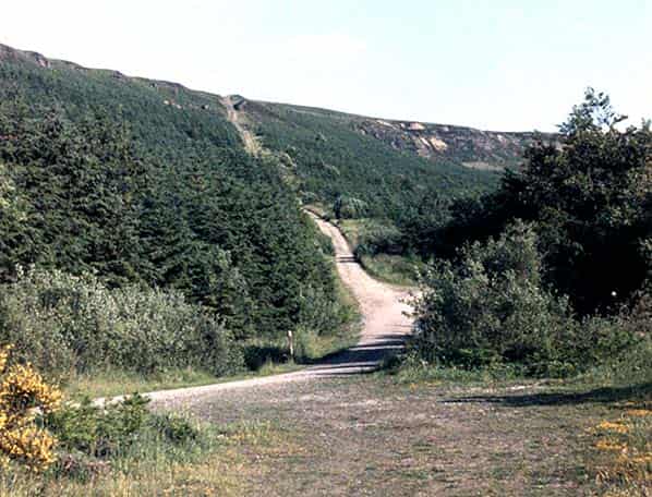
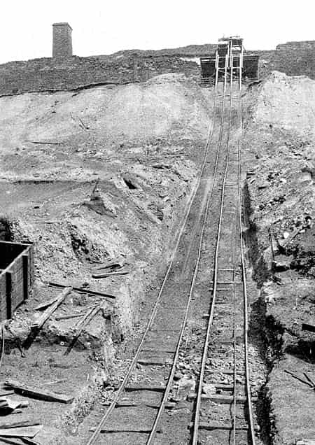
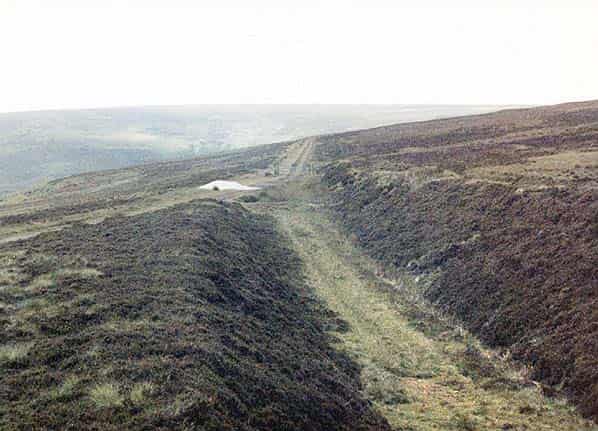
The Rosedale Branch leaves the southern end of the sidings in almost a straight line for 2.5 miles on a rising gradient to the start of Ingleby Incline.
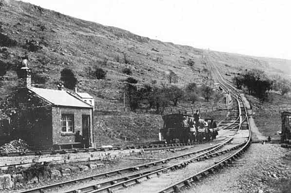
The incline is 1430 yards long and ascends to an altitude of 1370ft at the top starting at 1 in 11 gradient steepening to 1 in 5 by the top. At the incline top (Map ref NZ609026) were a drum house, workshops, four cottages and a collection of sidings.
For the next 11 miles the line does not drop below 1000 ft and crosses the watershed of Westerdale, Bransdale and Farndale by means of numerous curves and substantial cuttings and embankments to a facing junction where from 1873 to 1895 there was a 0.75mile long spur along the edge of Farndale to serve the Blakey Mines. The line then passed under the moor road from Hutton-le-Hole to Castleton (only road overbridge on the line) to Blakey Junction (SE685988) where it trails in to the line from Rosedale East Mines to Rosedale West Mines.
On a narrow section of Balkey Rigg at an altitude of 1200 ft there was a run-round loop, a private siding for the Farndale farmers plus four other sidings and several cottages.
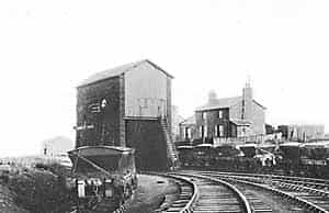
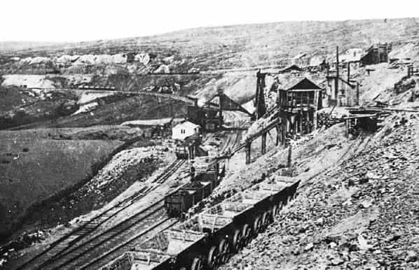
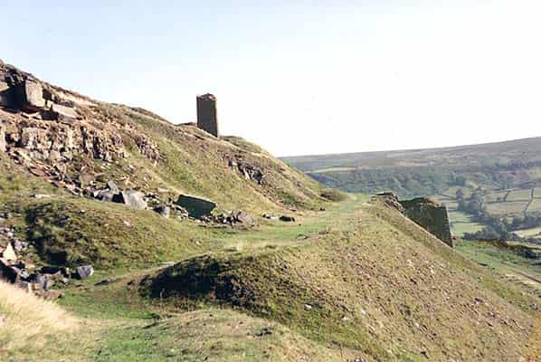
From Blakey Junction the line extended 3.75 miles on a falling gradient to stop just short of the Rosedale Abbey to Hutton-le-Hole Road at Bank Top (often now called Rosedale Chimney) (SE720951) at around 1000ft above sea level, where there was a two road engine shed and several sidings including a goods siding.
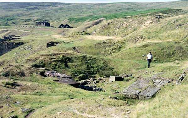
Approximately 25ft below were 16 railway cottages, a set of calcine kilns for iron ore, and an inclined tramway to Hollins West Mines.
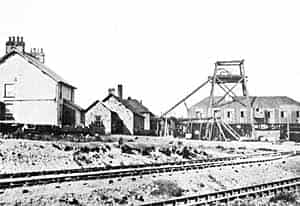
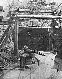
Midway between Blakey Junction and West Mines Terminus was Sheriff’s Pit Ironstone Mine (SE698962) with its 270ft deep vertical shaft plus horizontal drifts about 175ft below the pit down the valley side, one of which extended 1500ft to the shaft bottom, driven along an ironstone outcrop above Medd’s Farm, Thorgill.
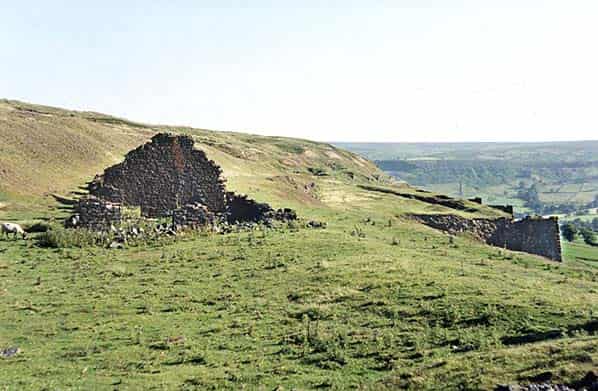
The drift to the shaft bottom was used to transport the mined ore from the other drifts to rail level at the pit head This mine operated from 1857 to March 1879 reopening in 1881 until 1911. The ironstone seam varied in thickness from 8ft at the outcrop to 5ft high and 80 yards wide where mining was abandoned. It is reported that the shaft was still open in 1974 but the buildings at the pit head (engine house, Manager’s House and workshops) have been demolished. Traces of a building, loading bay and the drift entrances can be found at the tips above Medd’s Farm.
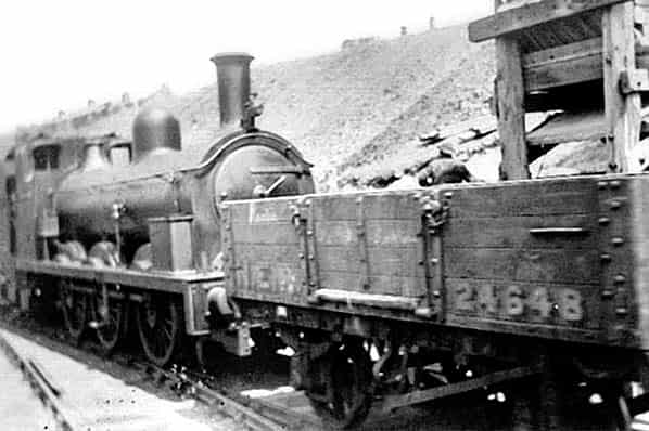
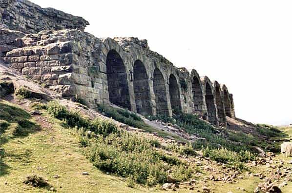
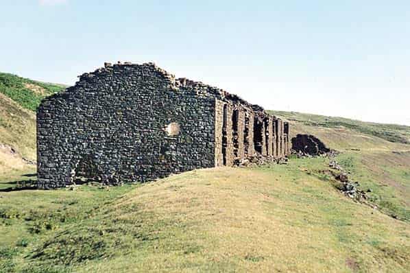
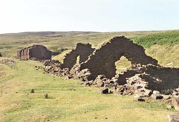
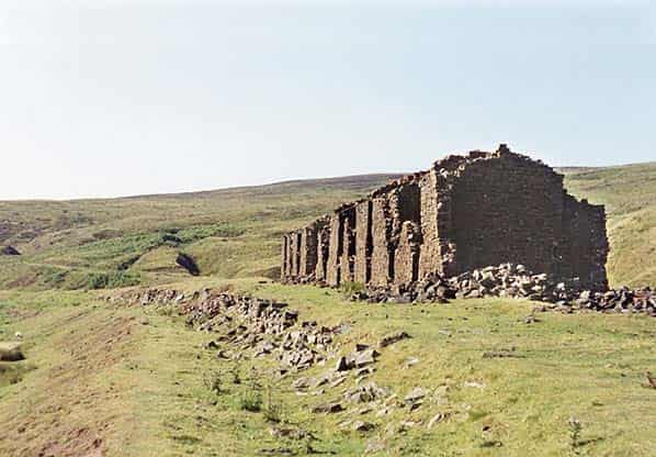
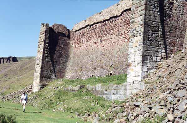
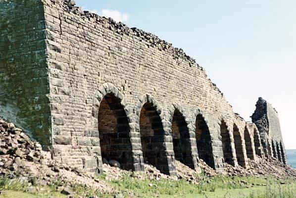
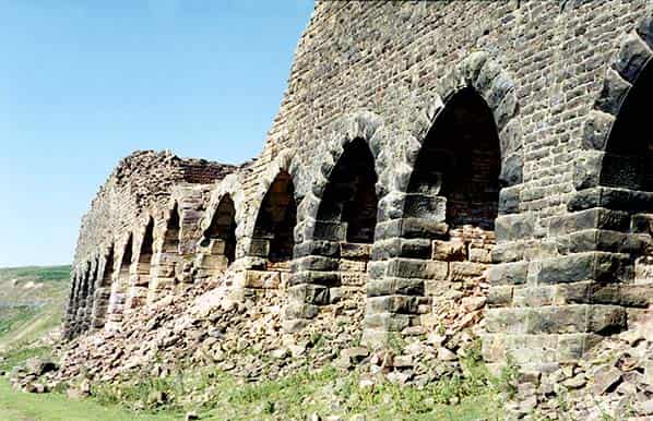
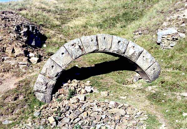
At Bank Top the inclined tramway from Hollins Mines (SE729945) transported the iron ore up around 400ft to the large kilns just below the N.E.R. branch terminus. The ore was tipped into the kilns from above to be ‘roasted’ to drive off water and carbonic acid gas. This process is known as calcinations and dramatically reduces the weight of the ironstone which in turn reduces transport costs and royalties. Initially using locally mined poor coal, later the empty wagons returning from the ironworks in County Durham brought coal for the calcinations process.
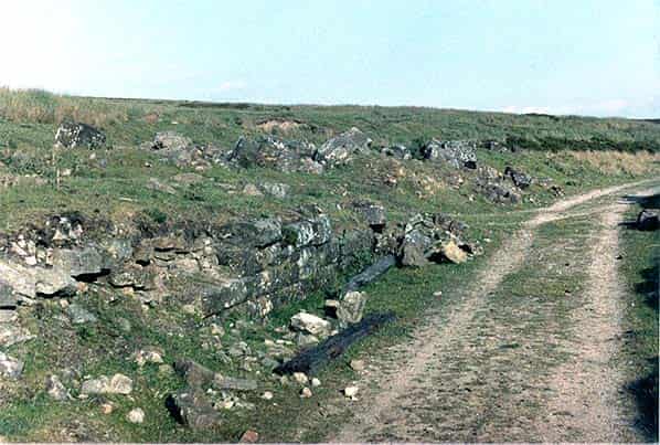
Much of the masonry of the kilns survives but all the shutters and ironwork have long gone. The calcinations process produces a lot of dust which is rich in iron oxide; this was recovered from 1920 onwards.
The N.E.R. recorded having transported over 200,000 tons of calcined ore in its first full year of operation rising to nearly 300,000 tons in 1864. Failure of The Rosedale & Ferryhill Iron Company caused closure in March 1879 only to be re-opened by the West Rosedale Ironstone Co. which continued the workings until final closure in 1881.
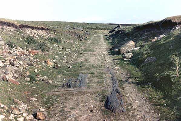
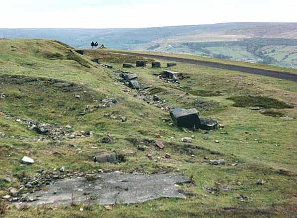
Surveying the site today you can find the site of the engine shed (by the concrete edges to the inspection pit), the masonry of the kilns, the foundations of the kilns chimney and its boiler house and the pond, several ex-railway cottages and the track on the inclined tramway to Hollins Mines although the bridge under the road has been filled in.
Retracing our steps to Blakey Junction and joining the branch to Rosedale East Mines.
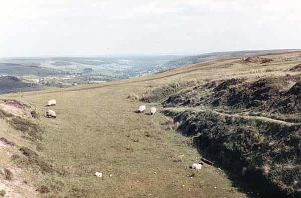
This single track branch was opened on August 18th 1865. The 4.75 mile route follows the valley sides of upper Rosedale on a falling gradient, up the west side, round the valley head and back down the East side, passing within 300 yards of the isolated Lion Inn (which still serves excellent meals and real ale) at a height of 1293ft on the Hutton-le-Hole to Castleton Road.
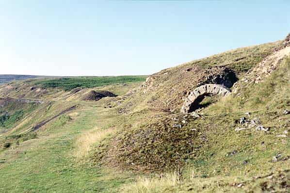
En-route round the dale head the line crosses the headwaters of Reeking Gill and the River Seven on large embankments pierced by culverts.
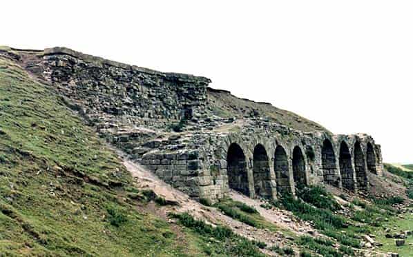
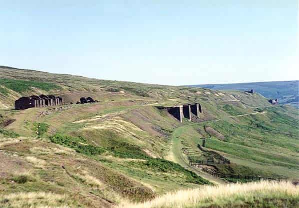
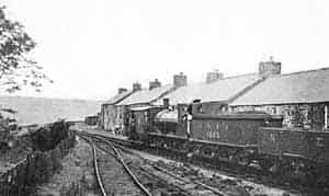
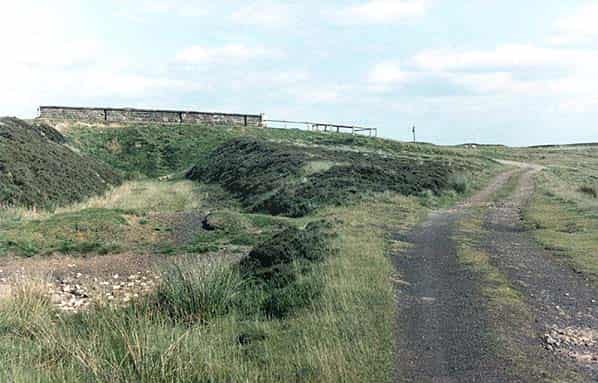
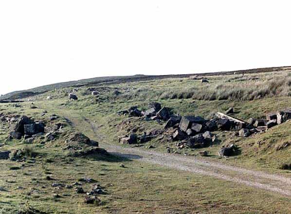
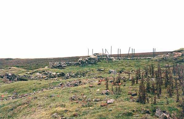
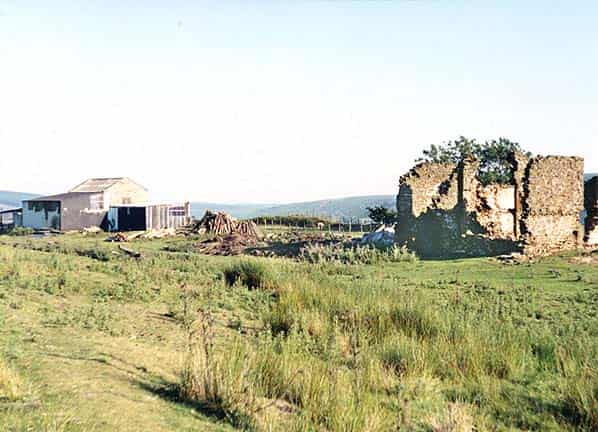
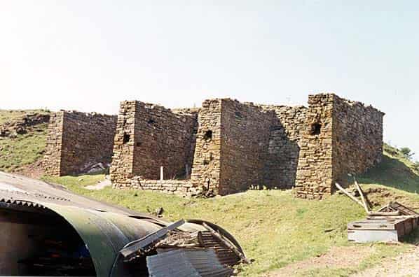
There is a siding to Nab Scar Quarries where a spur diverges above High Gill which carries on at the higher level to a number of sidings at the High Baring mine buildings. Below, the line continues past the Black Houses (linesmen’s cottages), the New Kilns and loading stages at High Baring and after about 0.333mile passes the old kilns to reach the terminus at Rosedale Goods Station at Low Baring (SE708978), often known locally as ‘The Depots’.
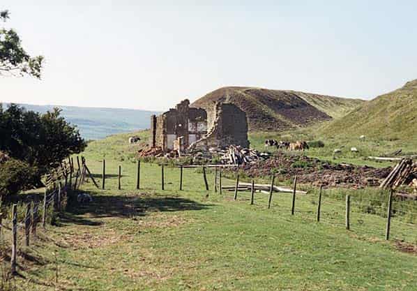
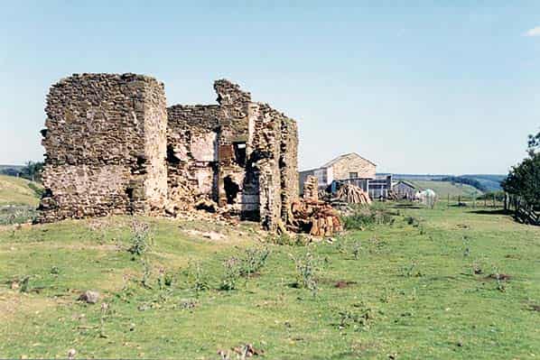
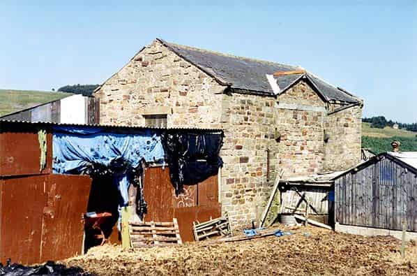
At the depot there are a long row of typical N.E.R. cottages, coal drops, a goods shed and the Depot Cottage. The station was closed in 1928. Today the goods shed is used by the local farmer, the depot cottage is still inhabited and some stone remains of the coal drops.
In the 1870’s there was a 3ft gauge tramway about a mile long to horizontal ironstone deposit outcrop towards Bell Top overlooking North Dale.Rosedale East Mines (SE706989) started operations in 1859/60 and continued on and off under several owners until the General Strke in 1926. The bed of workable ironstones varied to a maximum of 14ft in a 16ft seam in which there was 14inch thick seam of magnetic stone.
Water was always a problem requiring extensive pumping operations. There were several horizontal drifts into the hillside generally above the N.E.R. branch. The drifts had a 9ft headroom and some were 12ft wide. Candles and open lamps were used, the only danger being foul air. The main ventilation was the chimney still standing above the old kilns near Low Baring. 168,000 tons of ironstone was produced in 1866 doubling by the early 1870s.
In 1900 an electricity generating plant was installed and the electricity was used for lighting, drilling and haulage though this was all was removed by 1911.
OTHER MINING
Blakey Mines at Farndale East (SE682975) operated 6 drifts from 1876 to 1895 though it was stated in 1913 that workable ironstone deposits were not proved in Farndale and all that remains are traces of the mine buildings and the winding house at the top of the incline. The site of a bloomery has been located near Oak Crag (SE679963) and bell-pits of an unknown date can be seen near Park Corner on Harland Moor (SE 675927)
Inferior coal has been mined in shallow pits for centuries and their small waste heaps can be seen locally. They are most numerous around Sledge Shoe (SE 687977) and the Lion Inn (SE 680995)
There was a re-opened coal pit during the 1926 strike at Rosedale Head (NZ 680017) with many other shallow coal-pits including the following:-
- About 20 at Hamer Slack (SE730997)
- About 20 at West Gill Head (NZ 705005)
- About 20 at NZ 686016
- A scattered group of about 50 around Reeking Gill Head (NZ 695010)
- Up to 50 near Ralph Cross (NZ680017)
Jet mining was extensive in the area in the 19th century but had ceased by 1897. Traces can be found at several places including Dale Head (NZ 686003), Hill Cottages (SE705973), School Row (SE 711974), and Northdale (NZ 722975) and above Hobb Farm (SE716957)
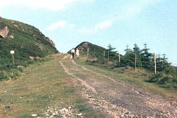
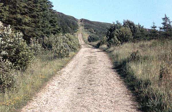
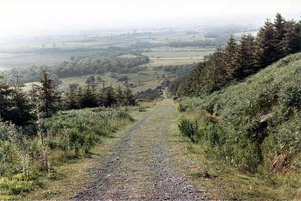
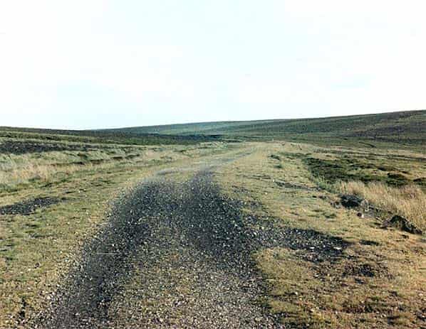
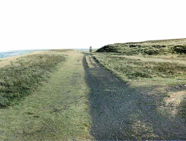
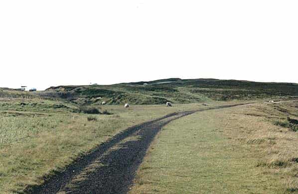
After all mining had ceased there was no demand for the railway which was declared closed 8th June 1929. The whole branch is now a recognised footpath.
Sources:
- Research Report No.9 - Rosedale Mines & Railway by R.H.Hayes & J.G.Rutter