")
Several generations of Portsmouth people have given the nickname “Palmerston’s Folly” to the Victorian forts on Portsdown Hill. The forts on the crest of the hill overlooking the town and harbour face inland and to some people look the wrong way. The development of new armaments plus the perceived threat of invasion led Prime Minster, Lord Henry Palmerston, to commission a revue and implement new defences to strengthen Portsmouth and the surrounding area. If there was an attack on Portsmouth from the north, none of the existing fortifications would be able to protect the dockyard and harbour against bombardment from Portsdown Hill.
The Royal Commission received its instruction in August 1859, that it should begin work by considering the defence of Portsmouth. The report was submitted in 1860, the recommendations were:
- To prevent landing from the enemy on the Isle of Wight
- Protection of the anchorage at Spithead.
- Defence of the Needles passage
- Protection of the harbour mouth
- The land defences
These were divided between the Gosport defences and the hill forts.
The War Department purchased the necessary acreage along Portsdown Hill from the Lord of the Manor. Approximately 900 acres were taken over completely and clearance rights were obtained for another 1000 acres.
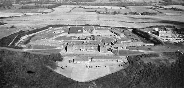
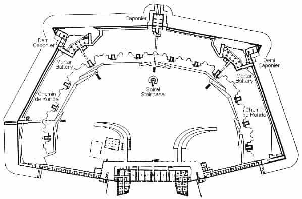
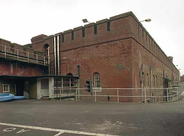
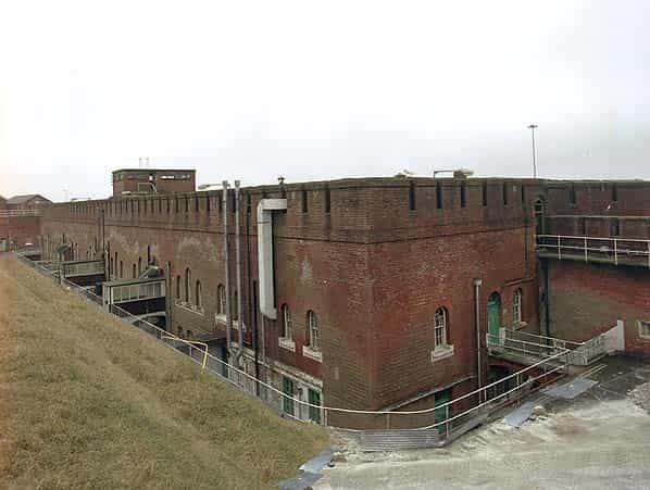
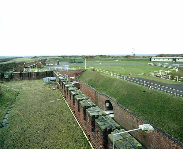
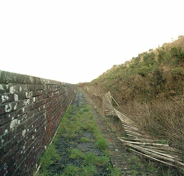
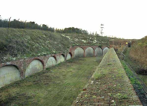
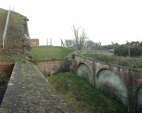
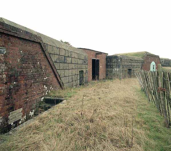
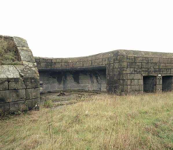
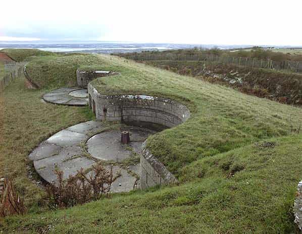
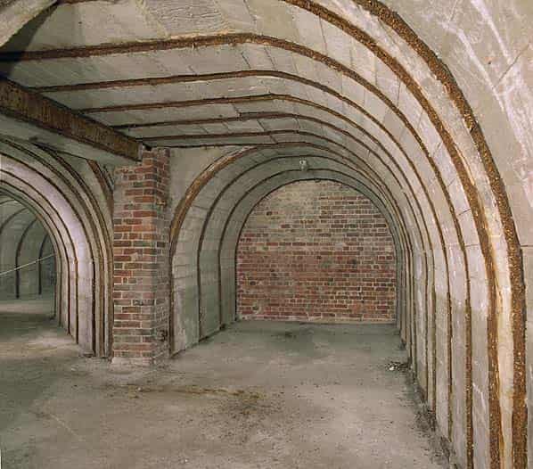
The Royal Engineers were responsible for the basic design of the hill forts, with Colonel, later Lieutenant General, Sir W. R. Drummond Jervois RE in charge. The design was that they should be surrounded by a deep ditch on the west, north and east sides. Access being gained from ramps down to the bottom of the ditches from the fort entrances on the south side at the back of the fort. There was also a dry moat with varied depth from 40 - 60 feet and width from 30 - 70 feet around the five forts.
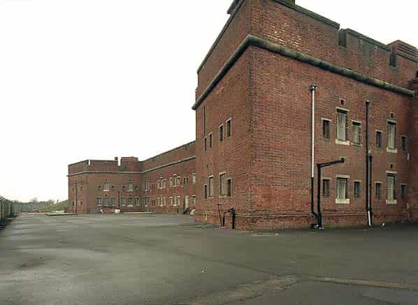
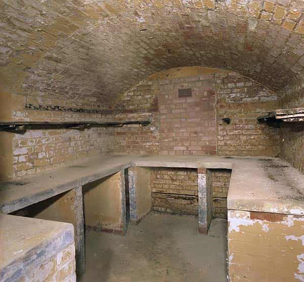
The escarp is about 10 - 15 feet thick backed by earthwork and surmounted by a rampart. The platforms on the inner side of the rampart were for additional guns firing over the parapet. On the south side, two storey accommodation was living quarters for about 250 men; there was also married quarters for twelve soldiers.
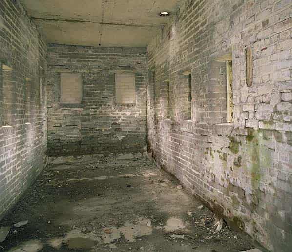
There were single storey rooms and a stable on either side of the barrack block. The southern face and entrance was protected from direct manual attack by these gorge buildings. The walls had loopholes for rifle fire. Underground tunnels went from the barrack block to the caponiers in the moat. The barrack block walls were 4 - 5 feet thick with a thick reinforced concrete roof.
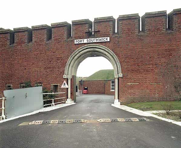
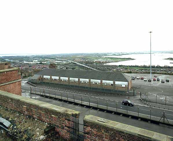
The five forts were Fort Wallington, (completed in 1865), Fort Southwick, (1870), Fort Purbrook, (1870), Fort Nelson, (1871), & Fort Widley.
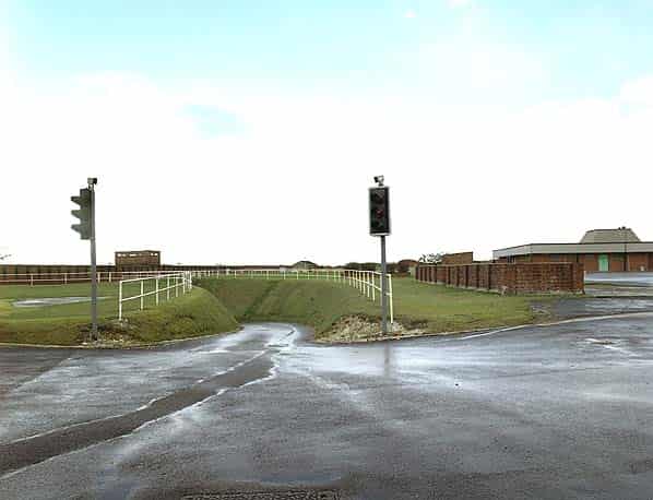
A military road was built along the crest of the hill, passing behind the forts on the south side; this then enabled good communications between them.
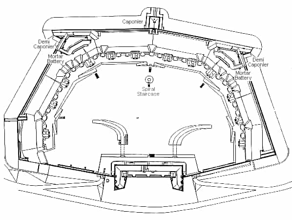
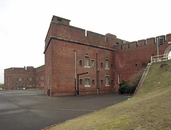
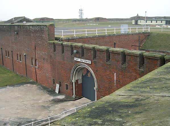
Construction of Fort Southwick started in 1861 and was completed by 1870, along with Fort Nelson it was designed to house a larger compliment of men in an inverted ‘U’ shaped barrack block in the centre of the gorge. Its dry ditch is revetted on the scarp with the counterscarp in brick and flint. It has one full caponier at the north projection to defend the ditch with two smaller demi caponiers at the shoulders. A small musketry gallery crosses the ditch at the south west angle to cover a minor branch of the ditch. Behind the demi caponiers and set into the rampart are mortar batteries of five mortars each.
In 1893 the forts armaments were nine 64 pounder RML’s (rifled muzzle loader), eight 7" RBL’s, (rifled breech loader), two on Pattern II Moncrief disappearing mounts and six on wooden traversing platforms betweeen the 64 pounders on the flanks and six 8" RML Howitzers, (replacing the mortars which were never fitted) that could fire at an elevation of 45 degrees. These were not, however, emplaced in the mortar pits; three were on ground platforms at the salients and three more were on travelling carriages.
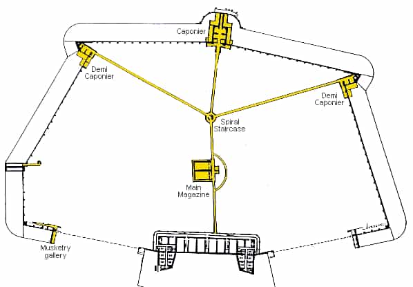
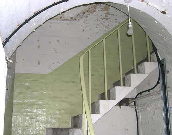
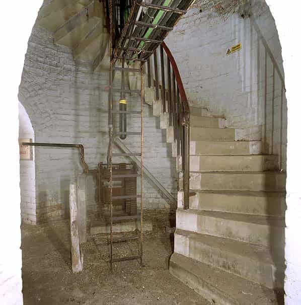
A central spiral stair from the parade ground gives access to the four main tunnels running from it radially. These lead to the barrack block and caponiers with stairs to the mortar batteries and chemain de ronde. The main magazine is located along the tunnel to the barrack block with a ‘D’ tunnel bypassing the magazine.
Fort Southwick occupies the high point of the hill and held the water storage tanks for the other forts, feeding them through a brick lined aqueduct.
The fort was disarmed in 1906 but was retained as a barracks. It was also used by the army to train soldiers how to capture and hold a fort. For three years after WW1 it became a demobilisation centre before being taken over by the Ordnance Survey (along with Fort Widley) as a cartographic training centre.
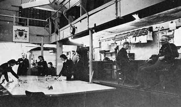
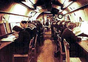
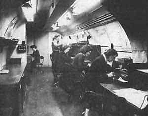
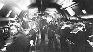
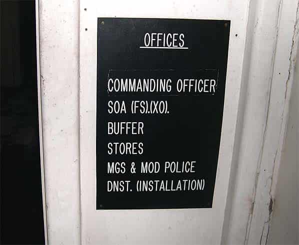
The UGHQ was completed in December 1942 and known as Portsmouth Naval Headquarters. It was designed as a conventional bombproof HQ for wartime use by the Commander-in-Chief Portsmouth containing a comprehensive naval operational control centre with associated communications centre and limited accommodation. An additional galley was provided in the main caponier which was accessed from the north-west stairs.
It was not, as is often stated, the headquarters of the Allied Commander-in-Chief ‘D’ Day Expeditionary Force. SHAEF (Supreme Headquarters Allied Expeditionary Force) which was located at Southwick House (now HMS Dryad) in Southwick village, a mile to the north of the fort. The Allied Naval Commander did, however, make full use of the UGHQ communications facilities for Operation ‘OVERLORD’ from his office at Southwick House. A radio transmitter linked from the UGHQ was located in the west demi-caponier and as part of the UGHQ a secure underground radio station was installed in tunnels excavated in the face of the Paulsgrove Chalk Pit a short distance to the south of the fort.
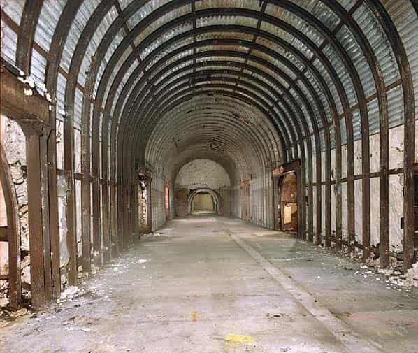
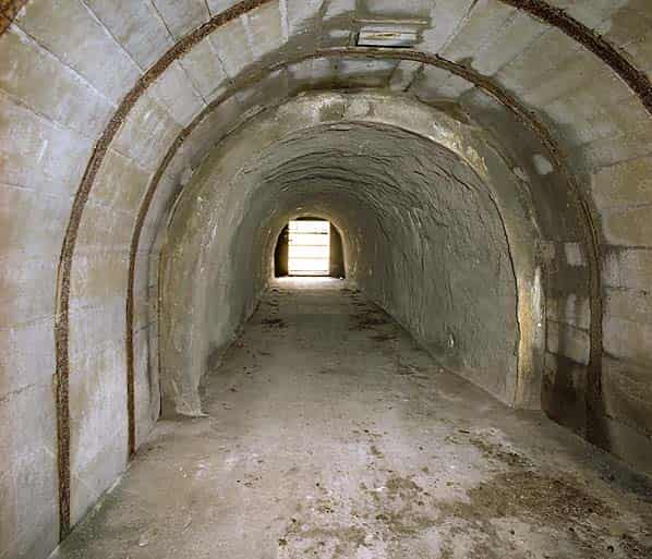
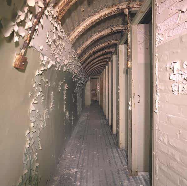
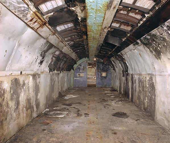
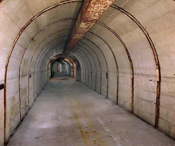
There are three main tunnels (110 yards in length) running parallel to each other with twelve cross passages (55 yards in length) providing office space, limited feeding facilities and some cabin and dormitory accommodation. In addition, two other tunnels and one cross passage were used as corridors and for emergency off-watch bunk sleeping.
The depth of the UGHQ varied according to the slope of the hill, but was in the region of 80-100 feet. There were two main entrances/exits. The eastern (179 steps) entrance was alongside the present CNH Plans Division Offices, whilst the Southern entrance, known as the South Adit was on the slope overlooking the harbour. Four other entrances, namely the Galley Tunnel (North west Stairs), the West Stairs, the Diesel Tunnel (later used as the main NATO Commcen entrance) and the Air Supply Tunnel could be opened for emergency evacuation.
Air conditioning was provided through anti-gas filters and the system could, if necessary, be operated as a closed recirculation circuit and 2 x 2,000 gallon tanks were provided for the exclusive use-of the UGHQ.
The War Complement, including the above-ground staff, was in the region of 140 Officers and 480 ratings with six weeks supply of food available for the UGHQ. Under normal conditions ample above-ground sleeping and living accommodation was provided.
Officer sleeping accommodation was, in the main, provided by using caravans parked in the moat. During a state of ‘alert’ however, the underground feeding and accommodation facilities were activated. The cabins and dormitories, together with the bunks along the passage tunnels, were used for off-watch sleeping.
At the end of World War II, the upper Fort was used by the HMS Mercury Signal School (1946-1948) for the training of Communication Branch National Service and Short Service ratings.
The UGHQ was however sealed off; the intention being that it should remain dormant ready for any future emergency. Once the Signal School moved out the fort was placed under the jurisdiction of the Captain of HMS Dryad and manned, on a care and maintenance basis, by a RN Officer and a small civilian staff.
During the 1950’s, between the Korean War (1950-52) and the Suez Crisis (1956), the Commander in Chief Portsmouth, who, on 21 February 1952 was appointed to the NATO post of Allied Commander in Chief Channel (CINCHAN), decided that to meet his National and NATO responsibilities he would require a Headquarters which could provide better facilities than those available in HM Dockyard. The answer was to reopen the UGHQ at Fort Southwick. Before this could be implemented it was discovered that the tunnels had been broken into through the South Adit and considerable damage caused by local vandals. A Royal Navy working party was put to work to return the UGHQ to a state of readiness this was completed in about twelve months. Later, during the Suez Crisis (1956) the entire UGHQ was refurbished to an operational state.
Between 1956 - 1960 the fort and UGHQ were activated for exercise periods, with all facilities being made available. The offices being used for exercise planning and subsequent analyses.
With the increasing NATO exercise cycle and pressure for office space, particularly for the Ships Maintenance Authority and Fleet Technical Staff it was decided to move CINCHAN and CINCHOME (Commander in Chief Home) staff to the fort on a permanent basis.
On 11 June 1958, the Portsmouth HQ Reserve Unit was commissioned in HMS VICTORY, Its brief was to carry out training for plotters and for communicators in the Main Signal Office and Command Typing School in HM Dockyard.
In September 1958 Fort Southwick took part in Exercise FALLEX ‘58 on completion of which the HQ Reserve Unit training was transferred to the Fort.
In April 1959 the ship name HMS ‘Southwick’ was allocated to the HQ Unit.
On 21st January 1966 the CINCHAN appointment was amalgamated with that of CINCEASTLANT (Commander in Chief Eastern Atlantic) and in consequence Channel staff moved to Northwood during 1968/69. The underground headquarters remained operational as a communications centre (COMMCEN) for the proposed new Naval Home Command Organisation (CINHOME later CINCNAVHOME) but it became evident that it was too big and required modernisation as the communications equipment was long overdue for updating.
There was also a problem of water seepage; the tunnels were becoming extremely damp and it was considered unwise to install new communications equipment in damp underground tunnels. A further consideration was that, after investigation of a serious fire in the underground operations room at RAF Neatishead, the Ministry of Defence fire authorities submitted a report that the UGHQ at Fort Southwick was a fire hazard.
When it became clear that the cost of fully modernising the underground headquarters was out of the question on financial grounds it was decided to build a new COMMCEN in the parade ground above.
The fort was retained by the MOD as the headquarters of the Commander in Chief, Naval Home Command until the late 1990’s and it formed part of an Admiralty Research Establishment. It was also used by the DCSA (Defence Communications Services Agency) as a communications centre for the Royal Navy. The COMMCEN remained in use until 2001 when its function was transferred to the Portsmouth Naval Base.
In July 2003 the fort was sold to Fort Southwick Company Ltd. It is proposed to convert the barrack block into luxury apartments maintaining the external and internal features of the listed building. There are also plans to refurbish the main caponier as a museum relating the history of the fort up to WW2. The main operations room in the UGHQ may also be renovated and opened to the public. A collection of military vehicles will be exhibited on the parade ground and many of these have already been brought to the site.
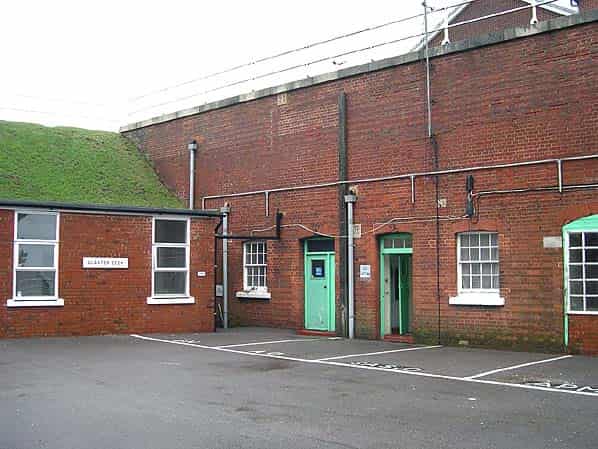
It should be stressed however that that no areas of the fort are currently open to the public and the company does not welcome casual visitors.
THE FORT & TUNNELS TODAY
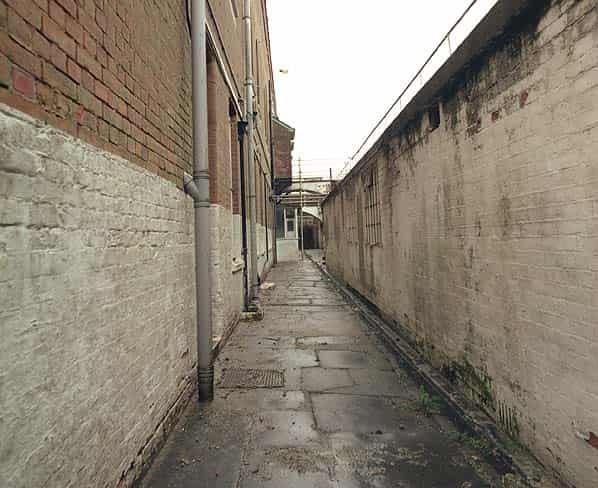
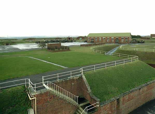
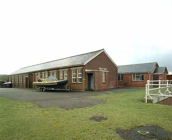
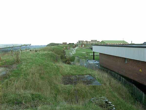
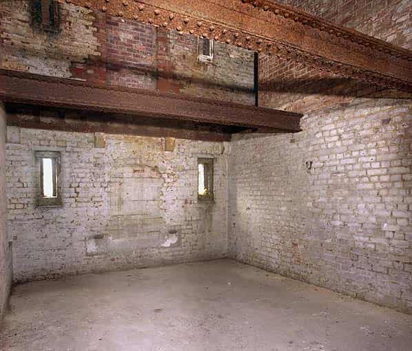
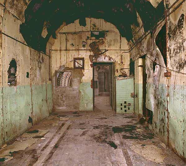
Having only recently been released by the MOD the fort is generally in good external condition. The main barrack block is completely derelict and internally has been stripped of most of its original fittings. It is currently being renovated and converted into luxury flats. Being a listed building this conversion will ensure that all external features will remain unaltered as will original internal walls. Only later partition walls will be removed. Three staircases lead up to the flat, grass covered roof, one at either end of the building and one in the centre.
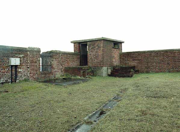
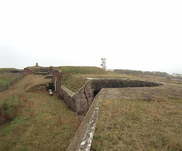
On the south east corner of the roof there is as small observation post for bombing triangulation, working in conjunction with similar posts at Fort Widley and Fort Purbrook.
In the centre of the roof there is a large two roomed signal station accessed by a flight of external wooden steps. One room looks over the parade ground and gun emplacements of the fort while the other looks over Portsmouth and out to sea. There would be direct communication from here to the signal tower in the dockyard and any ships in the harbour. There is an iron ladder fixed to the wall giving access to the flat roof.
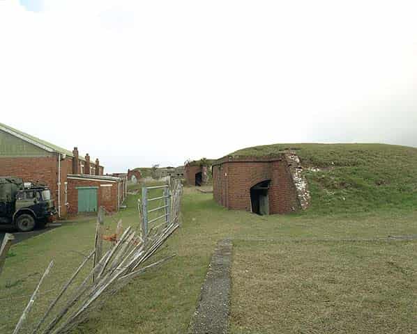
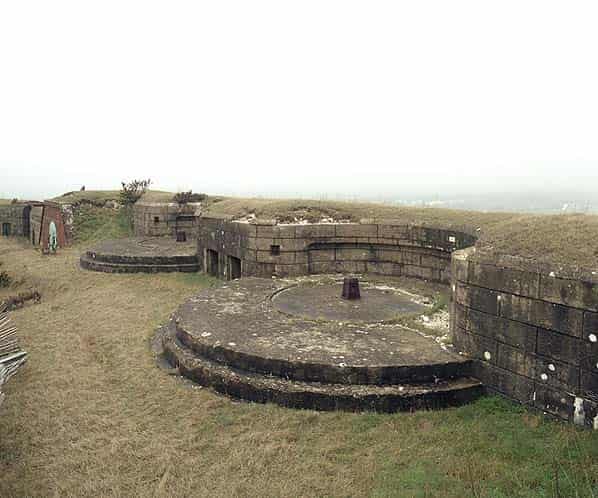
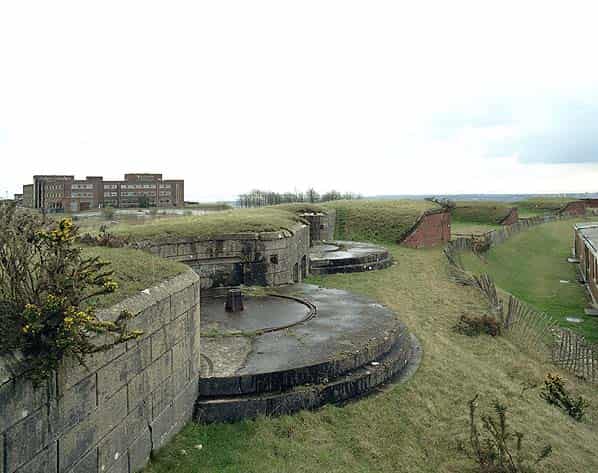
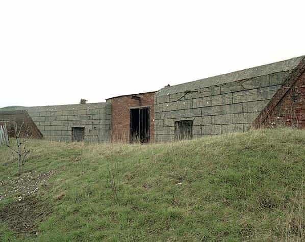
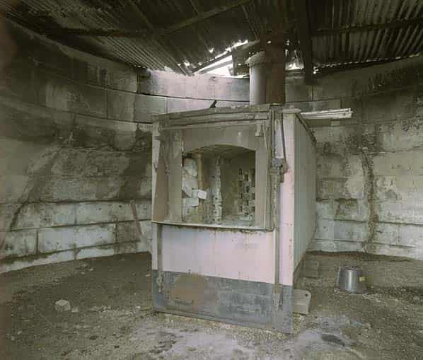
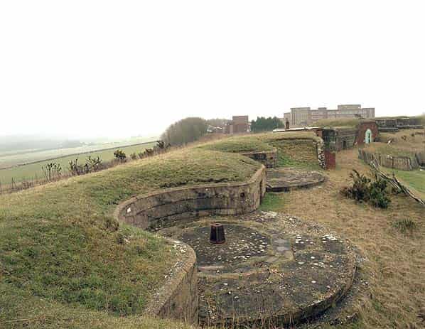
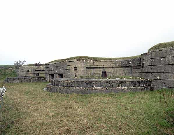
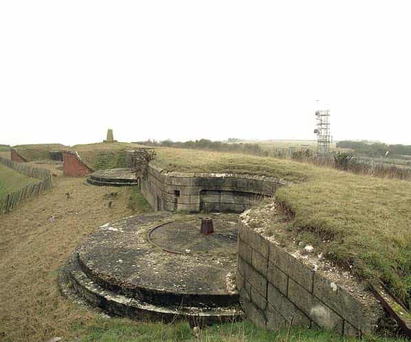
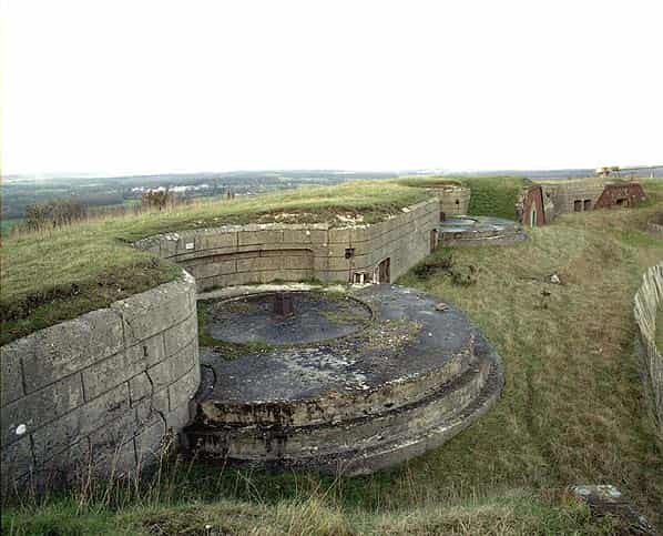
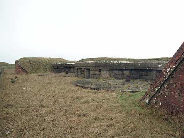
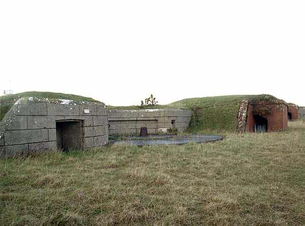
All the external gun emplacements on the ramparts are intact together with their hold fasts, ready ammunition lockers and adjacent expense magazines. From east to west these consist of one pair of 64 pounder RML’s, one Moncrief pit on the salient angle for a 7" RBL on a disappearing carriage. This emplacement has been roofed over with corrugated metal sheeting and now houses the forts incinerator with a small chimney on the roof. Two pairs of 64 pounder RML’s, a second Moncrief pit, a fourth pair of 64 pounder RML’s and finally a single 64 pounder RML emplacement.
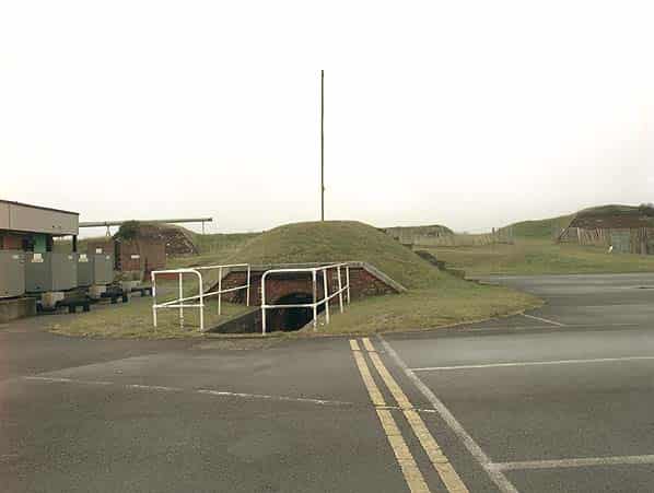
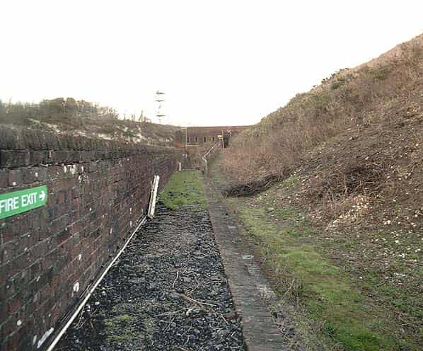
In the centre of the parade ground is the earth covered top of the spiral staircase with a winch mounted in the stairwell. Immediately to the north a stairway leads down to the upper level of the main caponier and from the upper level two stairways lead down to the lower caponier. Close to the two Moncrief pits, further stairways lead down to the casemated mortar batteries which are each laid out in an arc of five mortar emplacements. These would have fired a heavy projectile weighing 200 lbs at 45 degrees elevation to provide plunging shot that was to be employed against enemy siege works and breeching batteries. The mortars were never fitted as they were considered obsolete by the time the fort was completed and they were replaced by 8" RML Howitzers which were mounted, in a more favorable position on the ramparts. Today some of the mortar casemates are open while others have been bricked up to form rooms. From the bottom of the tunnel to the mortar batteries there is access out to the sentry path (chemin de ronde) and firing step at the base of the ramparts running around the inner ditch wall. This allowed soldier to step up and fire into the ditch.
On the western side of the parade ground there is a final stairway down to a two level flanking gallery which also acted as a traverse, a defensive position overlooking the firing step and chemin de ronde on either side. At the western end of the ditch steps lead down to a small musketry gallery for defending the short western branch of the ditch.
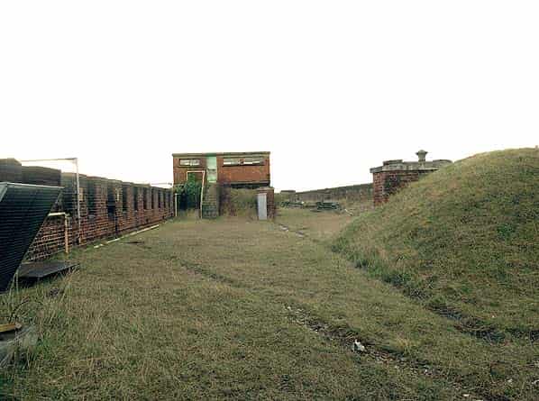
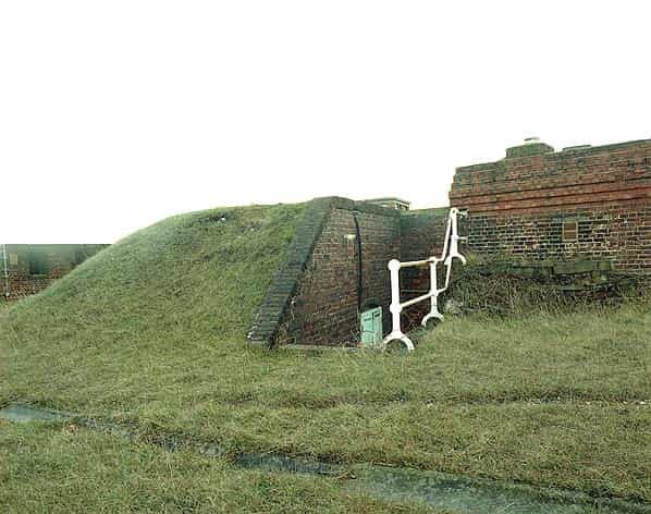
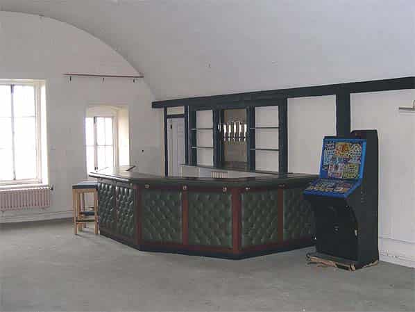
Several original buildings can still be seen on the parade ground, the largest, on the east side, was the secondary senior officers’ mess which was later used by the ATS. The most prominent building to the rear of the parade ground is the windowless prefabricated 1974 commcen and in front of it a small brick tower is the top of the ventilation shaft from the main magazine below.
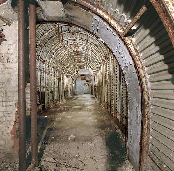
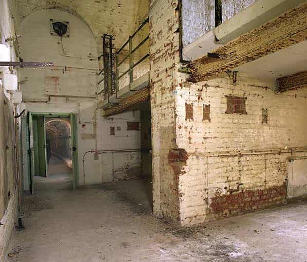
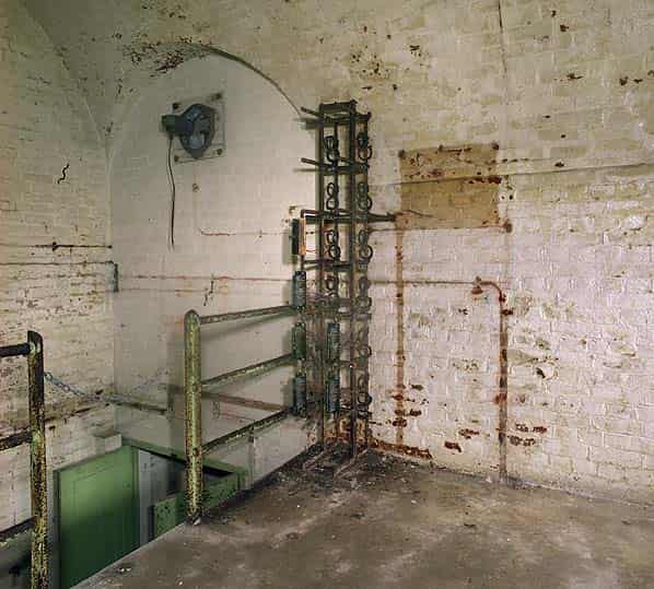
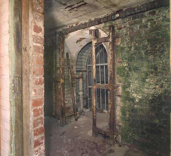
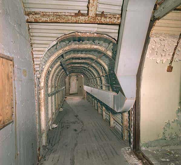
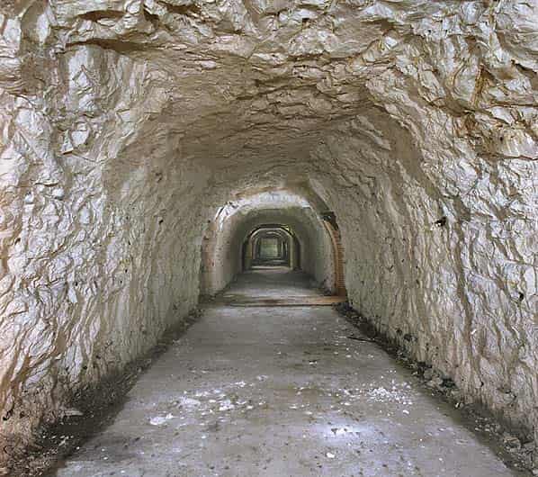
The main entrance to the Victorian tunnel network is from the centre of the gorge, in front of the barracks. From here a tunnel runs north to the base of the spiral staircase where a winch is still to be found in the stairwell. A short distance along the tunnel on the left hand side there is a metal grille gate at the top of a flight of steps (known as the north west stairs or galley stairs) down to the WW2 Combined Underground Headquarters. Half way along this tunnel the main magazine is located on the west side. This originally consisted of two vaulted chambers for the storage of barrels of black powder stored on racks in bays.
By the 1880s forts no longer stored powder in barrels. Instead they held made-up cartridges which were in turn stored in metal lined boxes on the racking in the main cartridge store. The other chamber was converted for use as a shell store. Immediate use ammunition was stored closer to the guns on the main ramparts in expense magazines. In more recent times the magazine has been used a wireless room. There are two small rooms on the opposite side of the tunnel to the magazine, they were the shifting lobbies. A semi-circular passage known as a ‘D’ tunnel, bypasses the magazine.
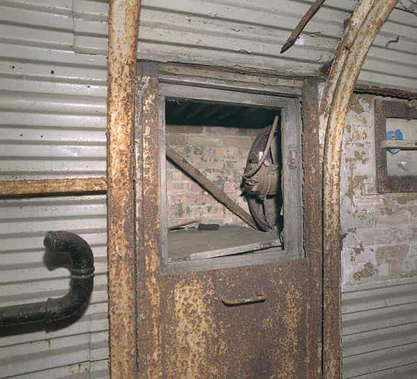
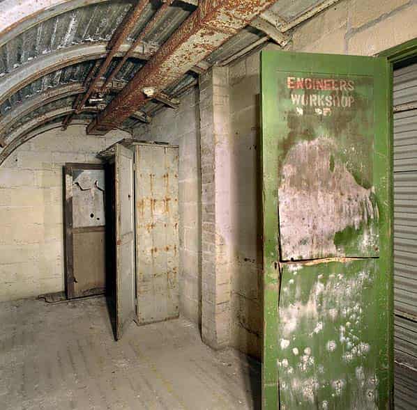
At the spiral staircase there are three further tunnels radiating from it, those to the north west and north east lead to the demi-caponiers while the short tunnel straight ahead (north) leads to the main caponier. A short distance along this tunnel on the right hand side there is a small room constructed during WW2, lined with corrugated metal sheeting; this was the WT store.
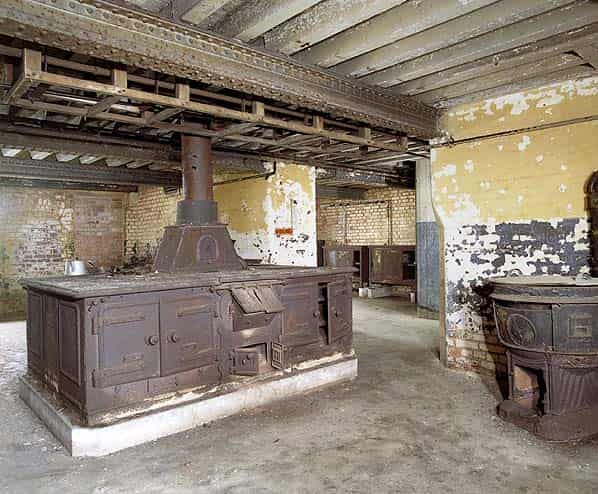
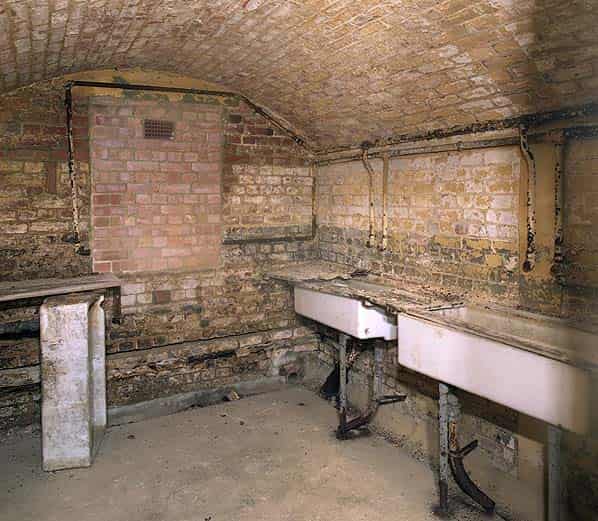
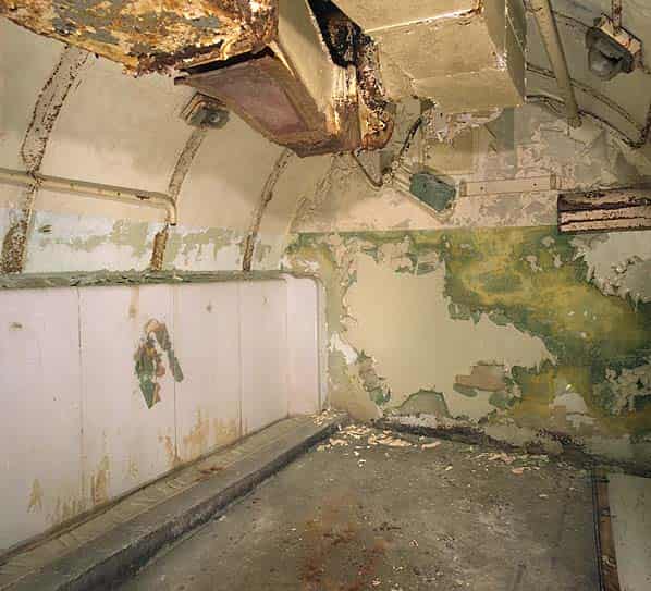
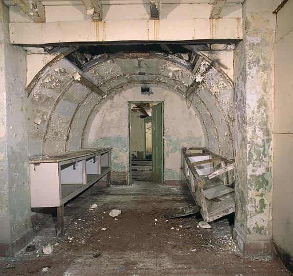
The caponier itself was converted during WW2 into a galley and mess for the fort. The mess was on the upper level where all the embrasures in the wall have been bricked up. There is still wording on the wall indicating who would have been allocated to each area. A ‘dumb waiter’ lift has been installed in the centre of the caponier for delivering food from the galley to the mess above.
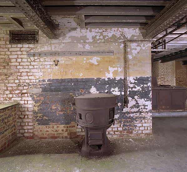
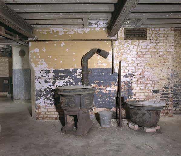
Entering the galley area there are two low vaulted rooms, one to the left and the other to the right. The room on the left was a wash room and still contains three butler sinks (one lying on the floor) and wooden draining boards. The other room is a food preparation room with a concrete work surface around three sides. In the centre of the galley there is a large cast iron range which originally came from a WW1 cruiser, a second range was removed some years ago and has been installed at the Royal Armouries Museum at Fort Nelson. Other galley equipment includes a number of ‘cooking boilers’ hot plates and a water heater. At the back of the galley there is a narrow section of the caponier that projected across the dry ditch; this contains latrines and a hot water boiler and tank.
The eastern two level demi-caponier appears not to have been used during WW2 but the western demi-caponier housed radio transmitting equipment and although this has all been removed a small telephone distribution frame is still fixed to the wall.
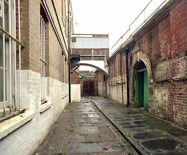
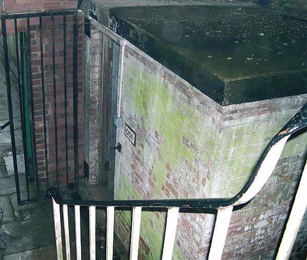
There are two further entrances (the east stairs and the west stairs) to the underground headquarters from either end of the gorge. There are also three further adits directly out to the hillside to the south of the fort from the level of the underground galleries. These are all located within a very secure compound. Two of them have been ‘plugged’ with several feet of concrete and partially covered over with earth. The eastern adit (known originally as the Diesel Tunnel) has been retained and was used as the main entrance to the 1950’s NATO communications ceentre. The gate has now been welded shut to avoid vandalism and there is a live CCTV camera just inside the gate.
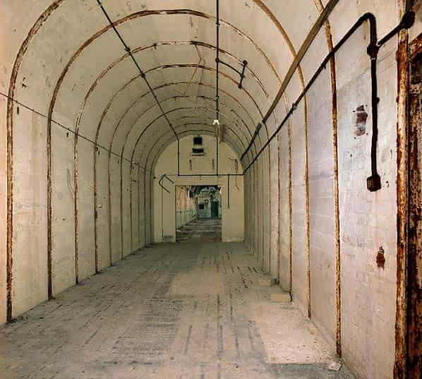
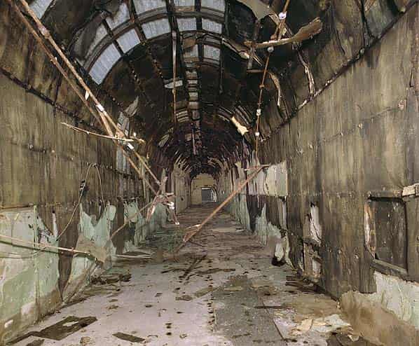
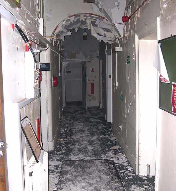
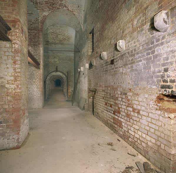
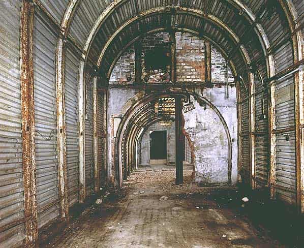
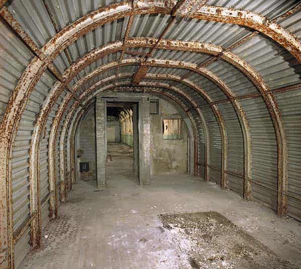
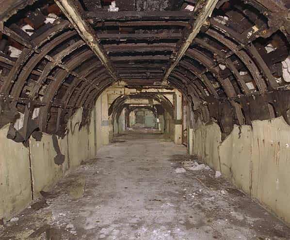
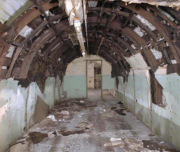
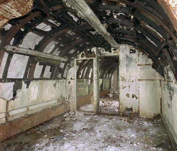
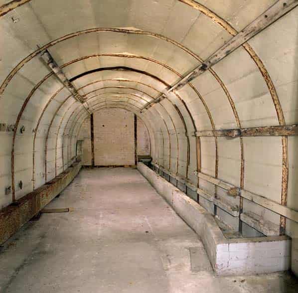
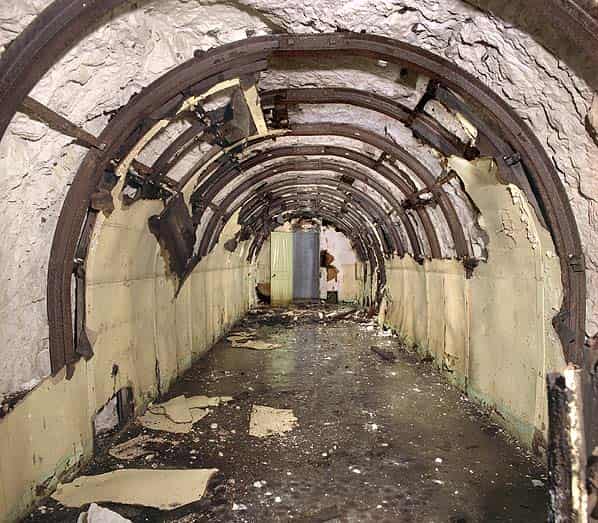
The underground headquarters is largely intact although stripped of most original fixtures and fittings. A section of tunnels to the north east was considered unsafe some years ago and has been sealed off with concrete block walls across the tunnels.
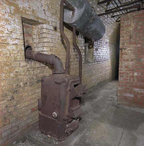
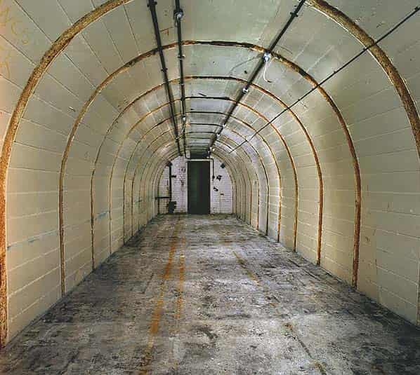
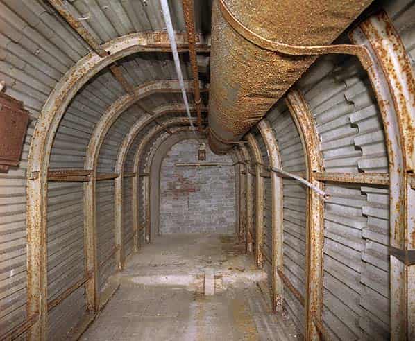
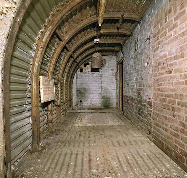
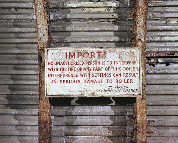
The rest of the tunnels are sound although quite damp with much of the original wooden wall lining now falling away. The northern cross passage has been stripped of all its lining. Ventilation trunking still remains through much of the tunnel network with some cupboards remaining in one of the workshops. There is little original signage apart from the emergency exists (this probably dates from NATO use) and the Boiler Room where there is a large wooden notice dating from WW2 which reads ‘No unauthorized person is to interfere with the fire or any part of the boiler. Interference with settings can result in serious damage to the boiler. By order officer in charge’. Although the boiler itself has gone a chimney pipe is still there.
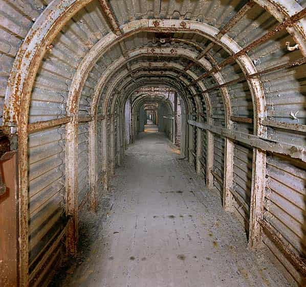
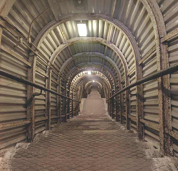
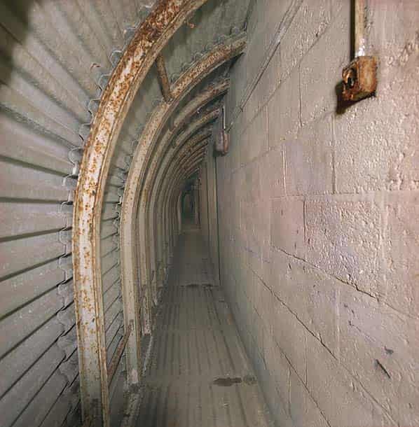
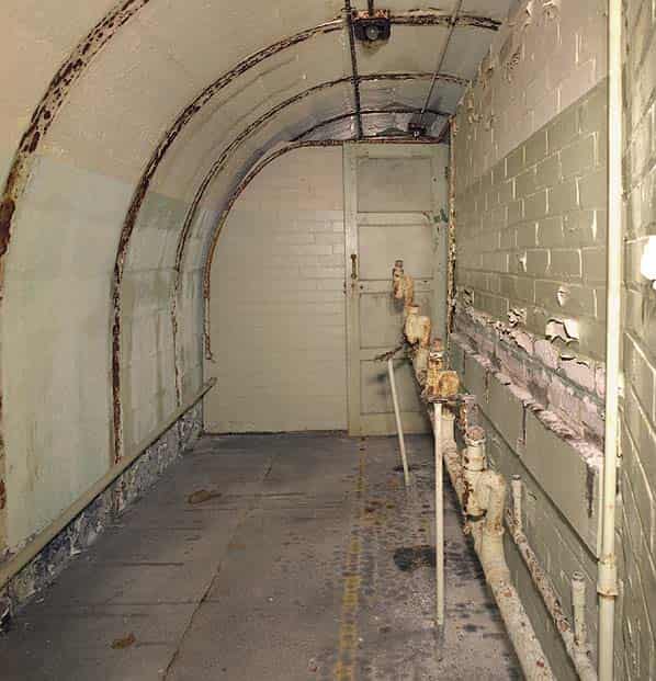
All the tunnels have an arched section and apart from the northern parallel cross-tunnel all still lined, some with corrugated metal sheeting. Some rooms have brick partition wall at the ends while others have wooden partitions. Some rooms have also been subdivided longitudinally forming a narrow corridor and one or more rooms. Again some of these partitions are of wood and others are of brick.
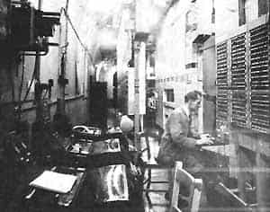
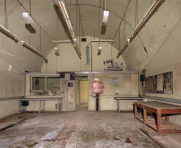
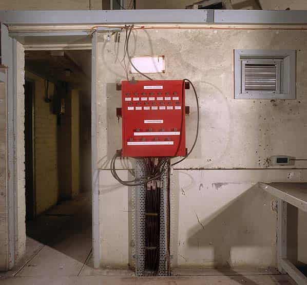
The WW2 Operation room in the north centre of the complex is of large proportions, approximately 25 feet high and 30 feet wide. This originally had a raised gallery overlooking the map table. The GPO equipment rooms in the south west corner of the complex also have a higher ceiling, the main distribution frames would have been mounted here. This section of the tunnel network was refurbished in the 1950’s for the NATO commcen and is in better condition with little or no debris on the floor.
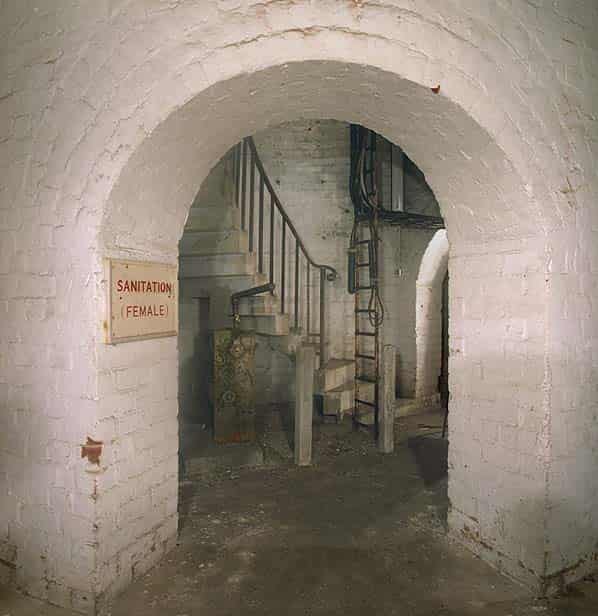
Some electrical fittings can still be seen and in the two main north - south corridors there are fixings on the wall for the off-watch bunks. Most of the tunnels have a concrete floor although some areas on the west side are tiled. The male toilets are still divided into individual cubicles with some WC’s and water cisterns intact along with the two communal urinals.
Only the east stairs are lit while the remainder of the tunnel complex is in darkness. Half way down the west stairs there is a tank room lined with corrugated sheeting. The water tank has been removed but the main feed pipe still protrudes from the ceiling.
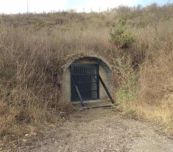
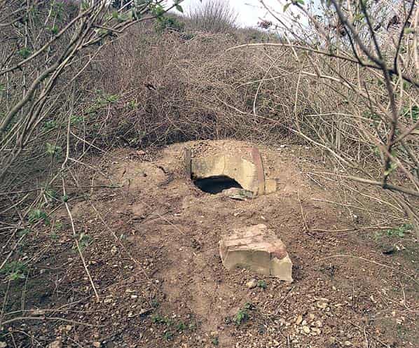
In May 1942 during the construction of the Combined Headquarters under Fort Southwick, 172 Tunneling Company of The Royal Engineers started tunneling into the face of the Paulsgrove chalk pit half a mile to the south east of the fort where they built a secure radio station.
The purpose of this facility was to act as a transmitting/receiving station for the underground headquarters. By locating the highly visible aerial arrays well away from the UGHQ it was hoped that this would draw the attention of the Luftwaffe away from the fort itself. The underground radio station was linked to the fort by secure buried communications lines.
Sources:
- Bob Jenner
- Palmerston Forts Society
- Hampshire Genealogical Society
- Portsdown Tunnels web site
- Peter Cobb
- David Moore
- English Heritage
- Portsmouth Evening News