In late 1939 a scheme was proposed by Vice-Admiral Sir James Somerville to set up radar stations to cover the Fair Isle Channel against U-boats passing through the channel to or from the Atlantic; Somerville was appointed Director of Anti-Submarine Weapons and Devices in January 1940. In the spring of 1940 this scheme was extended to the north of Shetland and to the Pentland Firth. The six stations, known as Admiralty Experimental Stations, in this scheme were located at Sumburgh, Fair Isle (two stations), Saxavord, South Ronaldsay and Dunnet Head and were operated by the Royal Navy.
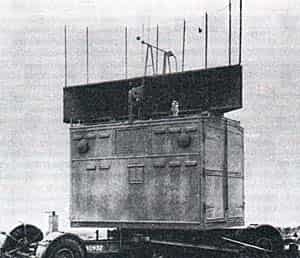
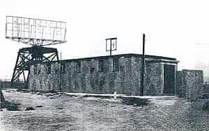
Dunnet Head, Admiralty Experimental Station No. 6, was the last to be constructed, work beginning in the summer of 1940 on high ground just to the south of the lighthouse. Like the others, Dunnet Head was a Coast Defence U-boat (C.D.U.) station, the naval version of the R.A.F.’s Chain Home Low (C.H.L.) radar which formed part of the early warning network round the coasts of Britain. The C.D.U. radar was able to track shipping and surfaced submarines to a distance of a few miles and could also detect aircraft at ranges of 100 miles or more, depending on the height of the aircraft. When erected, the station at Dunnet Head consisted of two separate huts, one for the transmitter and one for the receiver, with the aerial arrays mounted on gantries which straddled each hut. The aerial arrays were of the ‘bedstead’ type, so called because of their resemblance to mattresses. These aerial arrays were turned by hand, using a purpose built crank and gearbox in the manner of a bicycle with a chain running up through the roof to the aerial frame above. Following several months of construction work, A.E.S. 6 at Dunnet Head became operational in December 1940.
With developments in radar technology it eventually became possible to transmit and receive using a single aerial array and this method of operation was carried out at Dunnet Head from May 1942. However, further improvements continued and a move into a single brick building with a single aerial array on a gantry and power-turned aerial took place in December 1942.
The naval chapter in the story of Dunnet Head came to an end in October 1943 when the station transferred to the Royal Air Force when it was designated Station 49B under 70 Wing RAF, being operated by them until the station closed down.
The radar station is described as ‘caretaking’ by the end of the war with its future also described as ‘caretaking’.
The station had three radars, an AMES Type 2, 10cm AMES Type 30 (A CD1 Mk3 issued only to Admiralty stations) and a Type57 (AMES 14 Mk2 [T]).
During its operational lifetime, Dunnet Head plotted a number of enemy aircraft in the Orkney area as well as those over South Shetland and the Fair Isle passage, the latter generally meteorological reconnaissance of aircraft flying out into the North Atlantic.
In addition, tracks of some 35,000 friendly aircraft were plotted by the station during the three years it was operated by the Royal Navy.
Dunnet Head Today
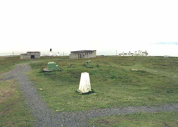
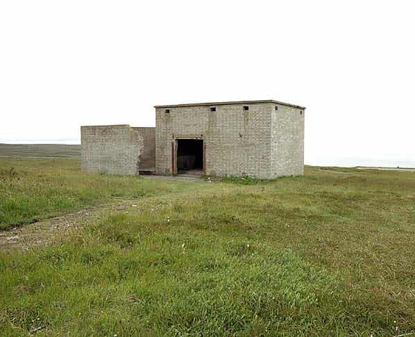
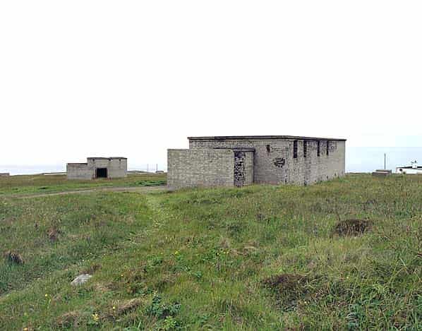
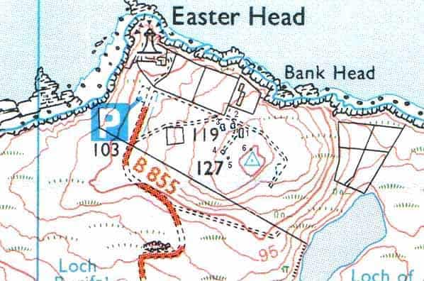
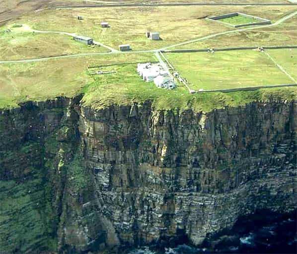
Dunnet Head is a public open space with free access to the radar buildings most of which are open. Five buildings remain on the site together with the underground Barrock Royal Observer Corps post built in 1959. The largest building is the operations block with four concrete bases at the western end which were the mountings for the 35' high gantry.
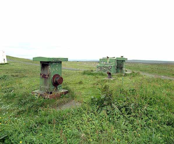
A short distance to the west is the power house and behind it the stand-by set house. The station was never connected to the mains supply so both these buildings would have housed a diesel generator. The stand-by set house has an open area to one side surrounded by a blast wall. The fuel tanks might have been located here.
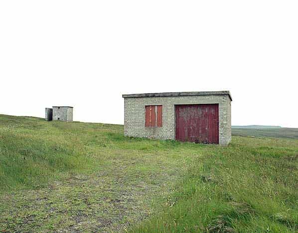
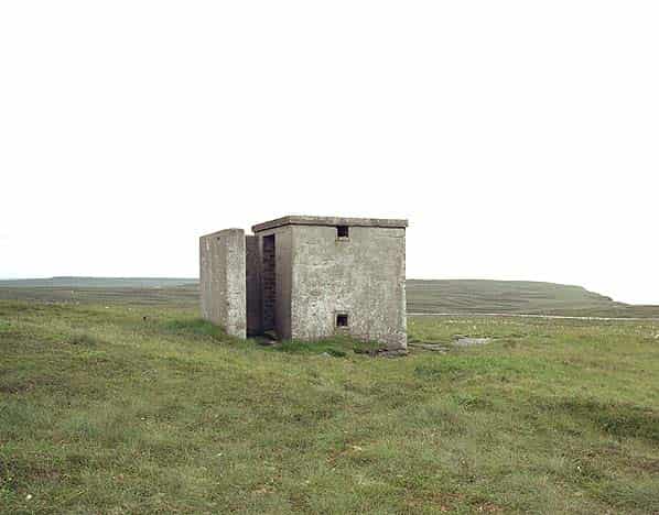
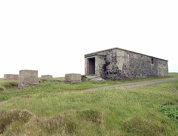
South west of the operations block, at the end of a track is a building with double wooden doors that was obviously designed to house a vehicle so this was probably an MT shed. Close by a small building with a blast protected entrance was the IFF cubicle. The term IFF derives from the words ‘Identification Friend or Foe. IFF allowed a radar operator to identify friendly aircraft. A transponder was fitted in the aircraft that responded to the signal from the radar station causing an udentifiable variation on the radar screen in the radar station.
Sources:
- Nick Catford
- Bob Jenner