")
The Valley Works acquired its' name 1939 when the Ministry of Supply instructed ICI’s Special Products Division to construct a factory and storage area in the Alyn Valley close to Rhydymwyn. The factory was to manufacture mustard gas. In the years 1940-1959 it was involved in the manufacturing, assembly or storage of chemical weapons or mustard gas in bulk containers. During the years 1947-1959 the tunnel complex held the majority of the country’s stock of mustard gas. In the post-war years major quantities of lower grade mustard gas was prepared for sea dumping. The Alyn Valley at Rhydymwyn has good road and rail links, water from mines and the Alwen Reservoir (Birkenhead Water) but not from the River Alyn which flows for only four months each year. There was also ample electricity from the North West Power Company’s Hawarden sub-station. On one side of the valley has a limestone hill. The valley was also in a flood plain with a meandering river coursing the valley. It is 6 miles from the tidal Dee Estuary but close to the chemical/industrial complexes of Runcorn/Widnes/Warrington.
DEVELOPMENT
In the late 1930s the Chamberlain Government and ICI planned that we should be in a position at the beginning of any war to retaliate in kind if the Germans, as expected, utilised mustard gas. Plans were made to build three mustard gas manufacturing factories (later built at Randle, Valley and Springfields), one phosgene factory (at Rocksavage) and three factories to provide the constituents for the mustard gas factories (at Hillhouse, Royd Mills and Wade). A prototype 50 tons a week Runcol plant was completed at CRDE Sutton Oak. In 1937 the initial buildings of a first mustard gas plant were started at Runcorn on Wigg Island in the River Mersey, this factory was named Randle Works. Work progressed on a low priority until 1939 when the factory rapidly expanded to having two Runcol plants (R1, R2) capable of producing 100 tons/week and three Pyro plants (PI,2,3) capable of producing 216 tons/week . The mustard storage capacity at Randle was 500 tons in 100 sunken 5 ton tanks dispersed around the site. It was considered that if the Germans did intend to use mustard gas it would attempt to bomb our production capability to preclude us from retaliating in kind. There was, therefore, an urgent need to find a concealed and bomb-proof shelter in a remote local area where mustard could be stored in bulk and some charging and manufacturing could take place. In April/June 1939 the Alyn Valley was surveyed by the Dept of Industrial Planning on behalf of ICI and the Ministry of Supply (MoS). The Treasury approved the sum of £546,000 for initial work on 27 August 1939 and work began on storage tunnels in the limestone hillside in October 1939.
SITE CONSTRUCTION
While the tunnels were being excavated temporary storage was made available by sinking twelve 65 ton tanks adjacent to the site on Antelope field. More permanent storage consisting of thirty 65 and 55 ton tanks and one static 250 ton tank was built at Woodside which is 3 miles away. These tanks were filled by the Randle mustard plants and delivery was made by road tanker accompanied by the Lancashire Constabulary. According to Sir Eric Driver, the civil engineer responsible, when the digging of the tunnels was taking place the first priority was to dig out a culvert to canalise the River Alyn.
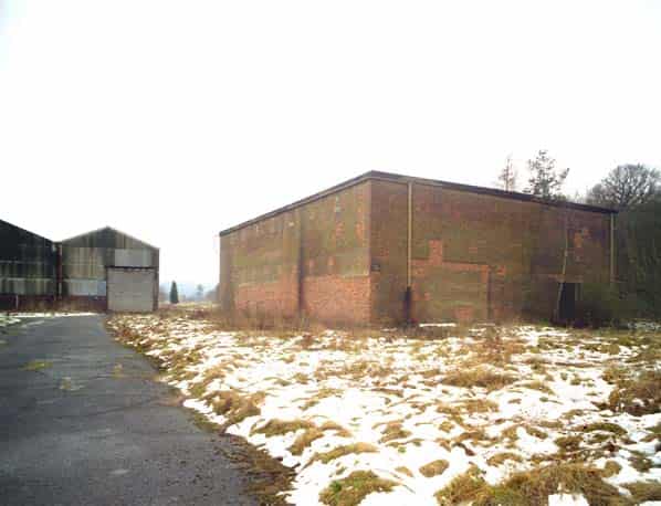
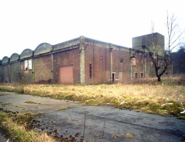
It was possible to build in the valley bottom in 1939 on the limestone base before the river was diverted. Another major project was to construct an effluent disposal pit measuring 60 ft in diameter and 30 ft in depth whose pumps lifted the effluent 160 ft for 3,000 yards through a 15 inch pipe then dropped it to Oakenholt a further 4 miles away through a 12 inch pipe discharging it into the tidal Dee Estuary. The River Alyn was canalised and diverted and the outage from the tunnels was used to fill in the redundant river course and level the valley floor. Two Runcol plants R3 and R4 were constructed to produce 100 tons per week followed by three Pyro factories P4, P5, and P6 with a potential production capability of 216 tons per week. P6 was never fitted out with production machinery and was converted for the testing of prototype gaseous diffusion cells for Tube Alloys. P4 and P5 were fitted out but never produced Pyro. P5 was used between 21 August 1944 and 13 November 1944 to convert mustard produced elsewhere to HBD. The buildings assigned to loading the mustard into the munitions and then bonding them K4, K4A and K5 were quickly completed. It was necessary to build a separate assembly area called the Danger Area (DA) where the charged and bonded munitions were fitted with explosives and fuses.
WORLD WAR II
The first operations until 1941 took the mustard shipped from Randle to Antelope and Woodside and charged and bonded the munitions in the charging sheds K4, K4A and K5. After 24 hours bonding the munitions were transported to the DA where they were handed over to employees who fused, filled with explosive, painted with identifying colour bands before packaging and making them available for dispatch to the Maintenance Units (MUs). The charged munitions were dispatched by train and escorted by personnel trained in dealing with spillage and ‘leakers’. The main source of these guards appears to have been from RAF Barnham.
From January 1941 onwards the Runcol factories R3 and R4 began production and by 1945 had produced 15,477 tons. The constituent chemicals were shipped to the site by rail. The ‘syrup’ (thiodiglycol) constituent came from Randle. The factory continued to weaponise the mustard shipped from Randle and in the later years Pyro was received from Springfields. Bulk mustard, both Runcol and Pyro, was later shipped in rail tankers to the Forward Filling Depots (FFDs)
In 1943 there were circa 2,200 people working at Valley, the vast majority were directed to work there by the government and billeted with local families. There were 5.2 million munitions manufactured in the war years many of them smoke generators which were heavily utilised from D-Day onwards. The factory cost £3.2 million pounds and ICI received a £60,000 agency fee for its involvement.
FORWARD FILLING DEPOTS
The most common and cost effective mustard gas weapon was the 651b light case bomb - an extremely fragile device and notoriously difficult to transport in quantity without incurring a number of “leakers”. The provision of bulk storage of mustard gas close to the bomber stations solved this problem. After testing the system at Woodside five Forward Filling Depots were constructed from 1942 onwards, they were, FFD1 Barnham (Little Heath), FFD2 Melchbourne Park, FFD3 Norton Disney, FFD4 Lord’s Bridge, FFD5 Escrick. Nos. 1 & 2 were under the control of the USAAF and were equipped with three tanks each filled with 500 tons of Runcol. They were designed to fill both the standard 65Ib LC bomb, plus the M33 spray tank. The other three units were operated by the RAF and would be used only for the 651b weapon. They were each fitted with two 250 ton tanks and were filled with 500 tons of Pyro in the case of Escrick and 250 tons each of Pyro and Runcol for FFDs 3 & 4.
THE ATOMIC BOMB CONNECTION
In December 1938 Otto Hahn and Fritz Strassman discovered that uranium when bombarded with neutrons emitted barium. It was subsequently discovered that this effect was caused when the uranium isotope U235 split into two parts(fission). When this happened at least two neutrons were ejected by the fission and this could lead to a chain reaction giving a large explosion. Uranium 235 occurred in the volume of seven parts per thousand in refined uranium. In February 1940 Rudolf Peierls and Robert Otto Frisch calculated that if you could separate U235 from uranium 238 as little as IKg would be a critical mass sufficient to cause the large explosion. This information was considered by the MAUD Committee who reported in July 1941 that it would take 10-15Kgs of U235 to make a bomb which would explode with a force of 1,800 tons of TNT. The most promising method of separation of the isotope was by gaseous diffusion and the world authority was Franz Simon, an expatriate German working in Oxford. If uranium in a gaseous form was pressurised against a membrane in a sealed chamber the isotope should travel more quickly through the membrane than U238. This slight enrichment would be used as input through 1,700 stages in cascade giving IKg of U235 a day, sufficient to make two bombs per month. It would take two years to be in a position to start production at a cost of £50 million. It was decided that it was necessary to test the gaseous diffusion principle and Metropolitan Vickers at Trafford Park, Manchester were contracted to build four pilot gaseous units at a cost of £150,000.
Three of these cells were installed in Building P6 at Rhydymwyn in 1941. These units were tested by a team of about seventy under the guidance of Rudolf Peierls and his assistant Klaus Fuchs. The Quebec Agreement signed by Roosevelt and Churchill on 19th August 1943 committed all future development of the Atomic Bomb to the USA and Canada and 20 UK-based scientists joined the Manhattan Project. In December 1943 Peierls and Fuchs went to New York as consultants to the Kellex Corporation who were building the K-25 gaseous diffusion at Oak Ridge, Tennessee. They never visited Oak Ridge and were excluded from all production details. In early 1944 Peierls left for Los Alamos where he ran the Tl section and Fuchs joined him in August 1944 to perfect the initiator for the plutonium device. When Peierls departed for the USA the gaseous diffusion testing program continued under the leadership of Dr Harold Schull Arms, an American ex-Rhodes Scholar, until January 1945 when the test equipment was sent to Didcot and Harwell. The only recorded radio-active material ever shipped to Valley was 2Kg of Uranium Hexafluoride and this was transferred to Harwell in 1945.
POST WWII
After 1945 the UK did not manufacture any Mustard gas. Randle had the capability to manufacture both Pyro and Runcol and its plants were kept on standby into the mid-1950s with periodic inspections, maintenance and up-grades. Springfields which only ever produced Pyro was rapidly decommissioned, tidied up and handed over to the nascent Atomic Energy Authority to prepare uranium ore and to chemically separate the plutonium content of the output from the Windscale reactors. Valley also rapidly had its mustard plants decommissioned. The tunnels and the factory site were administered separately. The Antelope field site, whose tanks had been removed to the tunnels early in the war, was cleared for civilian use. The thirty tanks from Woodside were emptied and removed to the tunnels; its 250 ton tank was decontaminated and imploded and the site was returned to the farmer in 1949. The policy in 1945/6 was to collect the mustard in weapons and bulk in the various Maintenance Units and grade it I, II or III. The mustard in the FFDs was also categorised and any bulk grade II or III was shipped by rail to Valley for decanting into 52 gallon drums for sea dumping. The tanks in the FFDs were then filled up with Grade I mustard decanted from munitions.
The mustard in the munitions at the MUs was graded and if not grade I was burnt on site or dumped at sea. It was later the practice to ship all the mustard munitions remaining to Bowes Moor or Harpur Hill for mass destruction. On 4th June 1946 stocks in the UK were as follows; Springfields 1,000 tons, Valley 3,000 tons, RAF poor mustard 1,200 tons, Woodside 2,000 tons, RAF filled bombs 1,500 tons, RAF FFDs 4,500 tons. This gives 14,200 tons of mustard.
By 1948 all of the mustard in the UK had been reduced to 5,000 tons in the Valley tunnels and 4,500 tons in the FFDs. A policy decision was made to destroy the mustard gas stocks as there were considered a costly irrelevance in a nuclear world and Major Ian Toler was tasked with destroying the stock located in the Valley tunnels at Randle by burning in the AOS machine. There was however a delay as it was decided to ship the 4,500 tons from the FFDs to Randle as Operation Pepperpot and Operation Spring Onion and to manufacture 10,000 one thousand pound new-style bombs. There was not sufficient mustard to achieve this in the FFDs and 2,000 were filled with Calcium Chloride. Between 1956 and 1958 the AOS burner ran non-stop for two years and destroyed all of the 5,000 tons Valley stock and the remaining mustard in various tanks and pots.
The Valley factory site was used until the early 1990s mainly as a buffer depot. The site covers 86.8 acres, has seven miles of secure fencing and has always been ‘Secret’. This has led to some bizarre conspiracy theories; it was never an alternate to Corsham that was Drakelow. The nation’s art treasures were stored at Manod not Valley. There is no fourth tunnel; the footprint of the tunnels today is the same as in 1941. There is no evidence of any secret communications centre. No steam engines ran in the tunnels, there is a rational explanation. There is no evidence of food being stored in the tunnels by the EEC. There were however secret plans for the tunnels which were Projects Wellbright, Mallard and Trojan.
REPORTS AND RECOMMENDATIONS
There have been a number of reports and desktop studies of the site over the last 25 years. The consensus opinion appears to be that although there are no overtly threatening issues, there are few records available for the latter war and post-war years when less stringent controls for handling mustard gas were the vogue. The toxic pits and the site generally are extensively monitored with on-site instrumentation. It is, however, unwise to permit digging around the site although it is eminently more benign than Randle which is a landfill area for Halton Council and a bird sanctuary. One solution at a cost of many millions of pounds would be to cover the whole 86.8 acres with concrete and open it up as a business park. The current solution is to maintain the seven miles of fencing and allow access on a managed basis. This also stops fly-tipping and the vandalism of the recently listed and scheduled buildings
THE HERITAGE SITE
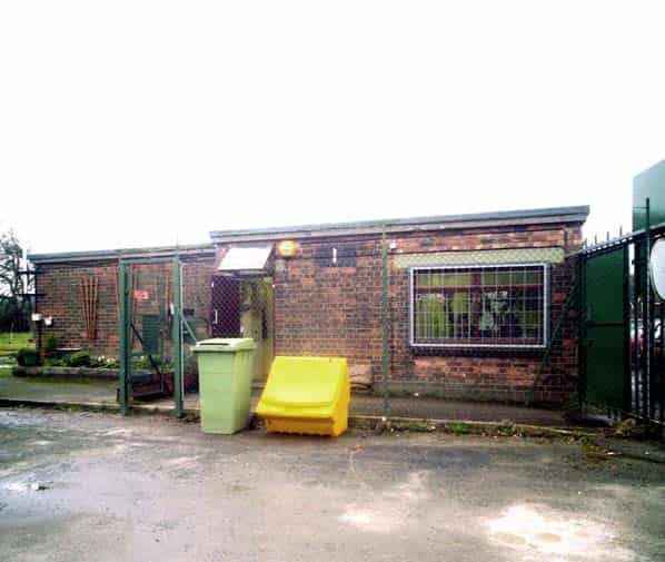
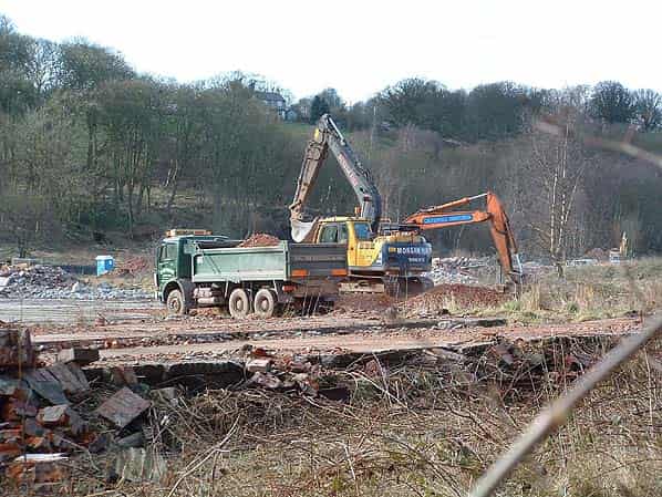
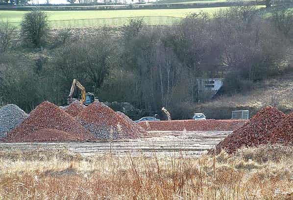
Valley has not been used since the mid-1990s. In the preceding post-war period many of the buildings were still in use, mainly as a buffer storage depot, but some were demolished because they were dangerous. In the 1980s the effluent disposal pit was filled in, the pipeline to the Dee Estuary was either removed or filled with slurry and a number of buildings were made safe or demolished. In 2003 major remediation work took place when a large number of buildings were demolished, the toxic drains were filled in and any suspect areas were covered with membranes and a large number of monitoring points were installed. As part of this package a Visitor Centre was built on the site of the old gatehouse. The site is still guarded but managed access is encouraged. The valley is beautiful and the Pyro buildings have a gaunt and majestic presence seeming to create a time-warp. On the 20th September 2008 the Runcol and three Pyro buildings were made Grade II listed buildings and 21 buildings in the danger area including the tunnels were scheduled by CADW. Visitors are encouraged to the site. North East Wales Wildlife is resident on the site and will welcome visitors from schools upwards. The Valley History Society takes visitors around the site and will take you into the threshold of the tunnels.
SITE VISIT REPORT
March 22nd 2001 saw 5 members of Sub Brit visit the former chemical weapons and food storage buffer depot at Rhydymwyn in North Wales. This visit was arranged with and fully sanctioned by the MAFF who own the site and we were met by 2 MAFF members of staff who would escort us around the site with the local civilian security guards.
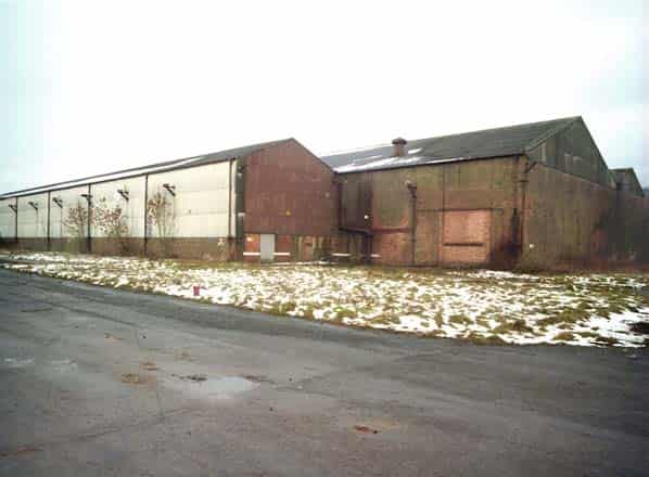
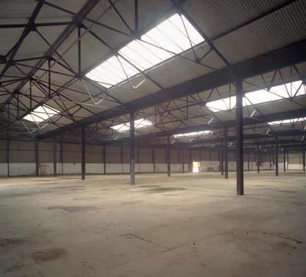
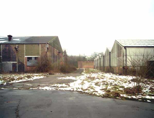
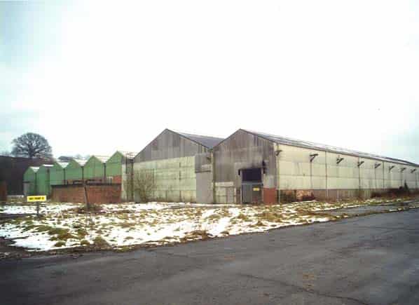
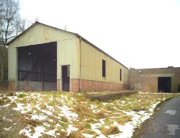
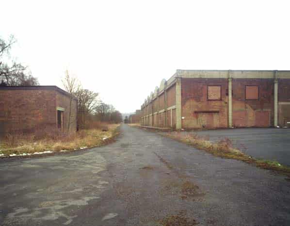
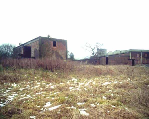
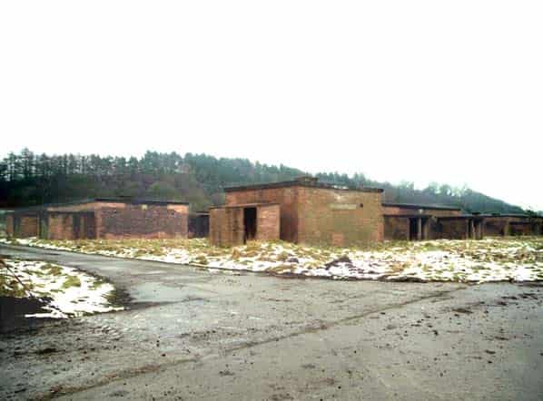
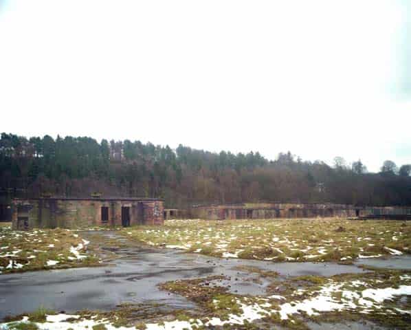
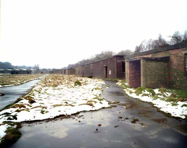
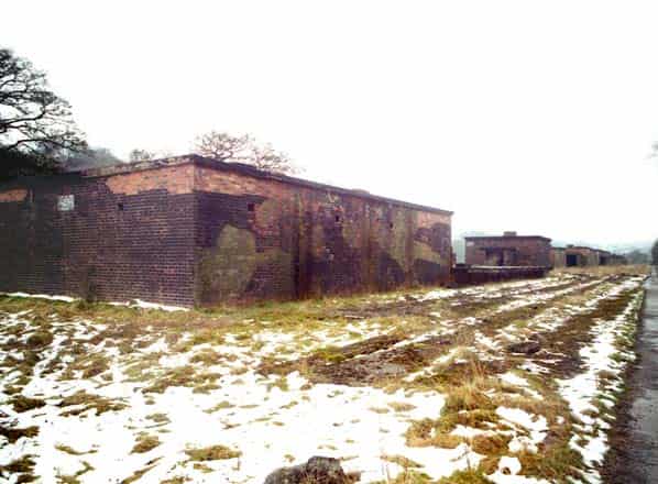
Having duly changed and collected hard hats and luminous safety jackets we started our tour of the site. Starting from the guardhouse at the northern end of the site we walked down the main road passing a number of buildings on both sides of us including P4 on our right. All these buildings were empty and had all the windows and doors removed. It became obvious that the site is very overgrown in parts and is not in use and hasn’t been for several years.
We passed a number of mounds and our guides explained how these were buildings that had been demolished and grassed over. There were a couple of shaft accesses from the site to the Milwr tunnel complex Halkin level but these have now been capped. The access points had suffered collapses and the cavers involved had not gained access into the Halkin level but had confirmed that it appeared that it once existed. There is no access to these ‘shafts’ that are now mounded over and grassed.
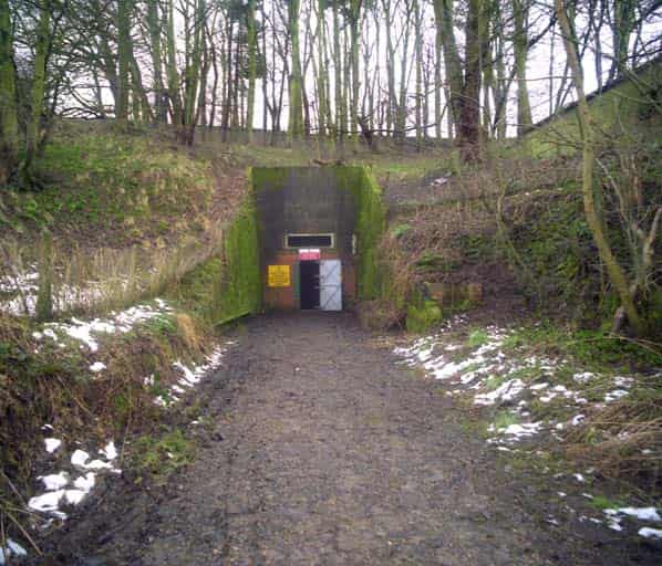
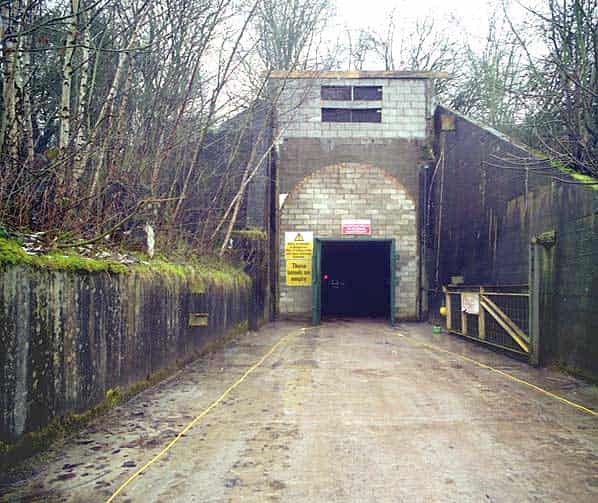
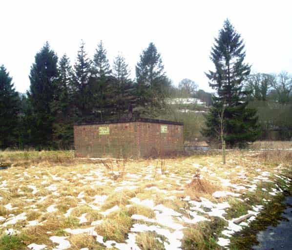
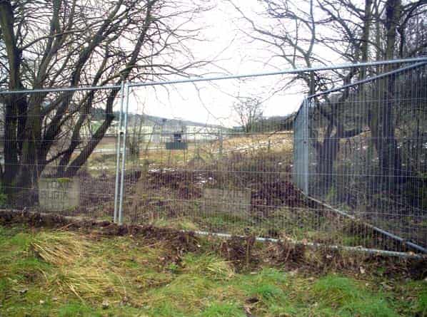
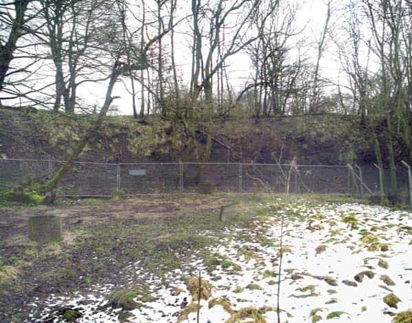
We continued along the road which turned right then left at which point we came level with the northern access tunnel into the underground complex. This tunnel now functions as the emergency escape from the underground area. The blast doors have been removed and the entrance bricked up. A single steel security door with heavy-duty locks now provides access into this tunnel. Continuing along we reached the middle tunnel that is opposite the gap between P5 and P6 buildings. This is now the main entrance into the underground complex and has 2 heavy-duty steel security doors on it with the former blast door area being bricked up.
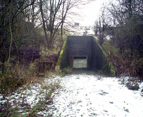
Further along the road on our right is the entrance to the southern tunnel and this entrance is now sealed but has ventilation grills fitted high up to assist airflow in the underground section.
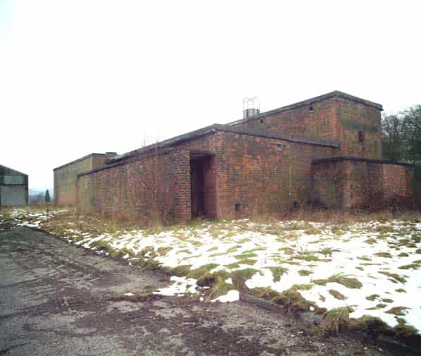
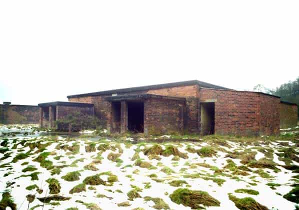
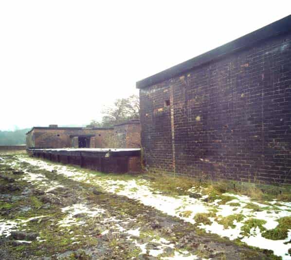
At this point the group split in 2, as we were restricted to a maximum of 4 people at a time underground due to health and safety requirements. Two Sub-Brit members and the 2 MAFF officials went into the tunnels whilst the remaining 3 Sub-Brit members headed to the southern end of the site to view the former filling rooms and the old railway platforms. With the others going into the tunnels we continued along the road through the site heading south. The River Alyn runs through a culvert along the length of the site with a branch of it running underneath the tunnels (more on this later). As we passed P6 and entered the southern part of the site the road surface changed from concrete to Colas. This was to reduce the risk of a spark from something being dropped onto the floor igniting one of the weapons being filled. The filling rooms are small brick and concrete structures with roof and wall vents and many have blast walls to protect the entrances. These buildings still have their WW2 camouflage paint clearly visible on then particularly on the east side which is protected from the weather. We continued along the main path down to the southern boundary fence, which is topped with barbed wire. Here the Alyn flows over what’s left of the weir following the floods last year and on to the Dee estuary.
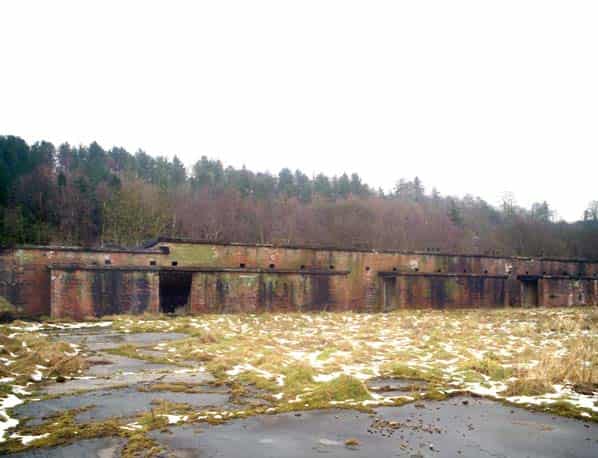
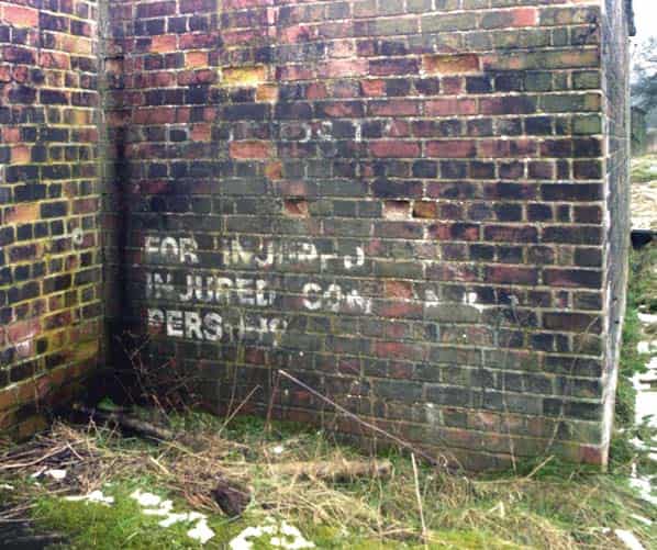
We turned and headed north walking along the east path through the site. From this path we could see much more of the paint on the side of the filling rooms and we entered all the buildings. One of these had a sign reading ‘cleanway to canteen’ painted on the wall in excellent condition. Many of these buildings are in a very poor state with leaking roofs etc. Set in the middle of the filling rooms was the railway platform. Again this was covered in Colas and we could clearly see where the 2 railway sidings used to be.
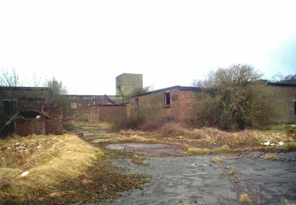
Continuing North we walked along the edge of the site and turned west back towards the main pathway when we reached the old sewage works. These still had a lot of machinery in place but were very dilapidated.
Walking along the side of the sewage works our guides explained how in the bad flooding last year the site became awash as the Alyn overflowed and a substantial amount of flotsam and rubbish was washed onto the site. There were numerous piles of this everywhere awaiting clearance. We crossed the end of the sewage works and headed back towards the east fence and picked up the east path again. Continuing North we passed the rear of P6 and at the gap between P5 and 6 crossed the site back to the main tunnel entrance where the first party were just emerging from the underground workings.
Before entering the underground workings we received a short but comprehensive safety briefing and collected our emergency respirators. Large signs outside the entrance told us that the tunnels were dangerous and empty. Our guide then led us into the tunnels.
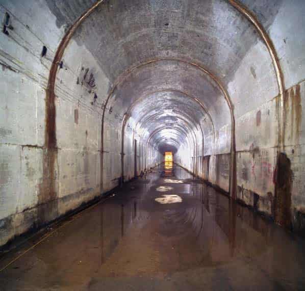
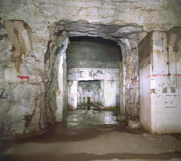
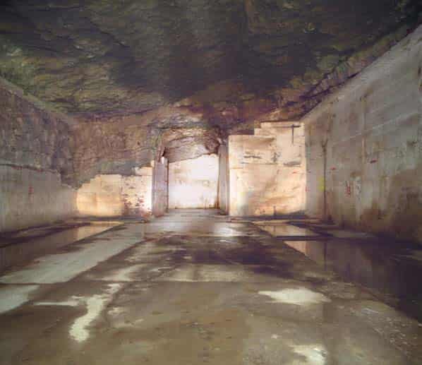
The main entrance tunnel is around 250M long and is concrete lined for the first half after which it is bare rock painted white. There is up to 3 inches of water on the floor of this entrance tunnel. This tunnel leads directly into chamber A that is transverse to the entrance tunnel. At this point it is possible to go left, right or straight on into chambers B,C and D.
We decide to turn right (north) and are standing at the midpoint of chamber A. The chambers are all identical and have rough rock walls painted white. Along the centre of this tunnel set into the floor are a series of drain cover grills, which are all badly rusted, and we were warned not to step on these as they would collapse under our bodyweight. There were various puddles of water on the floor in this chamber.
We could clearly hear the sound of water running and this got louder the further north we headed. Reaching the northern most point of chamber A we could look down the tunnel to the northern door which was our emergency escape route. This tunnel was empty.
Attached to the walls high above our heads were the fixing points for the runners for the long gone overhead cranes. There is no evidence of railway tracks in any of the tunnels.
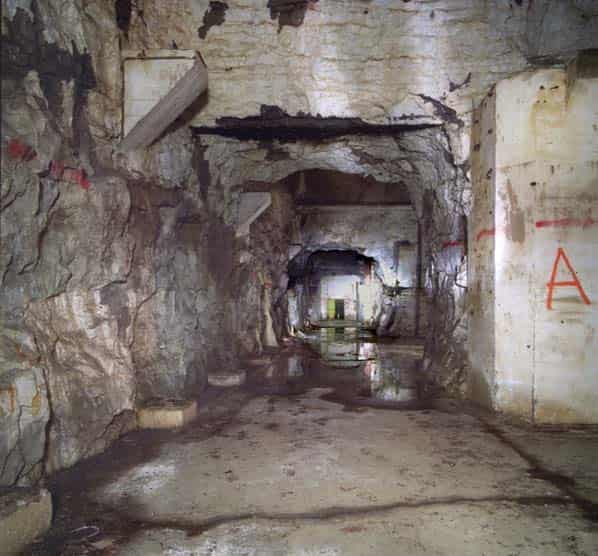
We turned left and headed down a short piece of tunnel into chamber B. Here we could see where the water noise was coming from.
From a hole high in the roof at the northern most point of chamber B a torrent of water was crashing down onto the floor below. This was causing the puddles that were to be found in various areas of the underground workings.
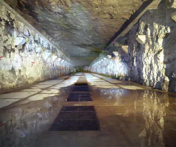
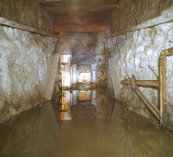
We turned south and headed down chamber B being careful not to tread in the grills set into the floor. We turned right and moved into chamber C which had sluice channels cut into the floor along each edge approximately 3 fete wide and 6 feet deep. The water tanks that stored the Runcol (Mustard Gas) filled shells were located in chambers C & D and the sluice channels were to remove water that leaked from the tanks into the drainage system that was below the tunnels (more on that later). These sluices were now filled with standing water and again the floor of these chambers was wet in places.
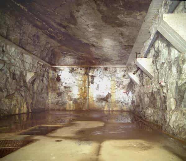
Moving into chamber D we moved to the northern end where we viewed the way through to the air shafts. In order to access the shafts it was necessary to cross a 6ft deep water pit. This used to be the way down into the drainage system beneath the underground chambers. The whole system was run by pumps that got rid of the excess water and the drains were up to 5ft tall in places. The pumps were switched off many years ago and these have now become flooded and access to them is not possible unless you have a wetsuit and breathing apparatus!
We continued south along chamber D and at the far end was the southern vent shaft access, which was identical to the northern one.
We crossed back into chamber C and then worked our way back to chamber B and eventually A.
In some of the chambers the consulting mine engineers employed by the MAFF have places measurements to check for shifting of materials in the chambers and this has resulted in loose rock being removed in a couple of places and a small amount of re-inforcing being put in at the southern vent shaft access.
We walked back to the main entrance tunnel and exited stopping to look at 2 vehicle gates that were rusted to the walls. These obviously provided an ‘air lock’ type gate for allowing vehicles in and out or the workings.
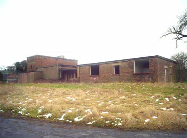
We emerged into the sunshine to be greeted by the 2nd Sub-Brit party making their way back towards us having toured the south of the site. We then all set off together to tour the rest of the site. We walked back across to the east path and continued along stopping to look in all buildings of interest. Building P5 used to house flour as part of the MAFF buffer stock and directly behind P5 is one of the sheds that used to house the shunter engines. There is a small amount of standard gauge track set into the floor outside P5 on its west side.
Continuing along we then visited the quality control labs where there were a number of yellow squares in the floor marked ‘toxic drain’. In these buildings which again had no windows or doors there were remains of light fittings and a number of power junction boxes on the walls.
We left the labs and walked across the north end of the site passing the old powerhouse and garages that house an ambulance and fire engine arriving back at the gatehouse.
Throughout the site there are numerous boreholes that the MAFF use for monitoring whether there is any leakage from the significant number of toxic waste burial pits which are marked and fenced off on the site.
The site is a mile long and is totally disused the only presence being security guards from Citex who are contracted to the MAFF to provide site security.
No restrictions whatsoever were placed on us by the MAFF and we extensively photographed and video’d the site and the underground workings.
I would like to take this opportunity to thank the MAFF for their extensive co-operation and allowing us to visit this important site.
Many of the buildings on the site were demolished early in 2003. Some works are being done at the foot of the bank adjacent to the tunnel entrances to stabilise the bank where some small buildings have been demolished, at the southern end of the site a new bank has been built to replace the washed out river bank, this is stone faced and has new boundary fencing to close the gap in the original boundary. See last two photographs in the gallery.
Sources:
- V/SPS 1939 Proposed Site Plan Held at DEFRA Records Alnwick
- TNA SUPP 5/1003
- ICI Internal History
- Interview with Sir Eric Driver 21 February 2008
- TNA SUPP 5/1011
- Interview with Dr Ted Howes 14 March 2008
- Dangerous Stuff by Graham Crisp. Unpublished with kind permission of the author
- Britain and Atomic Energy 1939-1945 by Margaret Go wing p217
- Personal questionnaires on the Los Alamos web site
- C&M VWM 84-111 Valley Works Managers Minutes 1946-48
- C&M 1-77 Minutes of meetings held at Randle 1945-1957