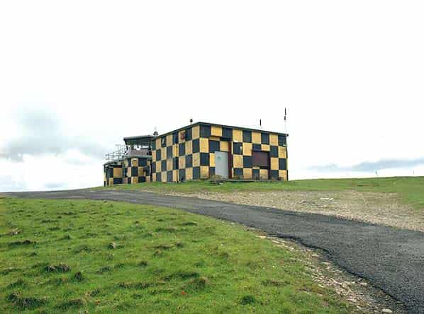
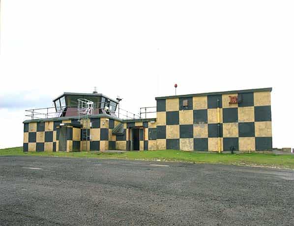
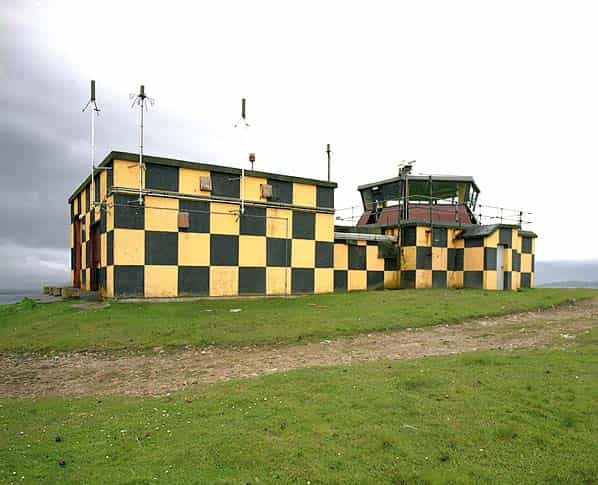
The final stage of the ROTOR Programme (Rotor 3) was to provide radar cover for the north and west of the British Isles which were still exposed to attack and to give low and surface level cover over the Atlantic, the absence of which prevented effective action against low flying enemy aircraft. Three new CEW stations were to be built at Faraid Head, Aird Uig, and Saxa Vord equipped with Type 80 Mk 2 and Type 13 radars. The new CEW operations buildings were to be above ground, heavily built and designated R10, similar in internal layout to the underground R1 bunkers.
Rotor 3 included five new Chain Home Extra Low (CHEL) stations equipped with Stage 1 radar equipment to enable detection and tracking of low flying aircraft. (Stage 1 comprised Type 7 Early Warning [E/W] GCI, Type 14 E/W search radar E/W or Fighter Control [CEW station], Type 13 H/F and a Type 15 [mobile Type 7] - radars from this list were installed as required) The proposed stations were at Kilchiaran, Murlough Bay (demolished), Prestatyn, Snaefell and West Myne (not built). These were to be heavily built operations blocks, designated R11; the above ground version of an R2 bunker.
Two new GCI stations were also proposed as part of the Rotor 3 programme, each equipped with a Type 80 radar and R8 prefabricated operations block. One at Ballywooden (Killard Point) in Northern Ireland and the other at Wick on the Scottish east coast. It is unclear if Wick was ever built. The proposed location was Hill of Ulbster the site of a WW2 Chain Home Low reserve radar station.
It was hoped that The ROTOR 3 programme would be complete by 1957 and all technical aspects were classified as ‘Super Priority’.
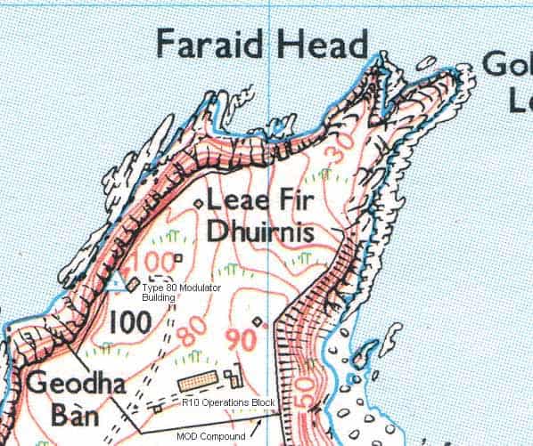
PRO File Air 2/2062 is the ‘Secret Works File’ on RAF Faraid Head; this file was opened on 18.5.1953 and lists the various dispersed sites, equipment and cost of the station. The total cost, including all the sites was £250,000.
Authorised equipment for the station was one Type 1A radar (Type 80), one Type 13 Mk V1, one Type 14 Mk IX, six Type 64 consoles, two Type 61 consoles, one ‘A’ Scope, three video mapping units and one radio link in lieu of a GPO phone line. This linked to the VHF transmitter site at Mael A' Bhuic. It is unclear whether the Type 80 radar was ever installed although some of the bases for the steel gantry that straddled the building are visible.
By the target completion date of 1956 some ROTOR stations had already closed down and the introduction of the ‘Comprehensive Radar Station’ as part of the ‘1958’ plan had no place for Faraid Head. The equipment was dismantled on 4th February 1957 and the station was placed on care and maintenance on 27th August 1957. All remaining equipment and personnel were withdrawn from 1st September 1958 and the site was abandoned.
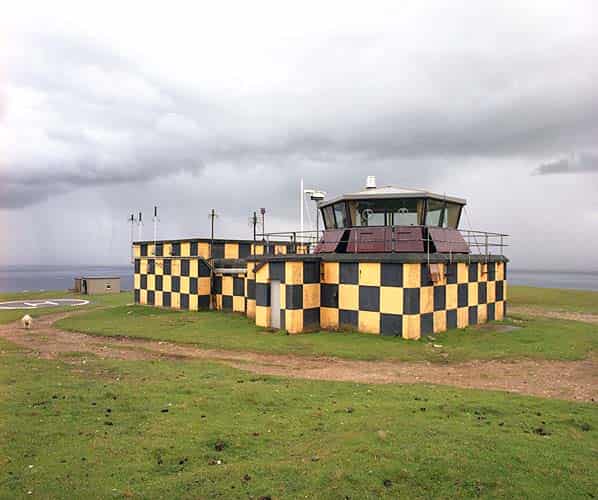
The head remained in MOD hand however and the Type 80 modulator building was renovated for use as a range control tower for the Cape Wrath and Garvie Island naval ranges. It still performs this function today.
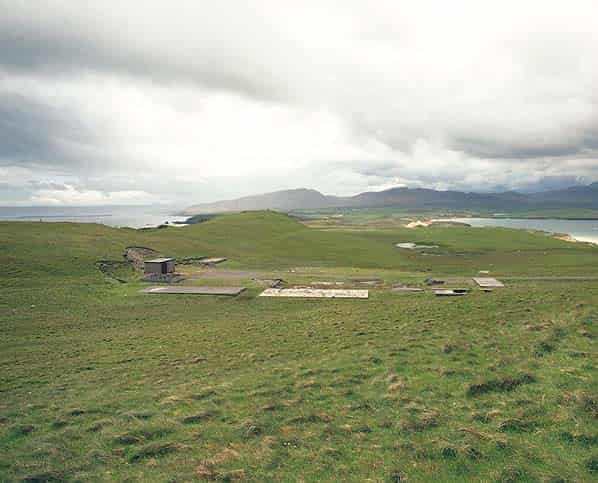
Most of the buildings on the technical site have now been demolished. They were located on a small plateau to the south and below the modulator building on the head. The position of each building on the site is clearly defined as the concrete bases can still be seen. One small building survives.
Internally the modulator building has been completely refitted with kitchen, dormitory, radio room, crew room and a ladder up into the new control tower built on the roof.
Faraid Head is located two miles to the north of Balnakeil village. There is a metaled road but much of it is impassable without a four wheel drive vehicle as sand from the surrounding dunes has blown across it, in places up to a foot thick. The first half mile involves driving along Balnakeil Beach. Much of the area is free public access but the head itself, including the modulator building and the technical site, is fenced with limited public access when the ranges are not in use.
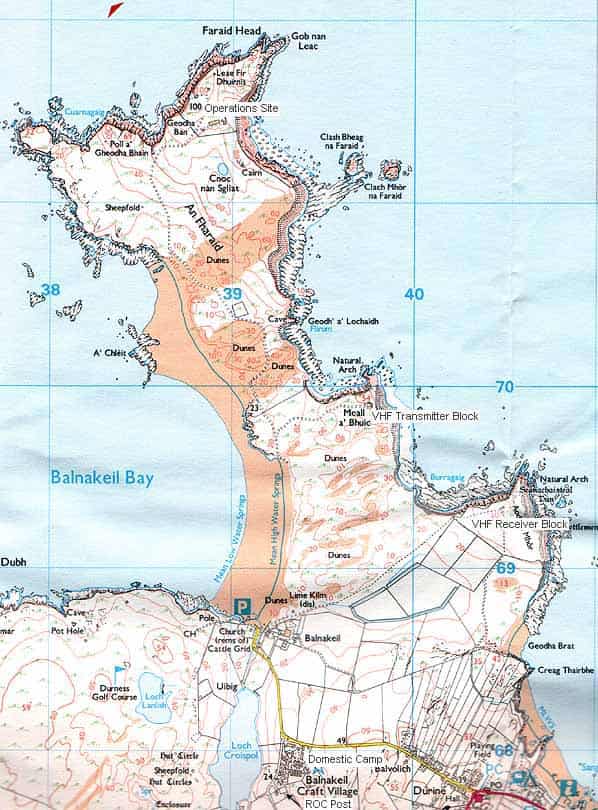
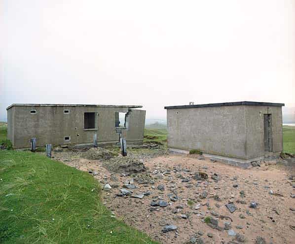
In order to provide communication between the controllers in the R10 operations block at RAF Faraid Head and the intercepting aircraft, two VHF/UHF multi-channel radio transmitter and receiver blocks were at built at remote sites to the south of Faraid Head. The blocks were remotely sited to stop interference and swamping of the radio signals by the radar arrays. Transmitter and receiver blocks come in two sizes, designated ‘small’ and ‘large’; those at Faraid Head are small.
Each site consisted of two buildings, the operations building and a standby set house. As built the transmitter site comprised the transmitter hall, mechanical and electrical room, store, workshop, staff room and toilet. The electrical room also housed GPO equipment with a tower and microwave link to the main operations site.
The two buildings stand at Mael A' Bhuic, another headland one mile south east of Faraid Head. Both buildings have been stripped of any original fittings and have been partly demolished as part of a training exercise. They are due to be blown up by the Royal Engineers as part of a future exercise. To the rear of the buildings four concrete mast bases and the stub of the transmitter aerial tower can also be seen.
The smaller receiver block is located at Aodanm Mhor, a third headland half a mile south east of the receiver site. It has not been visited but can be clearly seen from the transmitter site. As built the receiver site comprised a receiver room, mechanical and electrical room, store, workshop, staff room and toilet. A VHF fixer site was also located at Durness.
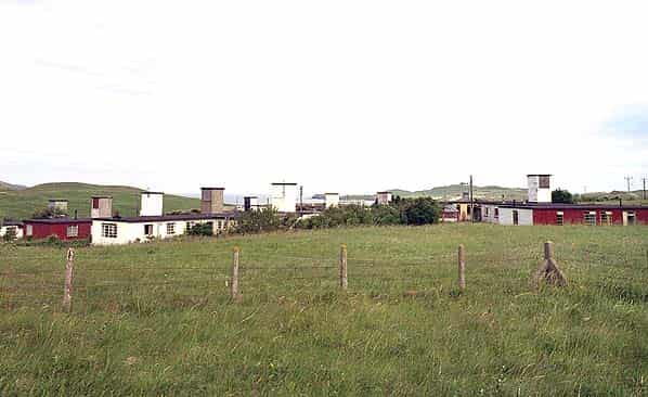
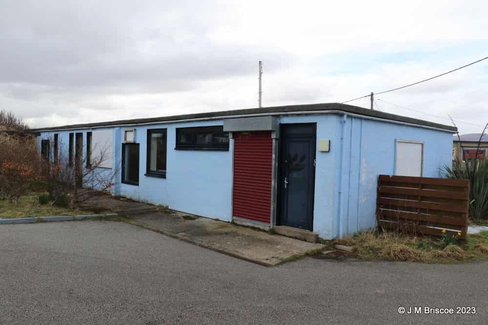
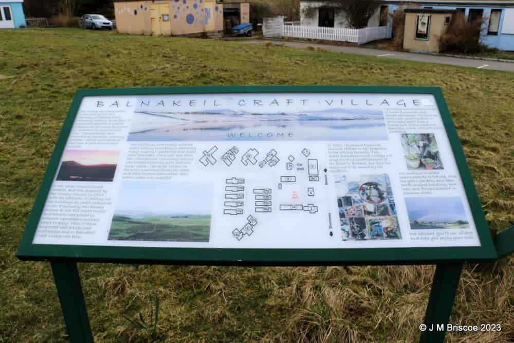
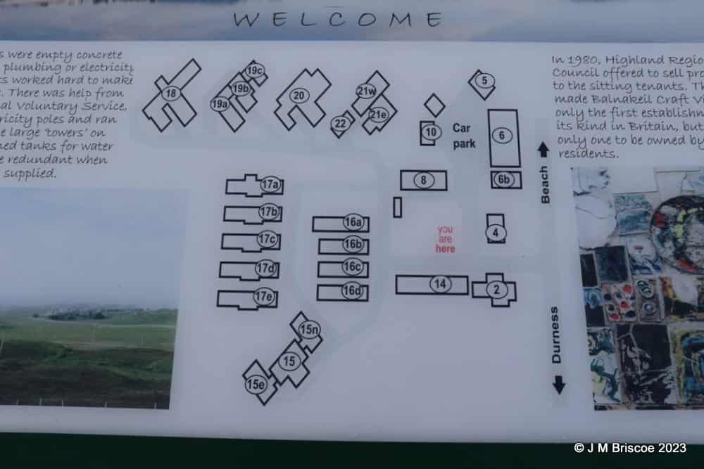
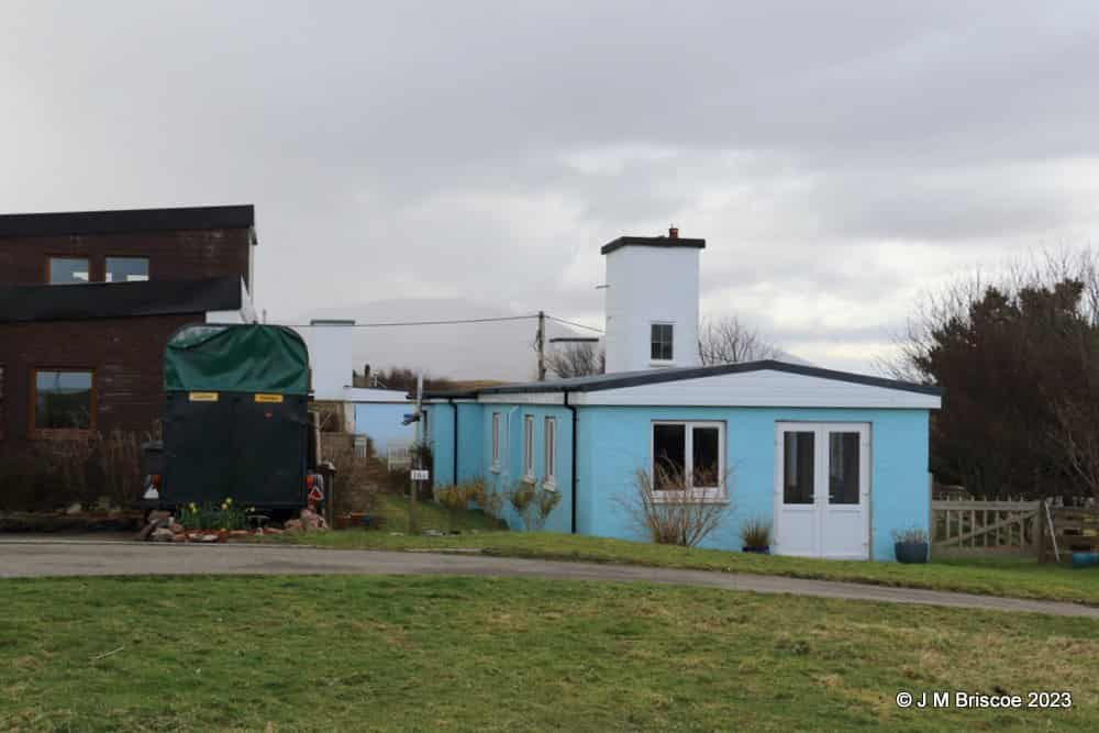
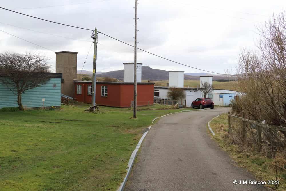
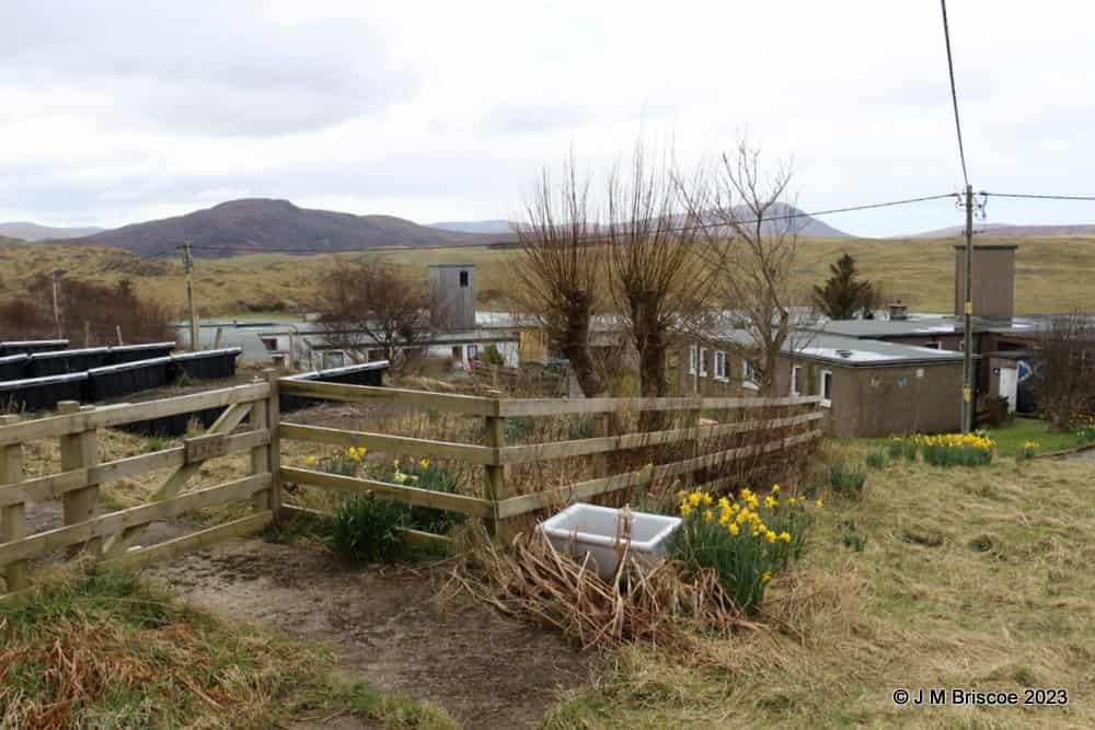
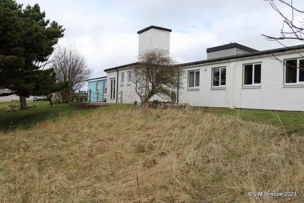
Initially the domestic camp for the adjacent Sango Chain Home radar station was used until the new camp at Balnakeil was built. This camp is largely intact; it was sold by the MOD in 1964 and now houses the Balkaneil Craft Centre.
The camp at Balnakeil consisted of the following buildings: guardhouse, armoury, fire tender shed, dog compound, main stores, inflammable stores, MT (Motor transport) shed, MT workshop, petrol pump facility, AMW office and store, station headquarters, post office, airman’s mess and rations store, airman’s institute and NAAFI staff quarters, airman’s quarters, airwomen’s quarters, officers mess and quarters, sergeant’s mess and quarters, sick quarters and a sub station.
Sources:
- Bob Jenner
- PRO file Air 2/2062