")
RAF Chenies was an R8 Ground Control Intercept (GCI) radar station (code HAM) built in the 1950’s as part of the post war ROTOR Programme. While most post war GCI stations utilised an existing WW2 site, Chenies was a green field site. Originally sited at Heathrow, it was known by this name until it was changed to Down Barns and on 5.9.1950 the name was changed again to Chenies.
Chenies was built as part of the first stage of the ROTOR Programme which was itself divided into four phases. Phase 1 was the re-establishment of 28 WW2 Chain Home radar stations. 13 were brought up to a fully operational state while the remaining 15 were brought up to a ‘readiness’ state. These stations would have required some notice before they were fully operational.
Phase 2 was the construction and installation of 14 new underground Centimetric Early Warning (CEW) and Chain Home Extra Low (CHEL) stations. Phase 3 was the construction and installation of 11 new underground GCI stations Phase 4 was the construction of 14 new semi-submerged or above ground GCI stations. These were generally (but not always) located on the west side of the country where the perceived threat of attack was not so great and to save on cost protected underground accommodation was therefore not provided.
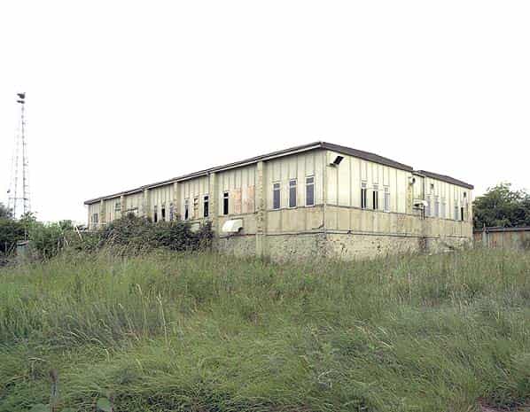
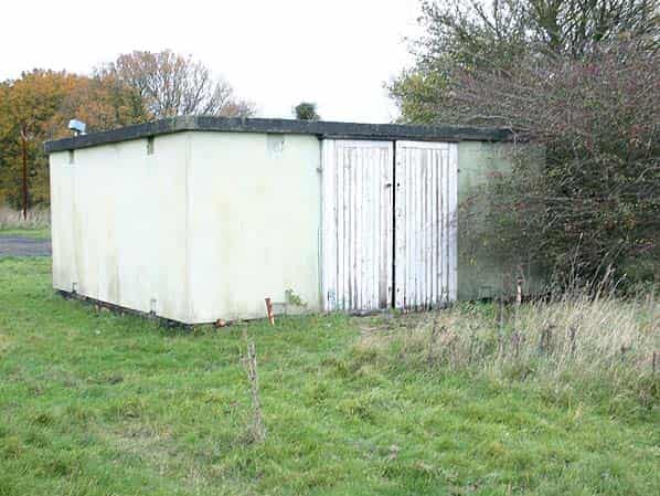
Phase 4 comprised of five R6 semi submerged protected stations and nine less substantial R8 stations. Normally, stations on the east side of the country would be protected but Chenies being in the centre of the country was provided with a prefabricated SECO R8 structure built of wood fibre and asbestos panels. Of the nine R8’s, Chenies was the only station to be fully operational, all the others were ‘readiness’. The other R8 technical blocks were at Calvo, Charmy Down, Comberton, Gailes, Hartland Point, Scaranish, St. Anne’s and Trewan Sands. Two further R8’s were later built at Killard Point (Ballywooden/Bishopscourt) in Northern Ireland and Wick in Scotland as part of the Rotor 3 programme.
By 30.8.1953 the first two phases of the ROTOR programme were finished and Phase 3 buildings were complete with the installation well advanced.
By this date the fourteen Phase 4 technical blocks which comprised five semi-sunken R6 structures and nine prefabricated R8 structures were nearing completion with technical installation expected to be finished by early 1954.
RAF Chenies had no married quarters or domestic camp with personnel being billeted at three of the dispersed sites of RAF Bovingdon, two miles north of Chenies from where they were bussed in daily.
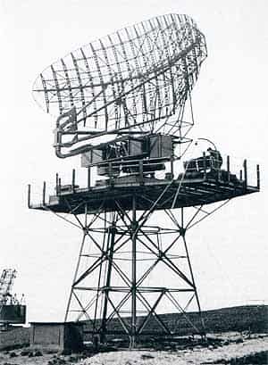
The following radars were originally planned for Chenies: one Type 14 Mk. VIII, one Type 14 Mk. IX, two Type 13 Mk. VI, one Type 13 Mk. VII, one AN/FPS3 and one AN/TPS10. (No Type 80 was planned or built at Chenies).
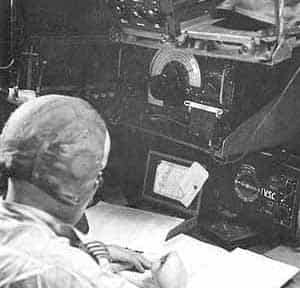
It is unclear when Chenies came became operational but in 1954 ‘163 Signals Unit, Chenies’ replaced the Fighter Command Control Unit at Heathrow, It is clear the station was not completely ready at this time as a temporary Type B operations hut was required for the AN/FPS3 radar.
The ROTOR station at Chenies was however short lived closing as a radar station prior to ‘The 1958 Plan’, the successor to the Rotor Plan.
In 1959 Chenies was awaiting disposal but along with RAF Bovingdon it was selected as an ideal site for the construction of underground silos for the Blue Streak missile programme. Disposal proceedings were immediately stopped but the project was later cancelled due to its apparent lack of credibility as a deterrent.
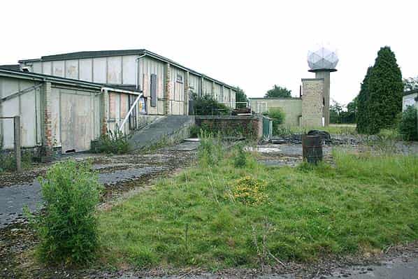
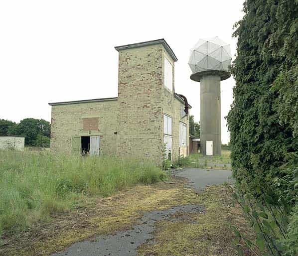
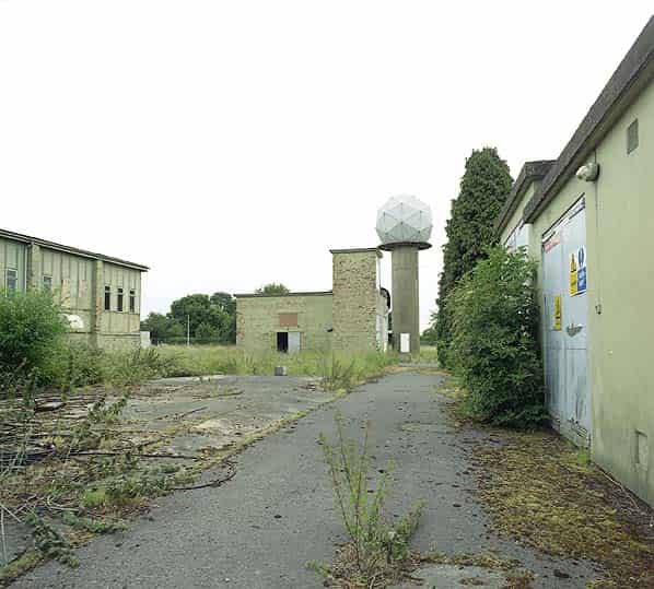
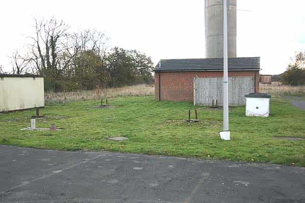
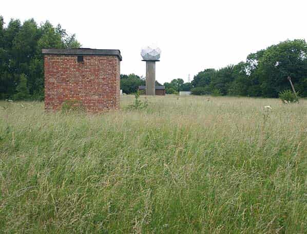
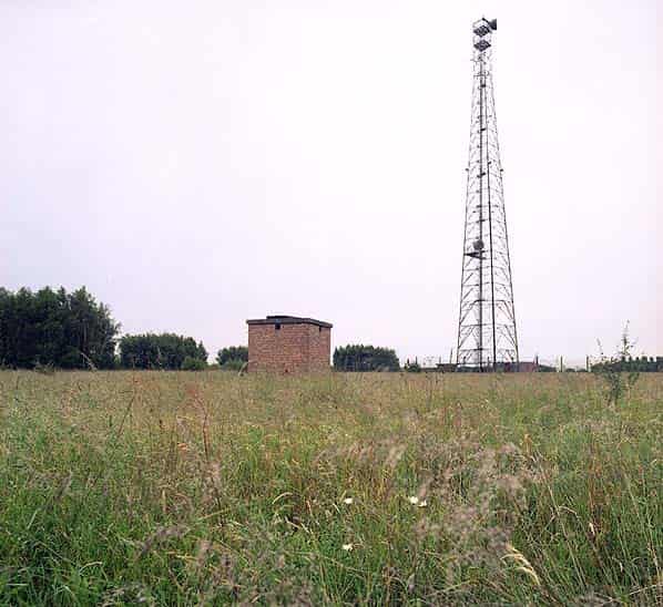
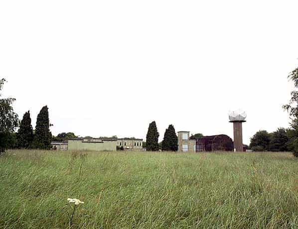
The station remained in RAF hands however becoming a Strike Command communications facility. In the mid 1980’s Chenies also took on a new role as part of the Gandalf Project when a new radar was installed for the Met Office. The new radar is one of a network of Met. Office C band radars, situated north-west of London. It provides high-resolution (2 km Cartesian grid, 5 minutes time interval) estimates of precipitation intensity and extent over the south-east of England and is partly funded by the Environment Agency.
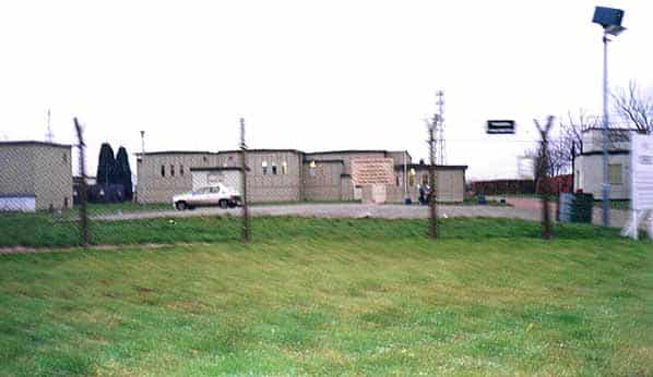
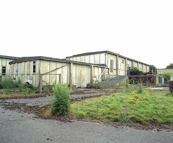
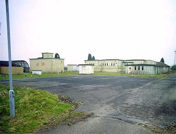
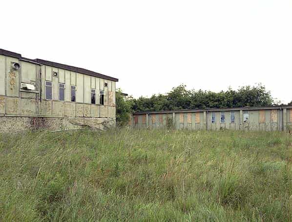
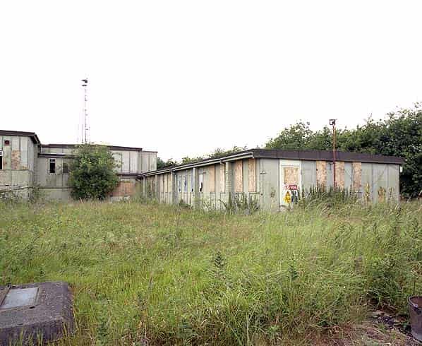
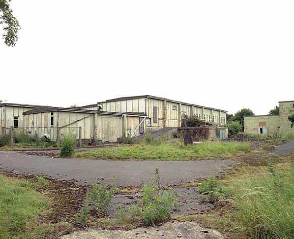
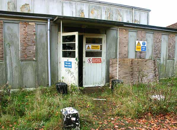
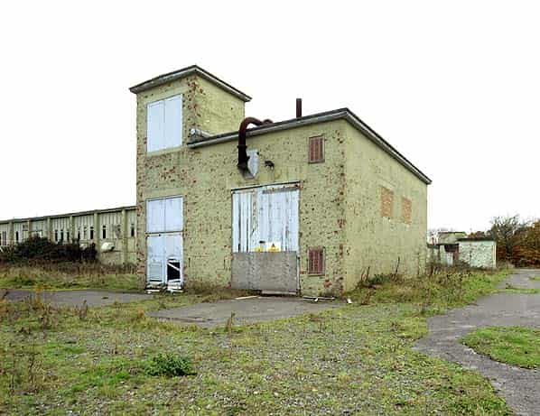
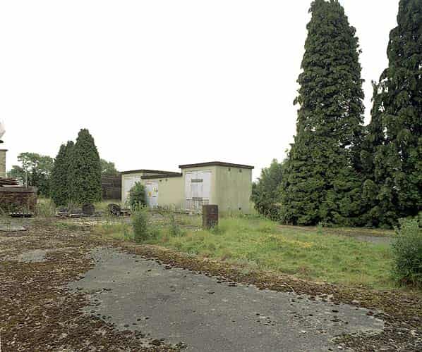
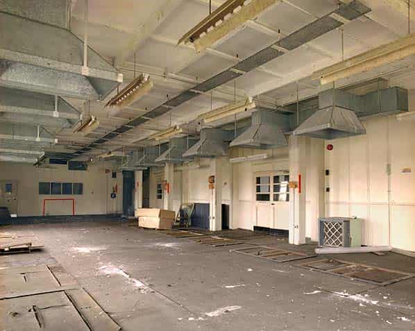
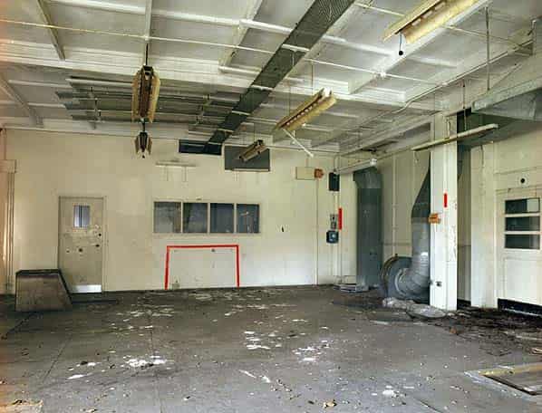
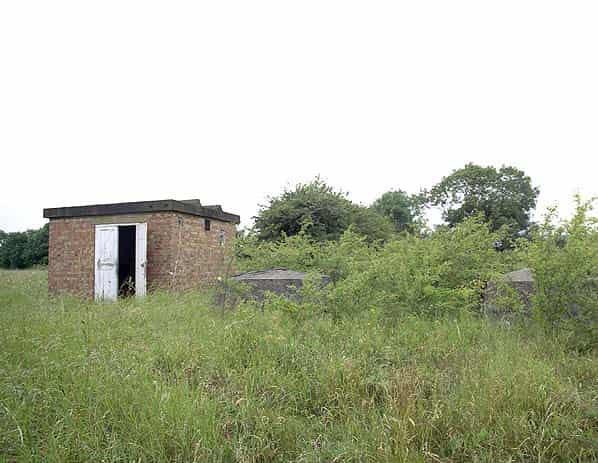
The R8 building has been redundant for many years. It was last used in the mid 1990’s as a sports facility for the RAF with the two level operations room adapted as a games hall. In the summer of 2004 the station was listed for disposal. The Strike Command radio station had closed and the mast has now been sold to NTL. This is already in its own secure compound and will remain in use, as will the Met. Office radar station which will be enclosed within another new compound. As part of the sale agreement the R8 structure must be demolished by the new owner. It is now the only remaining R8 building in anything like complete original condition. A section of the R8 at Wick still survives in industrial use while all the other R8 structures have been demolished although they all leave some evidence of their existence. Because it is now a unique building there have been numerous suggestions that it should be listed. Under current legislation however English Heritage are unable to list prefabricated structures so even though this is the only remaining example of this building there is no way it can be saved.
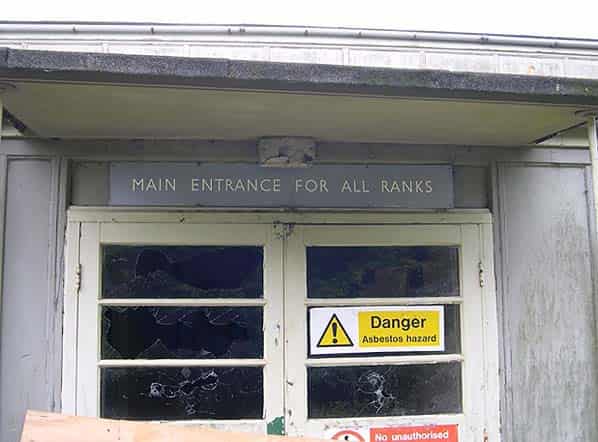
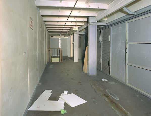
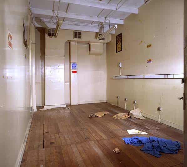
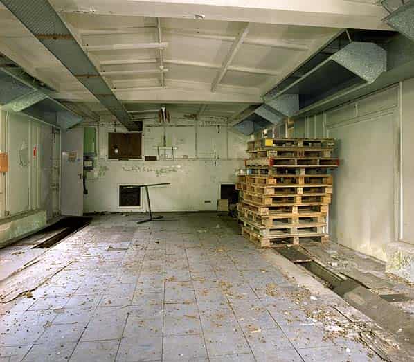
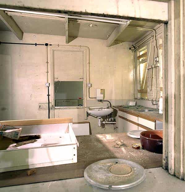
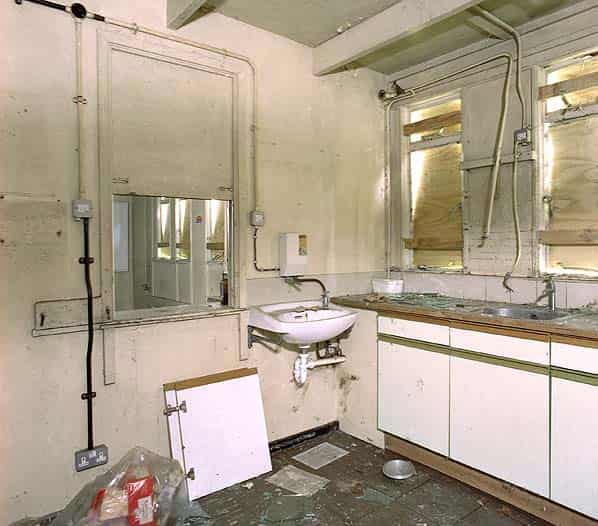
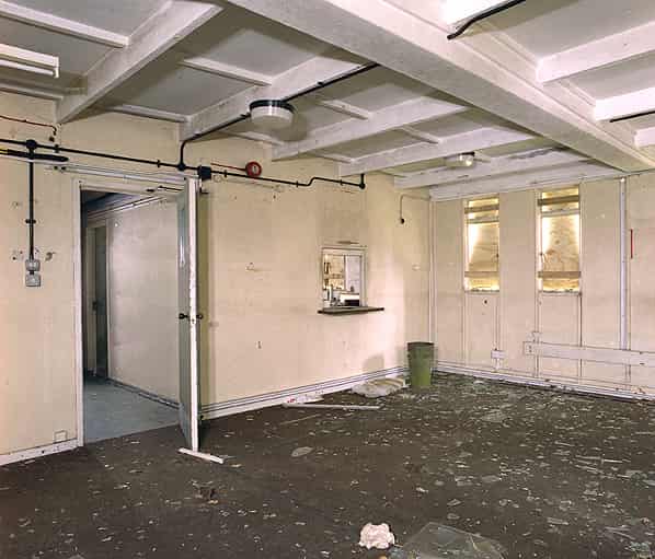
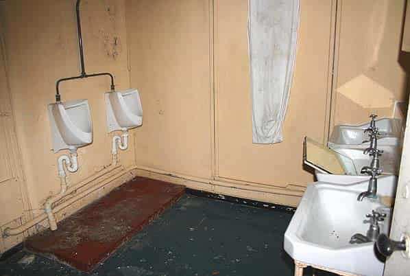
When visited in October 2004 the R8 was deteriorating badly. Although the structure is still intact it has been derelict since the mid 1990’s and has been subjected to ongoing vandalism over many years. All the entrance doors have been boarded up but a number of holes have been knocked through the outer walls to gain access to the inside of the building. As fast as the holes in the wall have been boarded over by the RAF a new one appears. The main entrance into the structure is on the north side which gives access into one of two spine corridors. Above the door there was a grey rotor sign saying ‘Main Entrance for all ranks’ (This has been recovered to RAF Holmpton). At one end of the corridor are the domestic rooms with a small kitchen with serving hatches into the RAF & WRAF rest rooms. The male and female toilets on the opposite side of the corridor are all intact although the WC pans have been filled with sand.
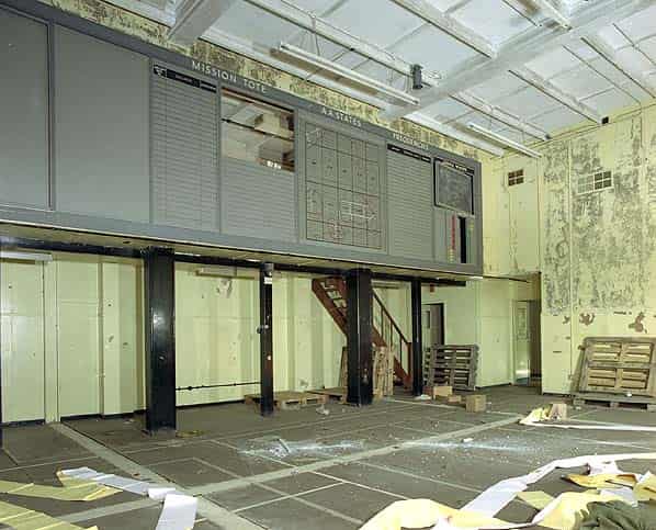
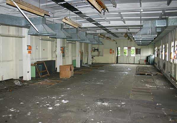
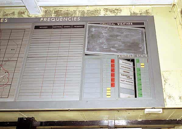
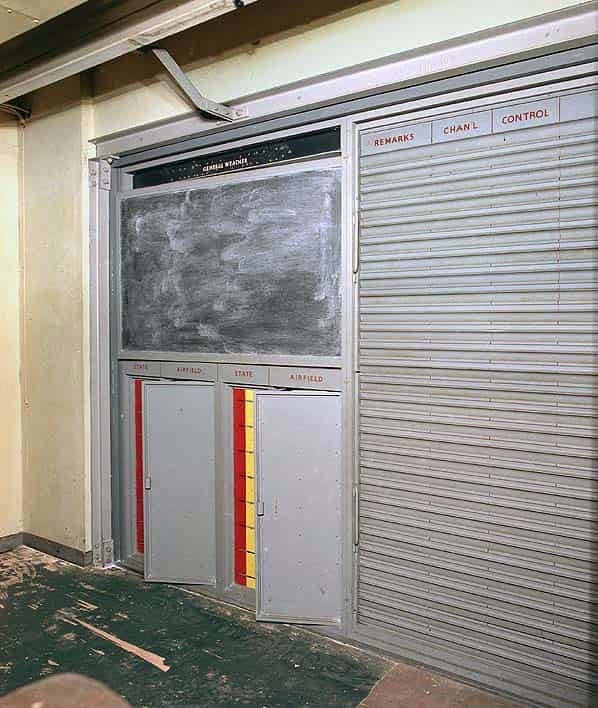
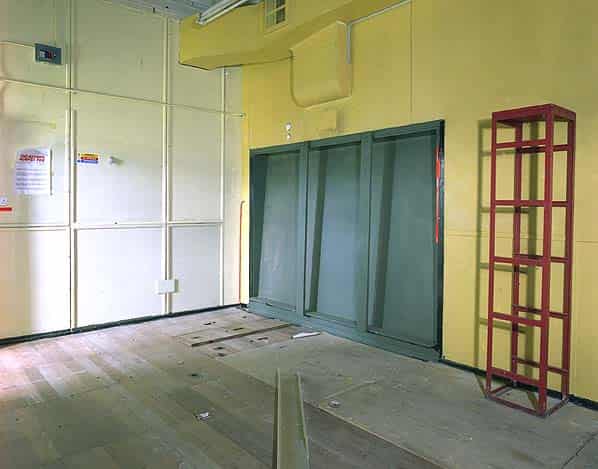
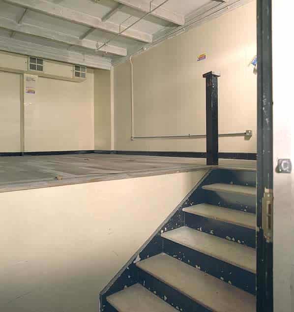
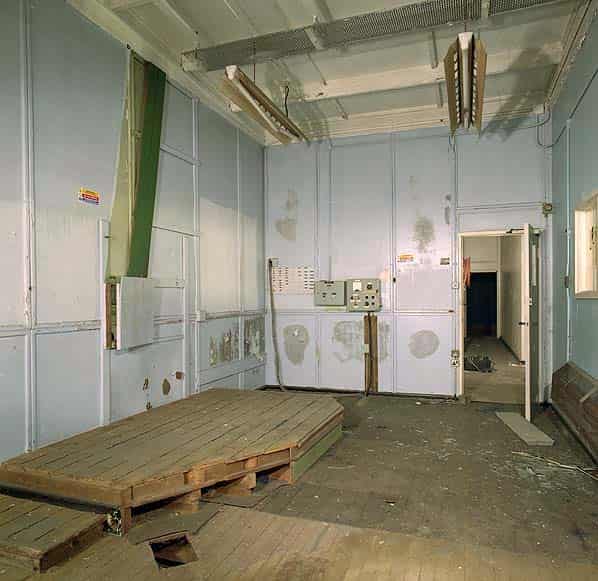
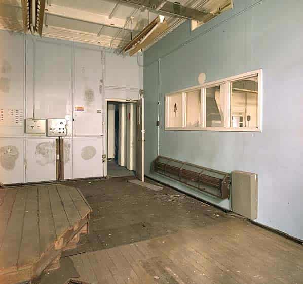
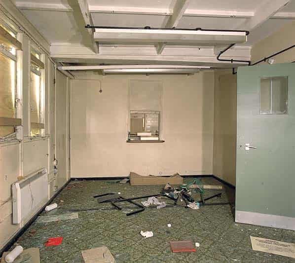
The two level operations room is also accessed from this corridor. Wooden steps lead up to the tote gallery, the metal Mission Tote panels (showing Anti Aircraft state, weather conditions etc) were all still intact at the time of our visit but have now been dismantled for reassembly in the ops. room at RAF Holmpton (Museum) in Yorkshire. The operations room was originally overlooked by the four intercept cabins and the chief controller’s cabin. All these cabins originally had sloping glass windows but the three windows at the back were removed and bricked up when the ops. room was converted into a sports hall. The two side windows (Intercept Cabin 2 & 3) are still there but the glass has been painted over.
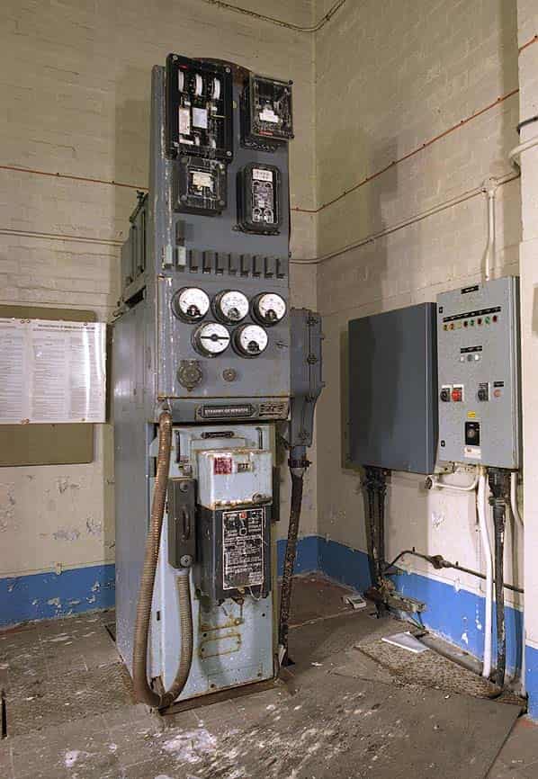
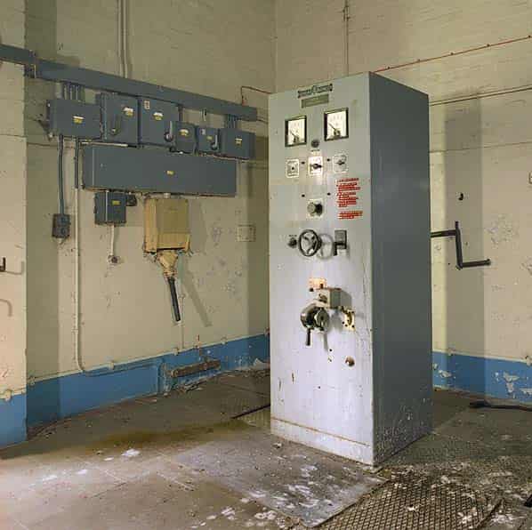
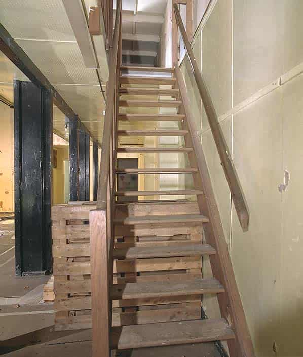
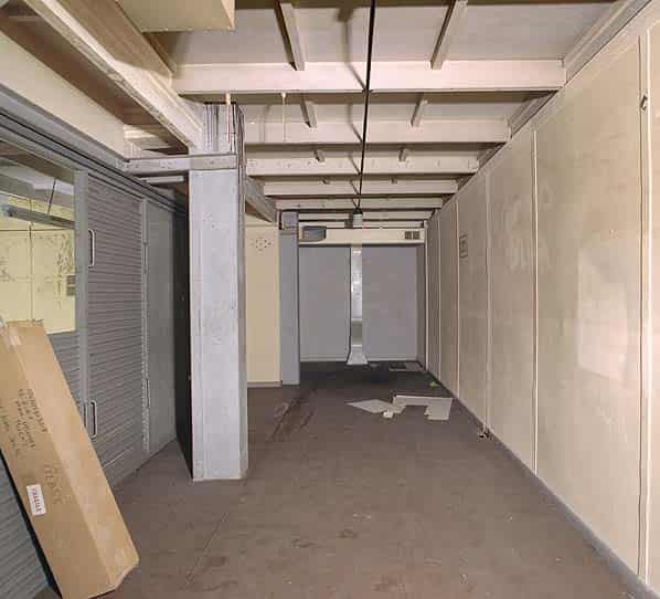
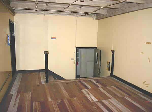
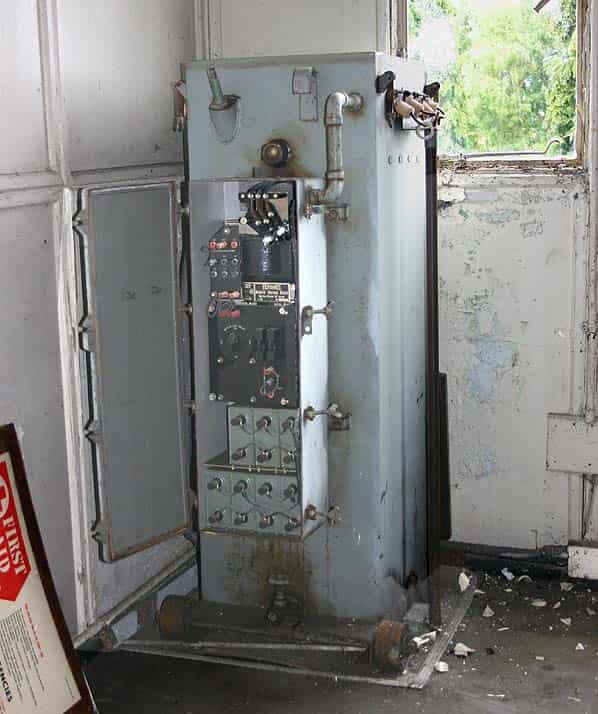
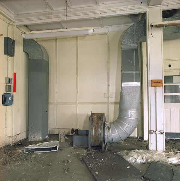
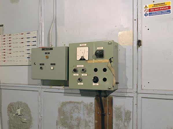
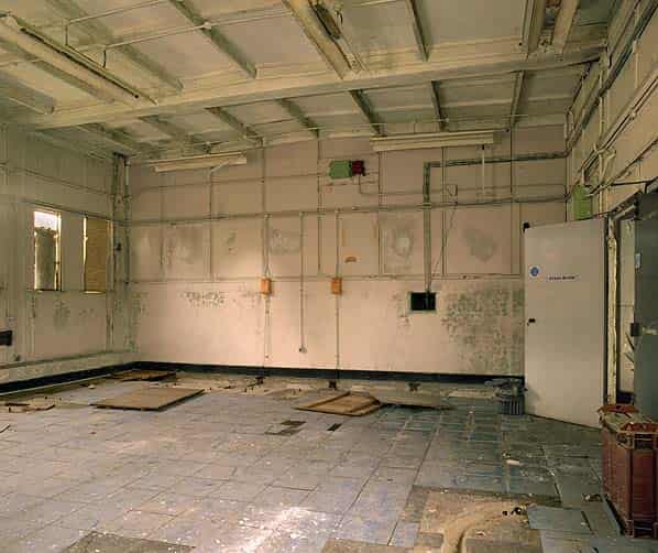
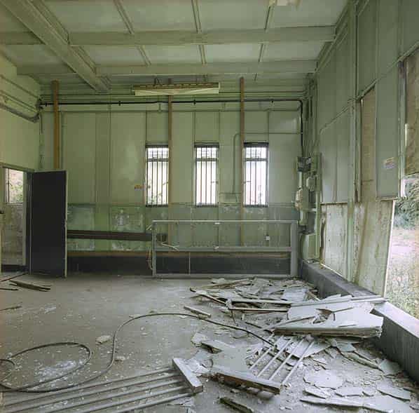
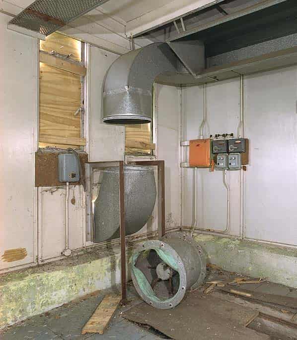
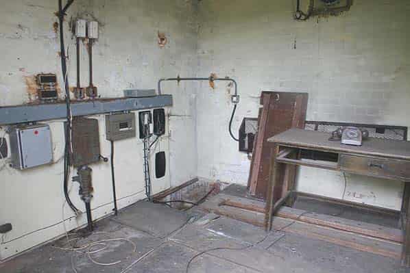
Half way along the spine corridor stairs lead up to a second spine corridor in the raised section of the building. From here there is access to the intercept cabins, chief controller’s cabin and fighter marshal’s cabin, all of which are empty. There are further steps into the chief controller’s cabin. On the opposite side of this corridor is the largest room in the bunker, the radar workshop and radar office. This is where all the radar equipment cabinets would have been housed. The position of the equipment racks is still clearly visible on the floor and the metal trunking for cooling the equipment is still suspended from the ceiling. A small cooling fan is still in place at one end of the room alongside a window into the adjacent supervisors room which has a wooden dais where the supervisor would have sat in a raised position and a small electrical cabinet on the wall that controlled the power to the building; the standby generator could have been brought into use from here. On the far side of the room there are double doors leading out to an open air raised platform with a concrete ramp and stairs. This was used for bringing heavy equipment into the building. A now demolished ventilation plant room was sited against this platform and its concrete base is still visible.
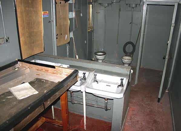
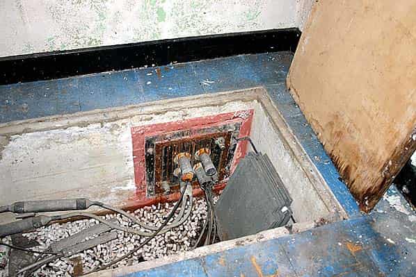
At the end of the upper level corridor, stairs lead down to the rear entrance and three further rooms. One of these housed further radar equipment and the other two were the GPO apparatus room which has a tiled floor and the frame room with some electrical switchgear and part of the main distribution frame (MDF) still in place.
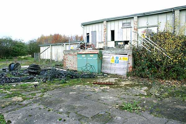
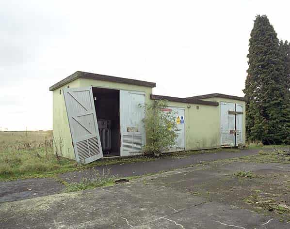
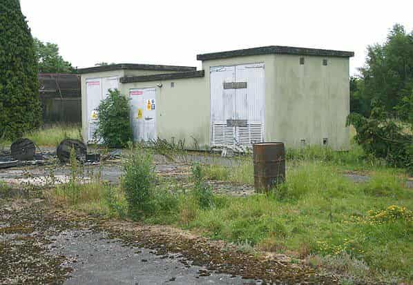
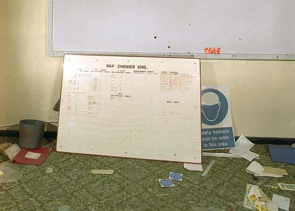
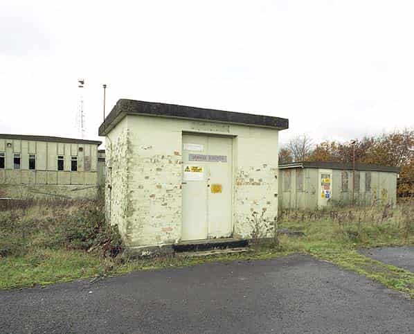
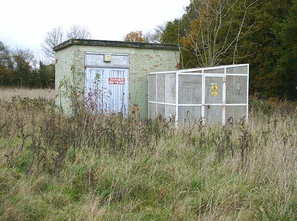
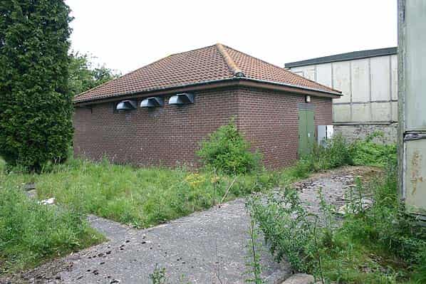
Several brick buildings are still standing around the R8. These include the sub station, high frequency switch house, standby set house with fuel compound, sewage ejectors, water tank and pump house. Most of these buildings still have their grey ROTOR signs screwed to the wall. A now demolished SECO guardhouse would have stood just inside the main gate although there is no evidence of it now. There is also no sign of dog kennels that are normally found at ROTOR stations.
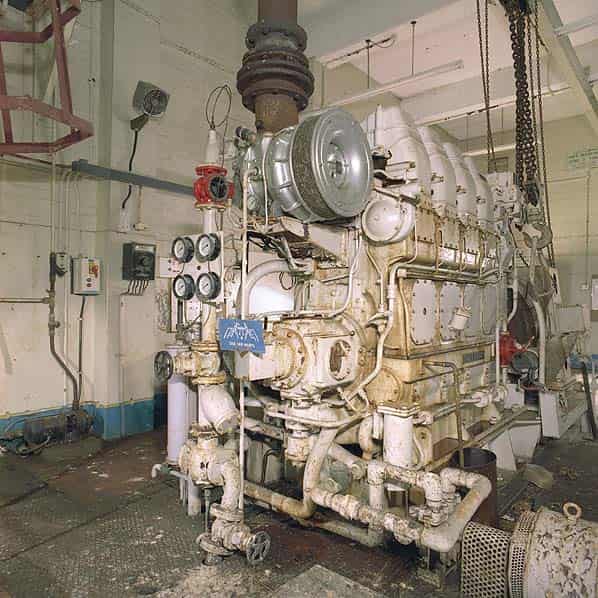
The standby set house still contains a large diesel generator, small fuel tank, switchgear and a large floor standing electrical control cabinet.
The double doors have been ripped off the building by vandals and it is open to the elements. The high frequency switch house is divided into three rooms each accessed through external doors. The two end rooms were open and one of these still contains a large mains transformer.
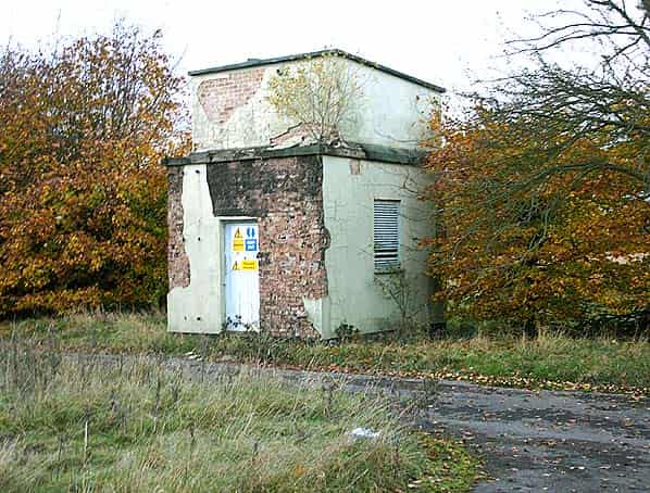
The sub station was locked and is still in use providing power for the NTL mast and the Met Office radar. A small modern brick building at one end of the R8 housed the radio equipment for the Strike Command communications facility but the building is now empty and NTL’s radio equipment is now housed in a smaller newer building close to the base of the mast within a compound.
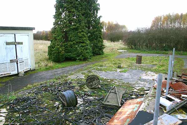
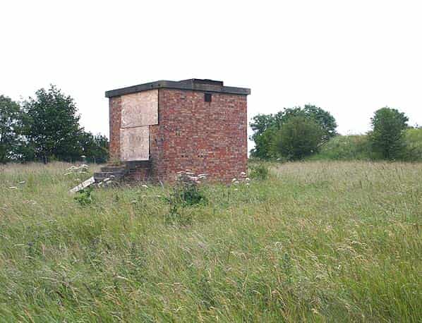
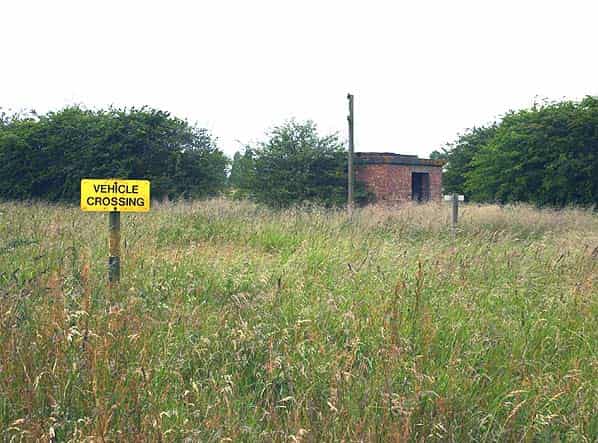
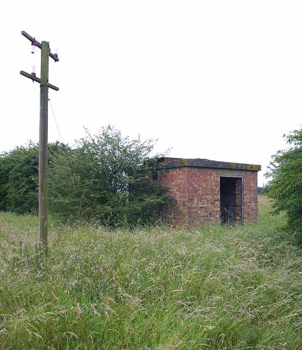
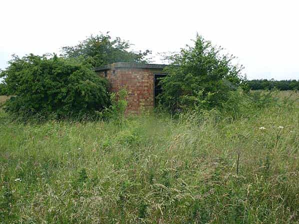
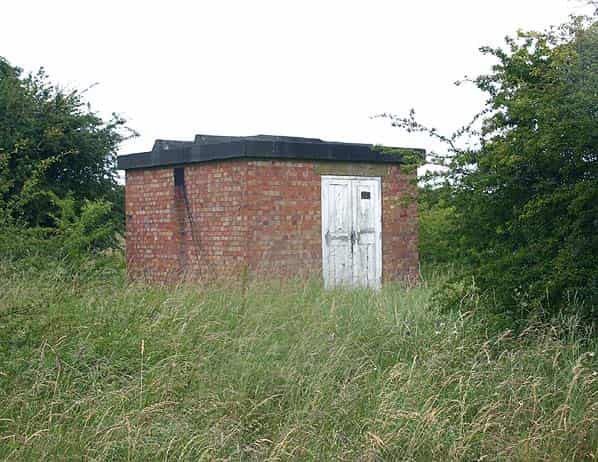
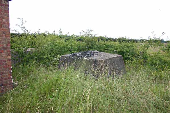
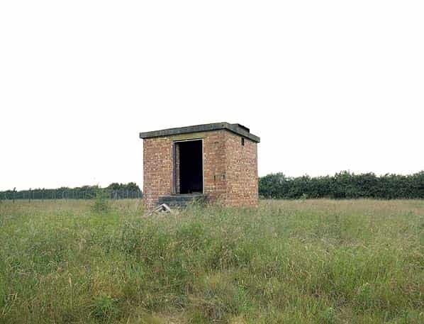
Close to the Met. Office radar station there is a square building, obviously from the ROTOR period and alongside it the truncated base for the AN/FPS3 radar gantry. This building was almost certainly the AN/FPS3 equipment room.
5 radar plinths are to be found in the surrounding fields, these would have been for the Type 13 and Type 14 radars. Four of the plinths would have had the radar mounted on the roof; these have an octagonal hole in the roof where the radar was mounted. The fifth plinth has a solid concrete roof. The radar here would have been mounted on a 25' gantry alongside. Close by there are four concrete bases for an aerial tower, it is unclear what this was for but it probably belongs to a later period. A number of other mast guying blocks are scattered around the site, these two probably belong to a later use for the site.
To the south of the R8 there is a grassed mound with stairs going up to this. This is the sewage tank for the station.
RAF Chenies was sold back to the original landowner in November 2004, the majority of the buildings on the site will be demolished and the land returned to agriculture.
Sources:
- PRO files: Air 8/1630 Air 2/10984 Air 8/2032 Appendix C Air2/11178
- Bob Jenner
- Dr. James Fox