ACE High NATO Communications System
Ace High is a now abandoned NATO communications system whose chief characteristics were the huge dish antennas used and its massive radiated power in a frequency band used today for mobile phones. You will find little about it on the Internet - except here!
At the end of this feature you will see plenty of reader feedback, some of which amends statements made in the main text.
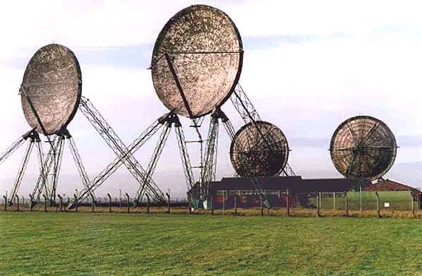
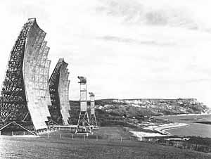
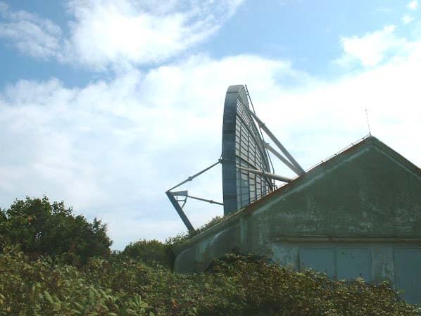
Dish antennas at Stenigot (David Farrant)
Until recently a search of the Internet for the ACE HIGH communications system gave just two references, both in individuals' personal curriculum vitae. The first mentions in passing this L-band troposcatter radio system but gives no further detail. The second is a little more informative and states of its author, Prof. Torleiv Maseng:
“His work has also involved working with digitisation of the ACE High network which is a NATO-owned and NATO operated communications system with 49 tropospheric-scatter links and 41 line-of-sight microwave links which provide high-capacity transmission links from the most northern flank of NATO in Norway to the easternmost flank of NATO in Turkey.”
INFORMATION SUMMARY
An entry in the reference yearbook Jane’s Military Communications for 1987 adds more information:
“ACE HIGH is a tropospheric scatter/microwave link system which dates back to 1956, when SHAPE developed a plan for an exclusive communications system which would comprise the minimum essential circuits of early warning and alert and implementation of the ‘tripwire’ retaliation strike plan. The network, comprising 49 tropospheric scatter links and 40 line-of-sight microwave links, extends from northern Norway and through central Europe to eastern Turkey. The system has 570 voice, 260 telegraph and 60 data circuits.In the coming years the system will be gradually replaced. This will involve the rationalised use of national defence systems and the substitution of some parts by new NATO-owned sub-systems.
A press statement by STC issued around 1960 gives a more detailed briefing. Communications equipment worth well over £1 million has been supplied and installed by Standard Telephones and Cables Limited for NATO’s vast ACE HIGH communications network, which has just been completed. The last station in the network, which extends 8,300 route miles, from the northern tip of Arctic Norway to the eastern edge of Turkey, has now been accepted by Supreme Headquarters Allied Powers Europe on behalf of the North Atlantic Treaty Organization. This network has been brought into service gradually as the stations and links have been completed. An original section, financed by the United States and operating for the past several years in Norway, has been incorporated into the ACE HIGH network and the first internationally funded station was put into operation by SHAPE almost two years ago.
The system makes available to the Supreme Allied Commander (SACEUR) more than 250 telephone and 180 telegraph circuits. Circuit capacity of the main backbone route is limited to 36 channels, although engineering design takes into account the probable need for expansion beyond this number. Any one of the speech channels can be multiplexed to provide 12 or 18 telegraph channels. The capacity will be further augmented by the continued use of the large number of circuits provided by the telephone systems of the European NATO nations.
System design of the network was tailored to meet the specialized requirements of Allied Command Europe, which needed reliable, secure and instantaneous communications to link its commanders in the European-wide command area. The network consists of 82 stations divided almost equally between tropospheric forward scatter (over-the-horizon) and line-of-sight microwave radio stations.
ACE HIGH represents the co-operative action of all NATO member nations, with the stations being located on the territory of nine of the 15 NATO powers. The nine are: Norway, Denmark, West Germany, Great Britain, Netherlands, France, Greece and Turkey. Paris and Norway are linked by two routes-one extending from Paris through France, Germany and Denmark into Norway, and the other from Paris to London then northward through the United Kingdom, the Shetland Islands and into Norway. The main station is at SHAPE, just a few miles from Paris within sight of the most famous of all aerial supports-the Eiffel Tower. The master control centre for the network is one of the major stations-Paris North-about 40 miles north of the French capital. This station is equipped with tropospheric scatter station equipment, line-of-sight microwave, and STC multiplex equipment to convert radio signals to speech and telegraphic communications. The stations, with huge 65-foot high circular aerials to pick up and transmit high frequency signals, are constructed on top of mountains or on other high ground.
The principle of the tropospheric forward scatter system. is to beam high-frequency signals against the troposphere (5 to 10 miles above the earth), pick up part of the reflected signal with highly sensitive receivers and beam it onward by the same means. This communications technique has many advantages. Its efficiency is not marred by atmospheric conditions; it has a computed circuit reliability of 99.9 per cent; and signals can be transmitted in stages of from 50 to 250 miles. Reduction of the number of required relay stations through these longer stages also means reduced operation and maintenance costs and personnel requirements.
As the stations were accepted by SHAPE, it has assumed responsibility for the operation and maintenance of the network, although the contractor, International Standard Engineering Inc., an affiliate of IT&T [as STC was], is continuing to provide highly skilled engineers and technicians to givc support in the huge task of maintaining the highly complex system and the training of military personnel who operate the stations.”
From this article it become clear that ACE stands for Allied Command Europe and the High probably relates to its operating frequency, above the normal range of UHF frequencies exploited at that time (UHF television had not yet been introduced in many European countries).
Two illustrations were provided with the press release; as these are from photocopies they cannot reproduce very clearly here.
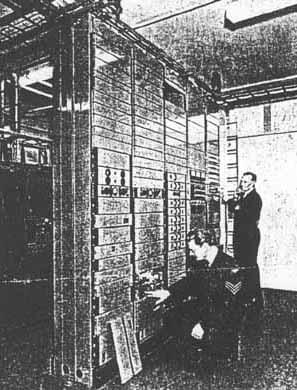
Royal Air Force technicians check STC multiplex equipment at an ACE HIGH station in England
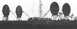
An ACE HIGH tropospheric scatter radio station in the south of England. Stations like this are located in nine of the fifteen NATO countries, providing a network that extends 8,300 route miles from the northern tip of Norway to the eastern edge of Turkey
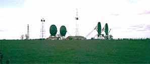
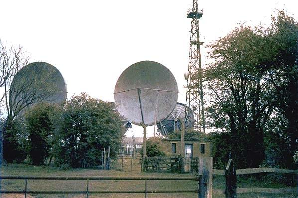
Here’s my own photo of the same spot taken in 1981.The location is Coldblow Lane in Kent and the differences between the two photos are:
Flyswatter antennas on the tower replaced by dishes and an additional microwave tower with dishes to the left of the station
A new tower belonging to Pye Mobile Radio for VHF communications also visible at far left. This ‘new’ microwave tower was an intermediate relay station on the British Forces Broadcasting Service 4GHz chain for taking British television programmes to troops stationed in West Germany. The London Control Centre was at the former London Weekend Television studios in Wembley and the microwave route ran from their broadcast unit depot at Stonebridge Park, via Botley Hill (near Westerham), Coldblow Lane, Dunkirk (between Faversham and Canterbury) to Swingate for a crossing of the English Channel to the French PTT station at Fiennes.A Trans-Belgium Link took the signals onward to Brunnsum in Germany and thenceforth to many locations all across the British Zone of Western Germany.
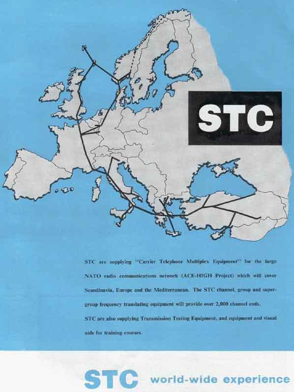
SCALE OF THE SYSTEM
Here is a map showing the extent of the system, taken from an STC advertisement of 1961.
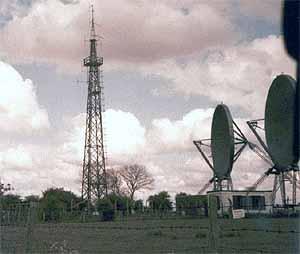
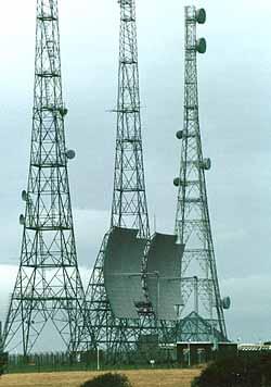
Here are two more views of the station at Coldblow Lane taken in 1981. Coldblow was close to Detling Hill, between Sittingbourne and Maidstone, Kent. This first picture fails to give the true scale of the dishes, which looked monstrous-and made a good landmark when seen from the M2 motorway in the distance near Junction 5 (A249).
(Andy Emmerson)
The Coldblow site was sold by auction in September 1986. The auctioneer was the firm of Clive Emson, Maidstone. “All that was on offer were some brick one-storey buildings (with no secret bunkers attached!).
A microwave tower on the site was retained by the Ministry of Defence and access rights to the tower were built into the sale agreement. The dishes, a local landmark, had been removed the previous year.” [information from David Mapley]
This would indicate the system closed during the early 1980s, which figures because the frequencies in which ACE HIGH operated were needed for the new Cellnet and Vodafone cellular radio systems, which opened in 1985. Television viewers in east Kent of a curious disposition (people like me!) who tuned above channel 68 could easily hear the ACE HIGH transmissions. They sounded just like whistles but some shortwave listeners claimed to have fed the audio into a communications receiver and have resolved individual conversations.
THE FUNCTION OF ACE HIGH
Duncan Campbell’s book The Unsinkable Aircraft Carrier provides an insight into the applications for ACE HIGH (pages 188 and 62).
The main NATO international network is Ace High, a troposcatter relay network which has five British Stations in a chain from Sumburgh in the Shetlands to Coldblow Lane, near Maidstone. The Ace High network was built in the early 1960s, primarily in order tolink NATO heads of state together in crisis. Two of twelve US/NATO interconnection sites are in the UK, at Mormond Hill Aberdeen and Coldblow Lane.
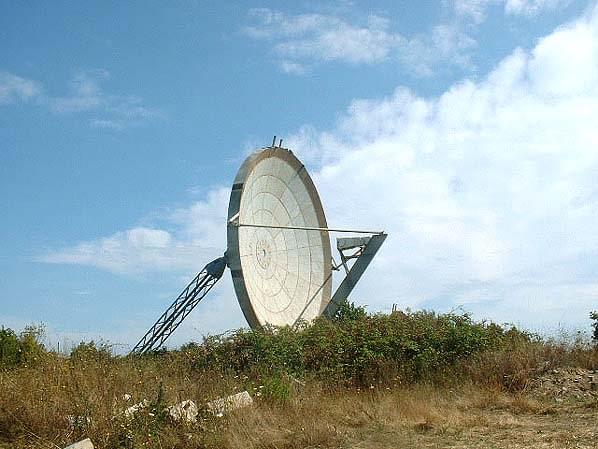
Billboard reflectors at Swingate, Dover (Bob Jenner)
From a site at Swingate in Dover, high on the celebrated chalk cliffs and overlooking the busy harbour and medieval castle, US Air Force transmitters beamed signals towards their counterpart networks run by the US Army and Air Force in France. This link ran on to US bases at Orleans and Bordeaux. A second connection to the Continent was made in March 1962, when a new communications station, at Martlesham Heath near Ipswich (Suffolk), was linked to Flobecq in Belgium.
In 1963, a longer-range link direct to Spain was built at Ringstead Bay, near Weymouth in Dorset. The link operated across hundreds of miles to Gorramendi, near Elizondo, in the Spanish Pyrenees.
Using massive billboard-style reflectors to direct enormous amounts of radio energy into the troposphere, novel ‘tropospheric scatter’ communications networks were all over the world.
Troposcatter station at Ringstead Bay
With aerials 150 feet high, the Ringstead Bay proposal occasioned considerable local controversy, and the Air Ministry was legally challenged on whether they had the right to compulsorily purchase British land for American defence purposes. Amongst the objectors to the powerful new station was the Royal Navy, one of whose officers pointed out that it would cause ‘serious interference’ to the many RN radio stations operating around nearby Portland Bill. However, the station was built, but it was closed by 1970 and dismantled in 1974. The Ringstead-Gorramendi link provided the High Wycombe Atomic Joint Co-ordination Centre with a direct connection to US nuclear forces straddling the Mediterranean in Spain itself, Morocco, at Wheelus Field near Tripoli in Libya, and further east. In order to provide the necessary microwave link relay stations, the US Air Force obtained four more facilities at Golden Pot, near Alton, Hants, Dean Hill near Salisbury, Bulbarrow Hill near Shaftesbury, and on Portland Bill.
This would indicate that the Ringstead and Martlesham Heath links were not directly part of ACE HIGH. However, they used exactly the same technologies and frequencies.
TECHNICAL DETAILS
Frequencies used by ACE HIGH (taken from the ITU international catalogue of radio frequencies) ranged from 832.56 to 959.28MHz. The emission mode was F9 (frequency modulation, miscellaneous), and output powers typically 10kW to 50kW. Throw in the colossal antenna gain from the 80ft dishes and you can imagine the kind of power they radiated (up to 10 megawatts effective radiated power).
A stylised map of the routes inside and leaving Britain looks something like this:
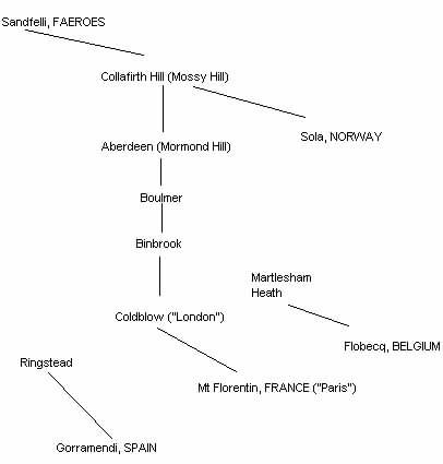
Ringstead is in Dorset, between Weymouth and Lulworth. Binbrook is in Lincs., Boulmer in Northumberland.
The station noted as Martlesham Heath (Suffolk) has nothing to do with the BT research station but was at the USAF base along the Foxhill road; it had local microwave feeders to/from Great Bromley & RAF Bentwaters. Collafirth Hill is in the Shetlands, where a branch of the network went to Sola in Norway. [Research by G4DYA and G8PTH].
PROMISE OF THINGS TO COME
Another researcher, Andrea Borgnino in Italy, is researching the subject. Below is just one of his finds:
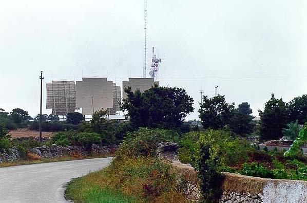
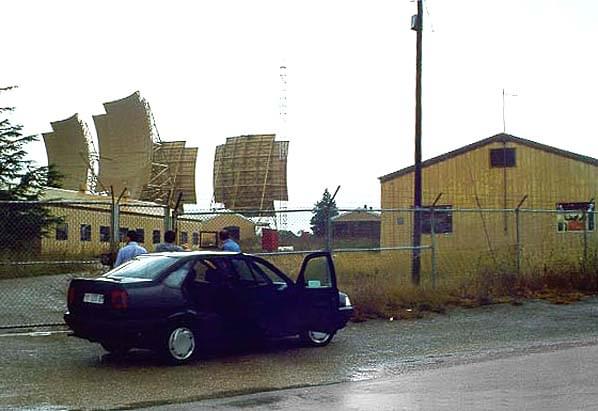
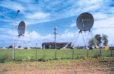
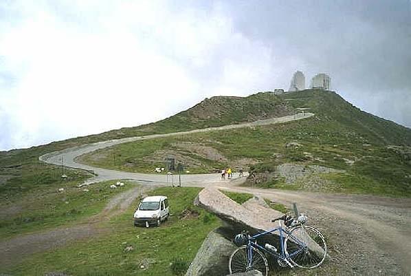
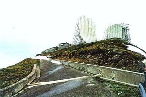
Below are a series of photographs of Ace High and NATO tropo sites in Italy submitted by Andrea Borgnino. The sites illustrated are:
- Belvedere: Martinafranca - Località Masseria - Chiantone - Puglia (south east Italy)
- Veneti: Portogruaro - Veneto (north east Italy)
- Monte Maniva - Lombardia (northern Italy)
- Monte Nardello Location - Roccaforte del greco - Calabria (south west Italy)
- Tolfa Ace High - 40km north of Rome
Some pictures were taken from The Sale of Defence Ministry Real-Estate website (now defunct) which was full of photos of ex-military bases.
Belvedere Troposcatter Station (Andrea Borgnino)
Belvedere Troposcatter Station (Andrea Borgnino)
Veneti tropscatter station (Andrea Borgnino)
Maniva troposcatter station (Andrea Borgnino)
Maniva troposcatter station (Andrea Borgnino)
Monte Nardello (Andrea Borgnino)
![]()
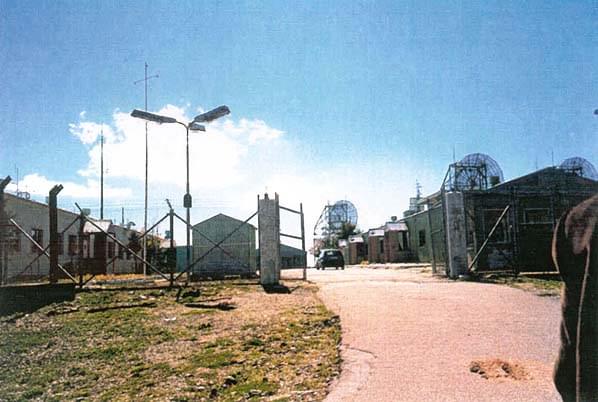
Tolfa Ace High Transmitter (Andrea Borgnino)
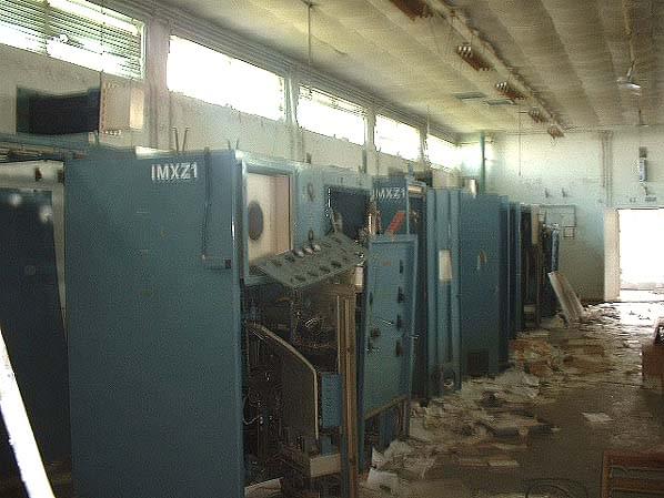
Tolfa Ace High transmitter room (Andrea Borgnino)
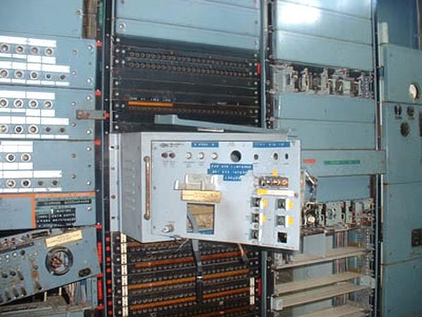
Tolfa Ace High patch bay (Andrea Borgnino)
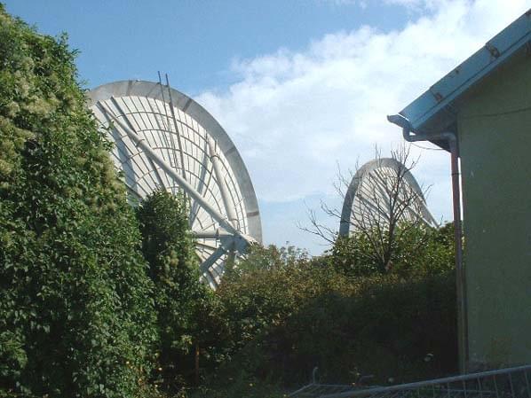
Tolfa Ace High north antenna (Andrea Borgnino)
Ace High north antenna (Andrea Borgnino)
Tolfa Ace High south antenna (Andrea Borgnino)
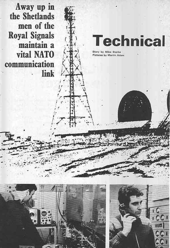
SOLDIER MAGAZINE ARTICLE
This article is a copy of a copy but it’s all we have. Date of publication is unknown but looks early 1970s by the typography. All copyrights acknowledged.
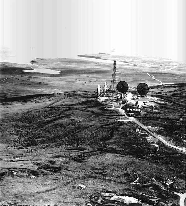
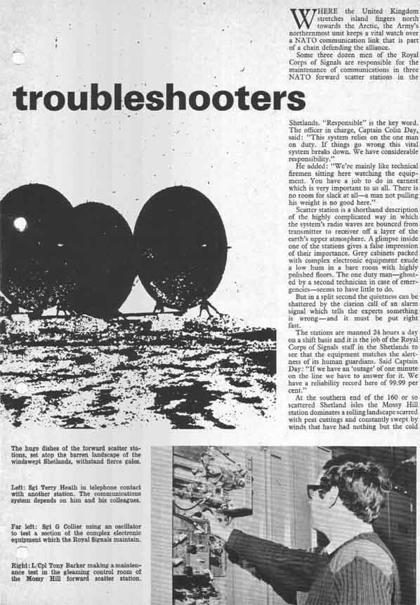
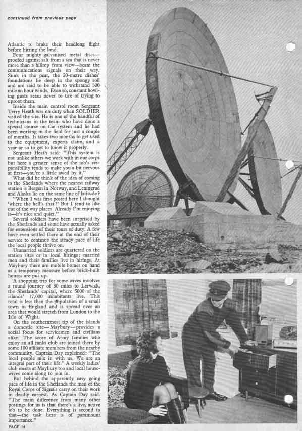
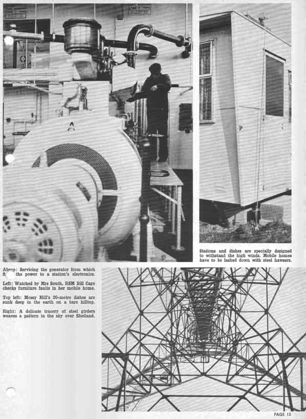
Scousburgh Hill, Shetland Courtesy of collection of Peter Leybourne. The site at the south of Shetland was known as Mossy Hill Station. It has now been cleared due to the very high winds at the location.
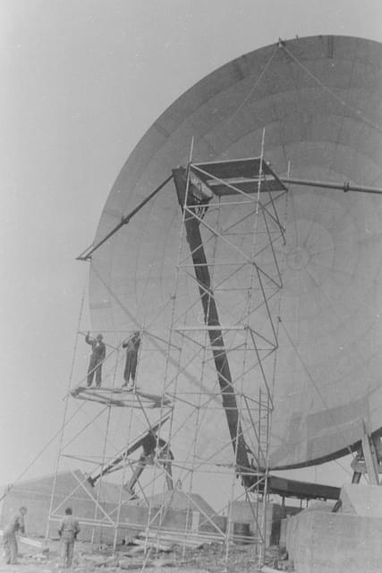
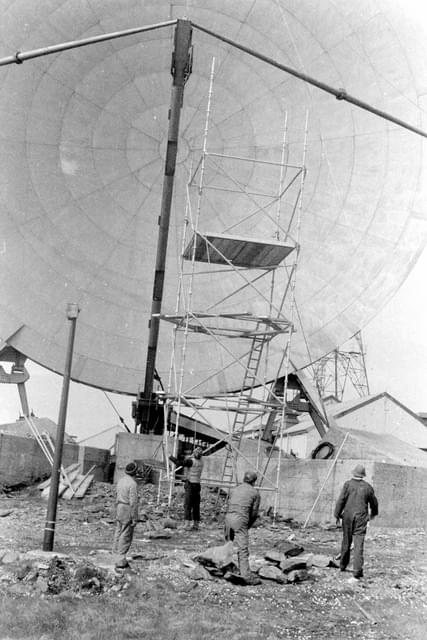
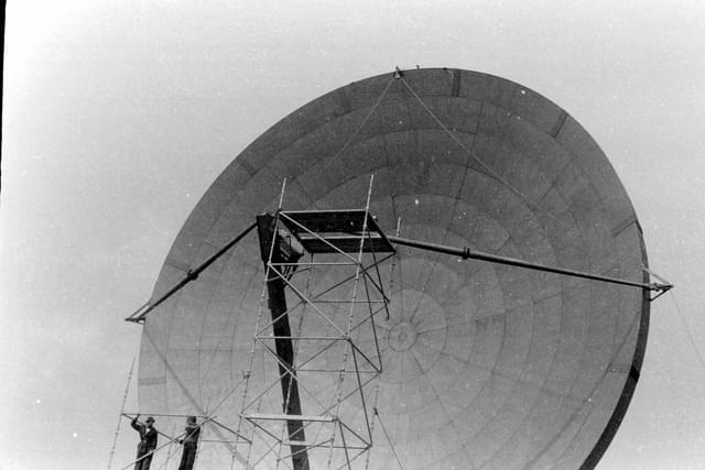

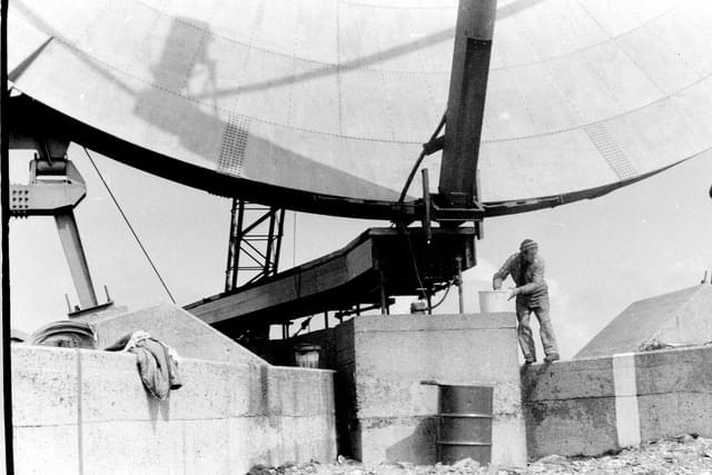 Construction of site at Scousburgh Hill, Shetland (Peter Leybourne)
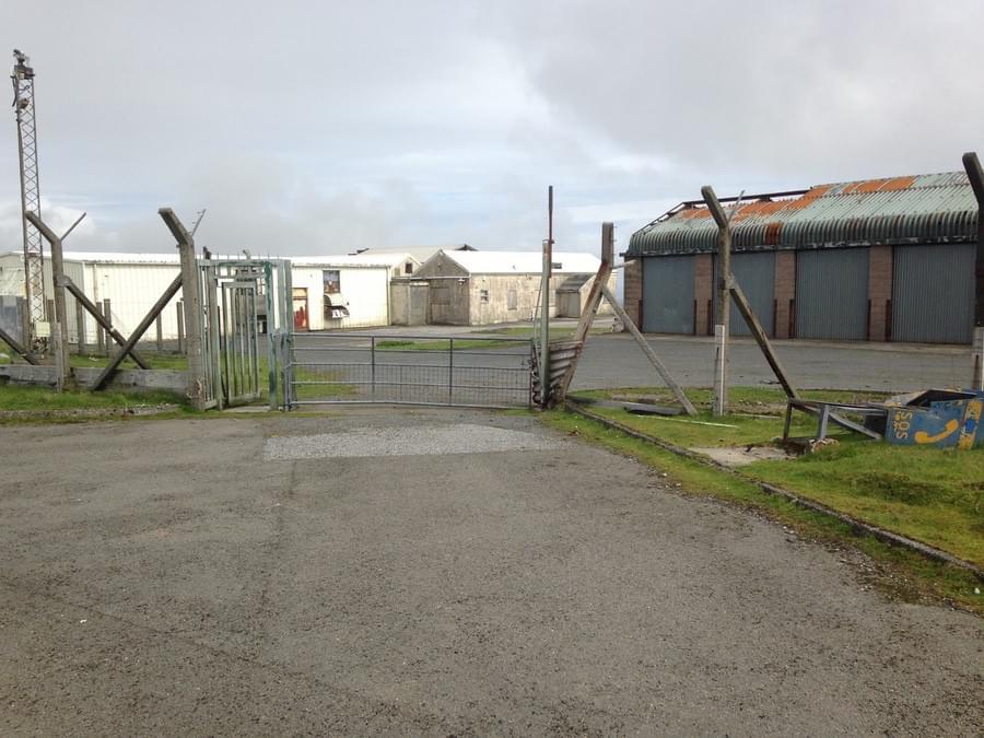
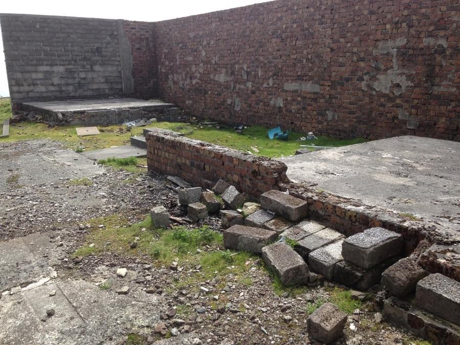
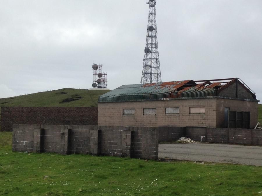
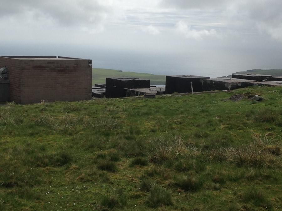
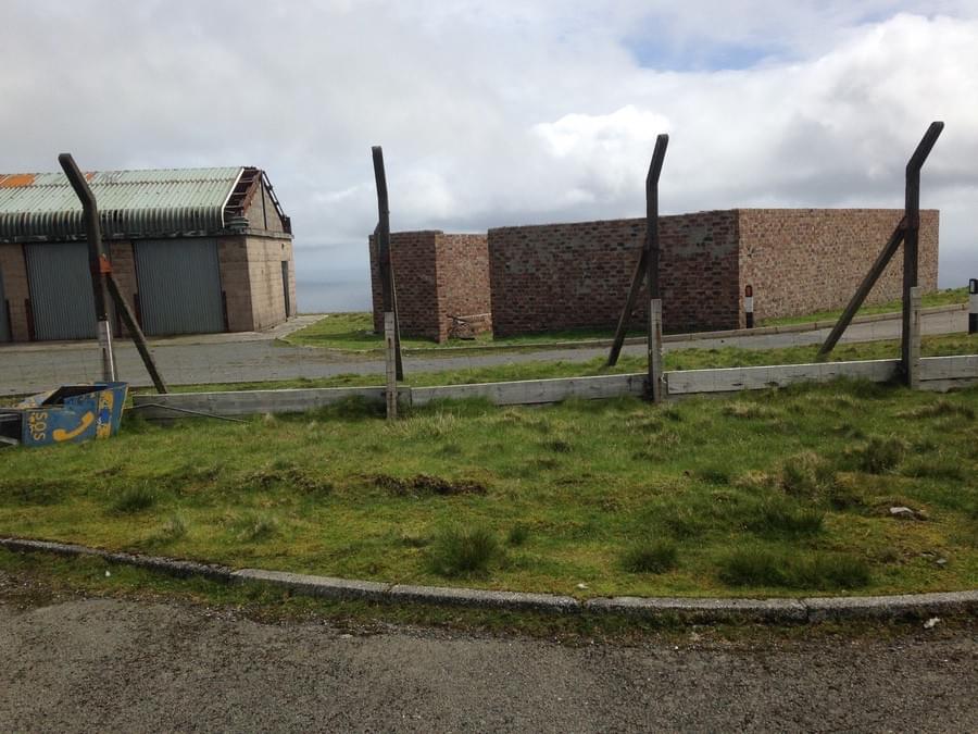
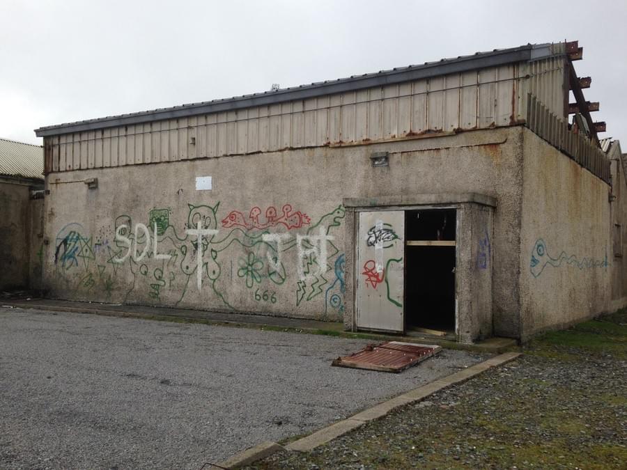
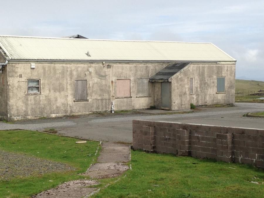
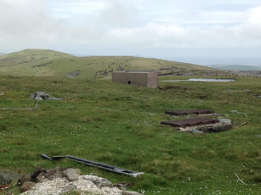
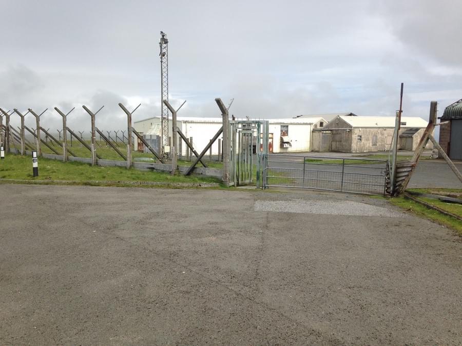
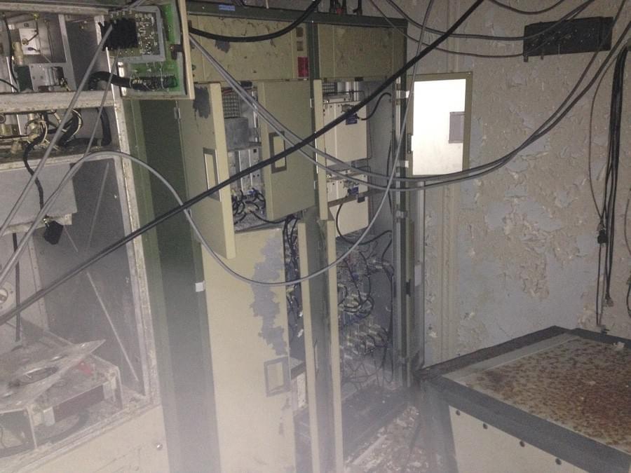
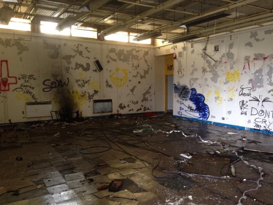 Abandoned site at Scousburgh Hill, Shetland prior to demolition (2023) (Tony Marriott)