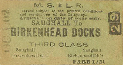
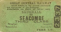
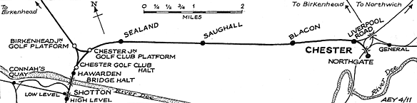
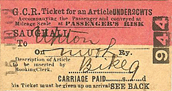
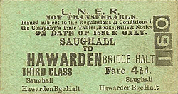
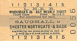
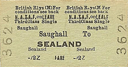
Station Name: SAUGHALL
old2.jpg) Looking east along the eastbound platform at Saughall station c.1910. The station appears to be very well kept by its Great Central Railway employees.
Copyright photo from John Alsop collection 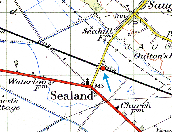 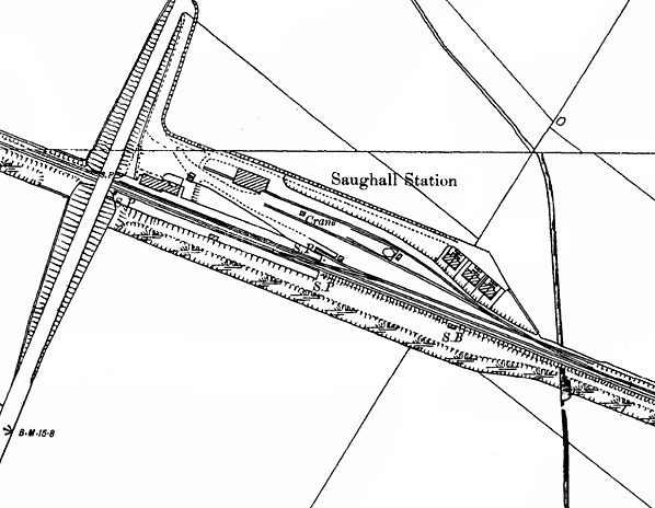
old4.jpg)
looking northeast towards Saughall station c.1910 when it was part of the Great Central Railway
Copyright photo from John Alsop collection old6.jpg)
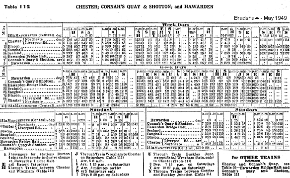
Looking west from Saughall stations west bound platform in October 1951 as a local stopping service to Chester Northgate arrives at the eastbound platform. The short formation of the train suggests that it may have originated from Shotton. There were at this time short workings between
Chester Northgate and Shotton. The loco is 67433, a 4-4-2 tank, built at Gorton (GCR) works in March 1905, to a Robinson design and GCR classed 9K. First numbered 5456, it was renumbered 7433 by the LNER. Nationalisation saw it shedded at 6E, Wrexham (LNER) and renumbered 67433. Finally it was withdrawn from 37A, Ardsley shed on 31.1.1958 and cut up at its birthplace in February 1959. Photo from John Mann collection 4.jpg) 7.jpg)
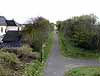
Saughall station looking east in June 1980. The station had been closed for more than a decade but goods services still passed through.
Photo by John Mann old1.jpg) A
train from Shotton Steel Works at the site of Saughall station in June 1992.
It is crossing from one line to the other. As the line had been closed
for a few years the track was in poor condition. It re-opened as a single
line and the best sections were chosen. This led to a number of points
where trains crossed from one line to the other.
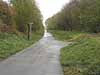
Photo by Dave Sallery from The Wrexham - Bidston Railway on the Penmorfa web site 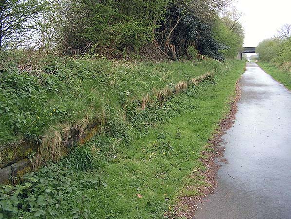 Saughall station looking west at the down platform in April 2005.
Photo
by
Paul Wright 9.jpg)
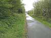
Looking east at Saughall station in April 2011. Both of the station's platforms could still be seen although the western end of the westbound platform had been demolished so that an access path could be accommodated. The large house to the left occupied part of the land on which the station building once stood.
Photo by Paul Wright 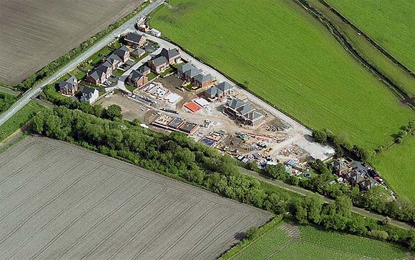
A modern aerial photograph shows that all the original land boundaries have been maintained . The railway runs diagonally across the picture and is now part of the Chester - Connah's Quay railway path. The goods yard has now been redeveloped as a small housing estate. The original six railway cottages can be seen on the right.
Click on thumbnail to enlarge
 Home Page Home Page
|
old_thumb3.jpg)
thumb5.jpg)
thumb6.jpg)