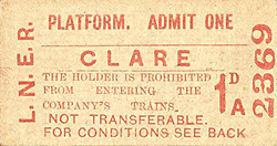
[Source:
Nick Catford]
Clare Station Gallery 1: December 1907 - Last Day old2.jpg) Looking west towards Clare station in December 1907 as an eastbound passenger train approached. The two timber buildings in the foreground are stores. Three wagons are seen in the coal yard siding on the right. The goods yard is seen beyond the platform.
Copyright photo from John Alsop collection  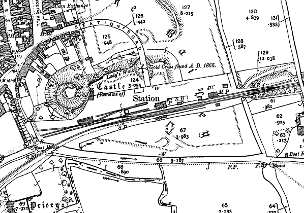 1904 1:2,500 OS map shows the original track layout. To the east of the station a single siding served the coal yard; coal bins are seen in the centre of the yard. The cattle dock is seen immediately west of the station building with a siding running either side. Cattle pens are seen on the dock. The goods shed is seen to the left of the dock; one siding passes through it, another passes in front of it. A well is shown at the end of Station Road, just inside the yard.
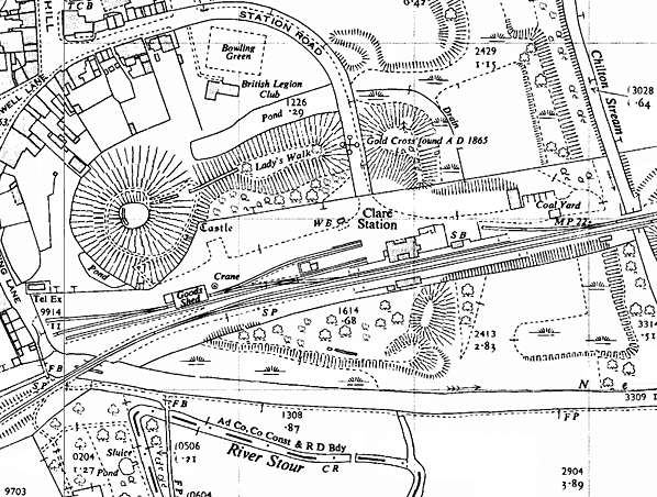 1957 1:2,500 OS map. The only major changes are the to east of the station where the storage buildings have been removed and the coal siding relaid at an angle across the yard. Additional coal bins have been provided. The 1 ton 10cwt capacity crane is seen to the east of the goods shed.
old4.jpg) Looking west towards Clare station from Highfield bridge in 1947. The coal yard is on the right just before the platform; two coal wagons are seen in the siding. Within a few years the wooden sheds to the right of the wagons would be demolished.
 The west end of Clare goods yard in April 1953, One siding passes through the goods shed and splits into two sidings on the west side of the shed loaded coal wagons are seen here. Another siding passes in front of the shed. The small building at the west end of the shed was the goods clerk's office. The 1 ton 10 cwt yard crane is seen at the east end of the shed. Out of view on the north face of the shed there are two large opening accessed by a raised platform for loading goods from road vehicles. The main entrance to the yard was from the station forecourt but there was also a secondary entrance onto Malting Lane which is seen on the left. Clare Castle motte and the remains of the keep are seen at the top of the picture. Click here to see an enlarged version of this photograph.
Reproduced with the kind permission of Simmons Aerofilms Ltd 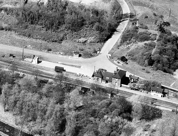 Clare station and cattle dock in April 1953. The main entrance to Clare station and goods yard is along Station Road which is seen coming in from the north. Turning right into the goods yard there is a weighbridge and an adjacent weigh office. To the west of the main station building the cattle dock is seen with sidings running both sides. Cattle pens are seen at the west end of the dock. The 'H' shaped station building is seen with a canopy between the two end wings partially filled in with wooden panels. The down side waiting shelter can be made out on the other platform. To the east of the station building the Clare signal box is seen on the platform. Click here to see an enlarged version of this photograph.
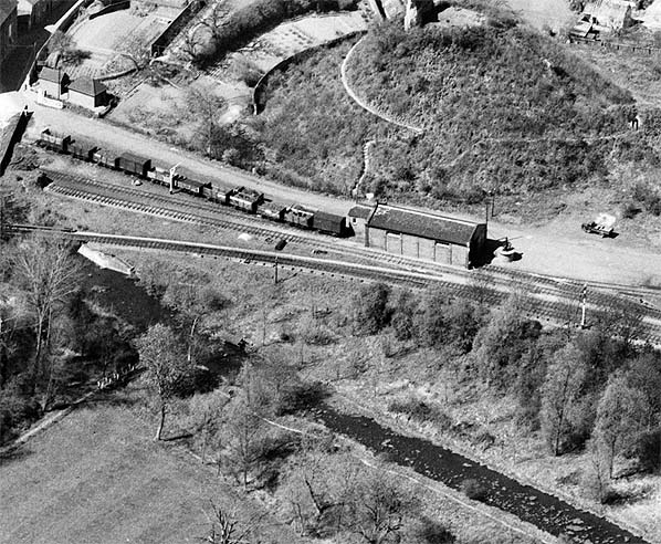
Reproduced with the kind permission of Simmons Aerofilms Ltd 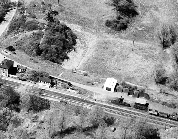 Clare coal yard is at the east end of the station and comprises a single siding; seen here in April 1953 with loaded coal wagons and coal bins to the rear. Two large wooden storage sheds are also seen. Within a few years these sheds would be demolished and the siding realigned. Click here to see an enlarged version of this photograph.
Reproduced with the kind permission of Simmons Aerofilms Ltd
old8.jpg)
An eastbound passenger train waits at Clare station in July 1956.
Photo from John Mann collection old9.jpg) Clare station looking west c1959. The gents' toilet is seen at the east end of the building. The station building is 'H' shaped with a glazed canopy between the two wings. It is difficult to make out at this resolution but there is a totem sign fixed to the wall, below head height, just to the left of the canopy. It appears to be the only totem on the up platform.
Photo from John Mann collection old6.jpg) old3.jpg) In January 1967
The Stour Valley line was used as the location of a TV commercial
made by Shell petrol. A Vauxhall Cresta was used by the petrol company
to prove their new mileage ingredient was more economical. Shell used
a railway line because gradients were negligible. The Stour Valley
was chosen because it was closed on a Sunday. For full details see
the Railcar
Association web site.
Photo by Mary Cowle old7.jpg) Looking east from the goods yard towards Clare station in February 1967. At this time the yard had been closed for five months but all the sidings appear to be in place. The cattle dock can be seen through the goods shed. An eastbound DMU stands in the up platform; the service is now in
its last few weeks. old10.jpg) A two car Cravens DMU (E56440 + E51279) with the M. & G.N.J.R.S. 'The East Anglian Branch Farewell Railtour' is seen at Clare station on Saturday 4 March 1967. This was the last day of public service at Clare although not the last train. There was a Sunday service over the line but no
trains stopped at Clare. Photo by Chris Totty old11.jpg) One of the blue BR Eastern Region running in boards on the down platform in March 1967. Photo by Chris Totty Click here for Clare Station Gallery 2:
 Home
Page Home
Page
|

 The station layout is shown on the 1904 1:2,500 OS map reproduced below. The goods yard was on the up side with one siding to the east serving a coal depot. There were also two timber storage sheds here. To the west side there were several sidings: one passed through the goods shed while another passed in front of it. From these sidings two further sidings ran east, either side of a cattle dock behind the west end of the platform. Cattle pens were sited on the dock. The goods yard could hold up to 50 wagons. No crane is shown on the map although the Railway Clearing House Handbook of Stations for 1904 lists a 1 ton 10 cwt capacity crane and this is shown at the east end of the goods shed on later maps.
 The signal box was destroyed by fire in the late 1960s and subsequently demolished. In June 1972 Clare Castle Country Park opened. The park comprised the thirteenth century motte and bailey castle earthworks and remains of the keep on 15 acres of land donated by Anthony de Fontblanque and 4½ acres of railway land with the station and goods yard on the inner bailey, bought for £10,000. The park is crossed by the Stour Valley Path. The goods shed was adapted as the country park visitors’ centre with the park ranger living in the station house. The goods shed still has its loading dock, and the roof is largely intact and consists of six trusses with a tie beam, principal rafter and king post. A short section of track was laid outside the goods shed. A goods wagon is kept in the shed and is brought out during the summer. In 2004 the 1865 type crane at nearby
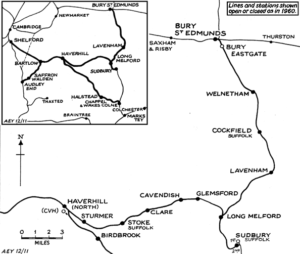
 The line from Marks Tey to Sudbury opened on 2.7.1849 and on
1.1.1854, the Eastern Counties Railway (ECR) took over the Eastern
Union Railway. In July 1860, the newly formed Sudbury & Clare
Railway Company revived the 1847 Act and by a new Act of July
1860 they were empowered to build a line from Sudbury to Clare
via Melford. However, as soon as the powers were obtained, the
ECR took over and immediately sought extended powers to build
from Sudbury to Shelford on the London-Cambridge main line, plus
a branch from Melford to Bury St. Edmunds. At the same time, the
Colne Valley Company, anxious to be independent from the ECR,
sought approval for a line to Cambridge.
The line from Marks Tey to Sudbury opened on 2.7.1849 and on
1.1.1854, the Eastern Counties Railway (ECR) took over the Eastern
Union Railway. In July 1860, the newly formed Sudbury & Clare
Railway Company revived the 1847 Act and by a new Act of July
1860 they were empowered to build a line from Sudbury to Clare
via Melford. However, as soon as the powers were obtained, the
ECR took over and immediately sought extended powers to build
from Sudbury to Shelford on the London-Cambridge main line, plus
a branch from Melford to Bury St. Edmunds. At the same time, the
Colne Valley Company, anxious to be independent from the ECR,
sought approval for a line to Cambridge.
 After the war excursion trains returned once again to Clacton
and other seaside resorts. Changes came when British Rail announced
a modernisation programme. From 1.1. 1959, steam was scrapped
and replaced by diesel Railbuses and Multiple Units. Although
passenger traffic showed some improvement, it was not enough to
overcome the increasing losses being incurred.
After the war excursion trains returned once again to Clacton
and other seaside resorts. Changes came when British Rail announced
a modernisation programme. From 1.1. 1959, steam was scrapped
and replaced by diesel Railbuses and Multiple Units. Although
passenger traffic showed some improvement, it was not enough to
overcome the increasing losses being incurred.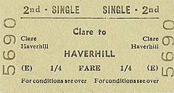 The Cambridge to Sudbury Rail Renewal Association was formed
in 1995 to campaign for the restoration of the rail service between
and Sudbury and Cambridge. A full feasibility study was commissioned
in 2003 which showed that 73.2% of people surveyed would use the
railway. It was then decided to form a limited company to present
a more professional approach.
The Cambridge to Sudbury Rail Renewal Association was formed
in 1995 to campaign for the restoration of the rail service between
and Sudbury and Cambridge. A full feasibility study was commissioned
in 2003 which showed that 73.2% of people surveyed would use the
railway. It was then decided to form a limited company to present
a more professional approach.