Barnham Heath is a largish area between Barnham and Thetford part of which is still used for military training (Barnham Camp) and part of which is in private hands. There were two areas of the heath related to chemical weapons (mustard gas). The north site later became the 94 Maintenance Unit Nuclear Bomb Store and is now the Gorse Industrial Estate. The south site (south of the Barnham - Elvenden road), most of which was sold to the Elvenden Estate, was the site of the Little Heath Forward Filling Depot (FFD) and the three 500 ton bulk storage pots. This area comprises 1.7 acres and is crossed by a public right of way. The depot remained in MOD hands until April 1997 when it was handed over to the Defence Land Agent prior to sale.
The chemical name for mustard gas is dichlorodiethyl sulphide. At normal temperature it is a liquid, rather like diesel oil in appearance with a smell similar to garlic. It was used as a war gas because it is a ‘vesicant’ which means that contact with the liquid or vapor will cause blisters on the skin similar to third degree burns and if inhaled will cause serious damage to the lungs which will almost inevitable cause death. Its value in conflict was due to the fact that it does not decompose and will remain active in the ground or on materials it has contaminated for many days, in fact months or even years. This makes it completely different from the effects of chlorine or phosgene which, as gasses, are readily dissipated in the atmosphere.
It is comparatively easy to manufacture given a supply of raw materials which are mostly readily available chemicals and there are really only two effective ways of decontaminating; one is by the application of bleaching powder and the other by burning.
There are two types of mustard gas, Runcol (HT) which is produced by the method used by the Germans in WW1 by reacting thiodiglycol (known as ‘Syrup’ during the war) with hydrochloric acid and Pyro (HS) which is produced by combining ethylene with sulphur dichloride. Runcol was more expensive to manufacture and was not suitable for tropical storage.
Chemical warfare was developed in Germany in 1915 but the allies were quick to respond with their own production and in the later years of WW1 mustard was used by both sides. Although chemical weapons were banned by the Geneva Protocols of the 1920’s this did not stop their use by the Japanese in 1931 and the Italians in 1935 and even Churchill supported their deployment. With the coming of WW2 it was decided that the manufacture of chemical weapons should once again be undertaken to act as a deterrent as Germany would almost certainly be producing them.
Mustard gas was produced by ICI from 1938 at their Randle plant on Wigg Island near Runcorn in Cheshire and initially weapons were filled or ‘charged’ at Randle. It soon became clear that a safe storage facility was required for these weapons and in 1939 work started building the Valley Works at Rhydymwyn in North Wales.
In 1941 it was proposed that five forward filling depots (FFD) should be constructed and they were ready for use by 1944. The five depots were:
- FFD 1 Little Heath, Suffolk - Under the control of 94 Maintenance Unit
- FFD 2 Melchbourne/Riseley, Bedfordshire - American FFD - Station 572
- FFD 3 Norton Disney, Lincolnshire - Under the control of 93 Maintenance Unit
- FFD 4 Lords Bridge, Cambridgeshire - Under the control of 95 Maintenance Unit
- FFD 5 West Cottingwith/Escrick, Yorkshire - Under the control of 80 Sub Maintenance Unit
The layout of the five FFD’s is similar, the major buildings being storage sheds for empty cases, a bonding building, a charging building(s) where the cases were filled; these buildings were linked together by covered ways . There were also underground storage tanks knows as ‘pots’ where the chemical agent was stored; at Little Heath there were three of them, each holding 500 tons of chemical agent. At Little Heath there were two charging buildings and a railway loading dock inside the bonding shed with a short spur from the Thetford - Bury St. Edmunds Railway Line.
No munitions were filled at the site after 1945. Immediately after the war, due to the danger of storing filled munitions over long periods, it was decided to decant agent out of the 65 lb LC (light case) bombs and the spray tanks into storage tanks and dispose of the munitions by incineration followed by dumping.
Agent was decanted into the three large pots capable of holding 500 tons of mustard each.
Decanting and burning of US munitions (1000/115 lb bombs and M47-A2 chemical bombs) left behind also took place. Some barrels (presumably used in the decanting process) were burnt locally and others sent to Risley FFD to be burnt. This activity continued until about 1949 when the storage pot pipework was dismantled.
Stocks of new munitions continued to be stored at the site in case new supplies were needed and in 1946 unspecified quantities of mustard were taken to the Valley Works at Rhydymwyn in North Wales for storage in support of a continuing military requirement.
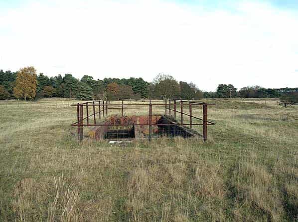
In 1951 Pot A was discovered to have been leaking and the bulk of the material stored in it was transferred to another pot, leaving only about 12 tonnes. In 1953 the decision to remove all the agent and contamination from the area was taken to allow development of the area to take place.
In October 1953 the remaining 12 tonnes in the pot was taken to Randle in a trial run for a large operation to take place in 1954 during which the other two pots were emptied and the contents sent to Randle by train.
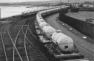
The mustard was loaded into 5 tonne road/rail tankers; 6 trains with up to 25 tankers each were transported. The agent was used to fill some of the ten thousand 1000 lb aircraft bombs at Randle in 1954/5.
All equipment including pipework and pumps was dismantled and the clean parts disposed of as scrap and contaminated material either incinerated or buried in the pots.
Decontamination consisted of treating the entire area with bleach and harrowing surrounding areas to a depth of 18", watering in bleach in layers. Metal and tools were cleaned with carbon tetrachloride, cement and stone with bleach and water. The pots were sealed in December 1954.
Large areas of the Barnham Heath site were declared clear of chemical weapon (CW) contamination in 1954 and vacated by the RAF in 1963. The main part of the site was used for light engineering but the area immediately surrounding the pots remained in RAF hands.
In 1991 the pot roofs were broken down along with 1 metre of wall, the rubble placed in the vessels and the area sealed and covered in compacted clay. Pots A & B were virtually empty at this time, only C having a considerable amount of scrap material inside. Only part of this was examined and decanted into Pot B prior to infilling. The rest was not examined and surrounding soil was not sampled at this time.
In 1995 all three pots were excavated and scrap material removed. Two ground bombs containing mustard were discovered at this time. By September 1996 the site had been cleared and the pots refilled. The remaining land was transferred to the Defence Land Agents prior to sale at the end of April1997.
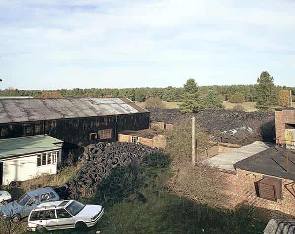
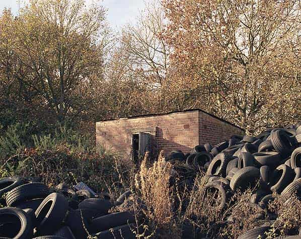
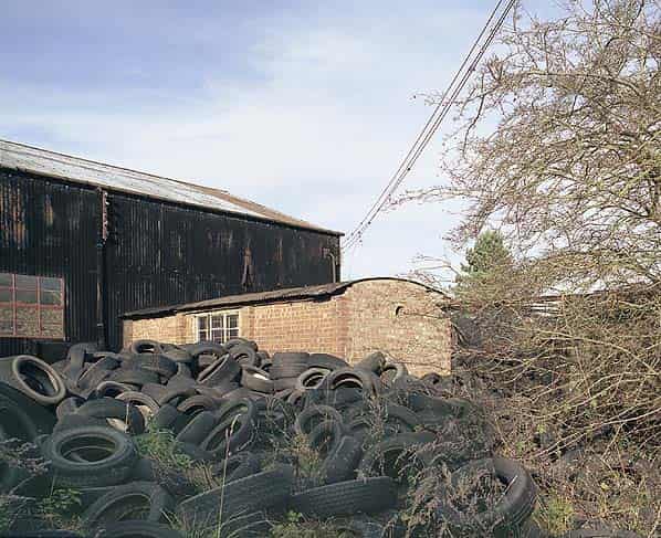
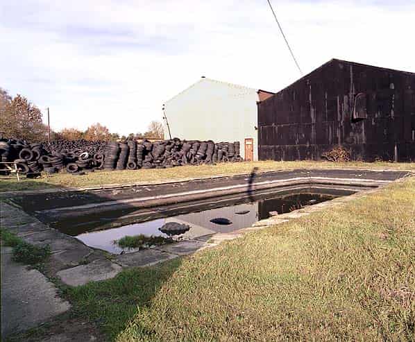
In the late 1990’s the site has been used for the storage and disposal of old tyres; the company eventually went bankrupt and the owner was imprisoned for two months for failing to dispose of the tyres despite a court order a year earlier and for shredding tyres without a licence.
In the February 2002 the site was sold to the East of England Tank Museum who specialise in restoring, preserving and exhibiting historic military vehicles from all over the world. They are hoping to restore many of the buildings and set up a display relating to the history of the site. A major project however, will be the removal of 1,000,000 tyres still stored at the site.
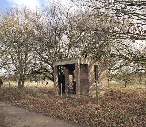
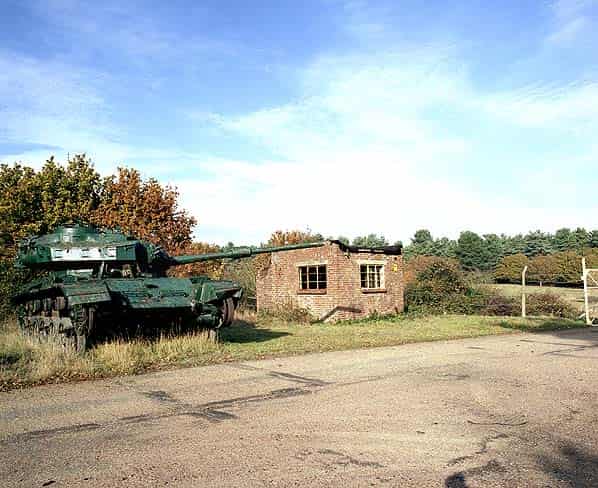
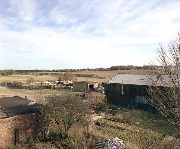
The 1.7 acre site is located at the end of an access road 1 mile south west of the Elveden - Barnham Road; the road is also a public right of way. Half way along the road there is a small picket post on the east side. Just inside the entrance gate there is a dilapidated guardhouse on the right and just past it there is a junction, the road to the left ran along the north side of the three pots and is now the main access to the museum. Straight ahead the road crosses the old railway spur where a short section of standard gauge track is embedded in the concrete.
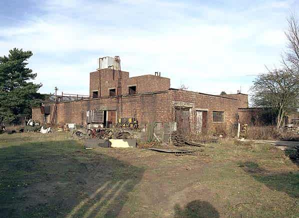
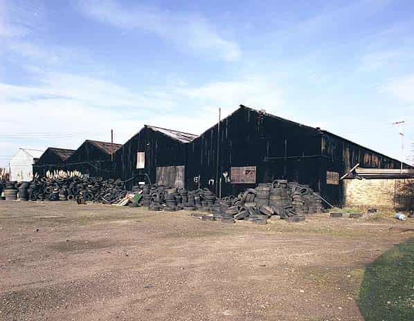
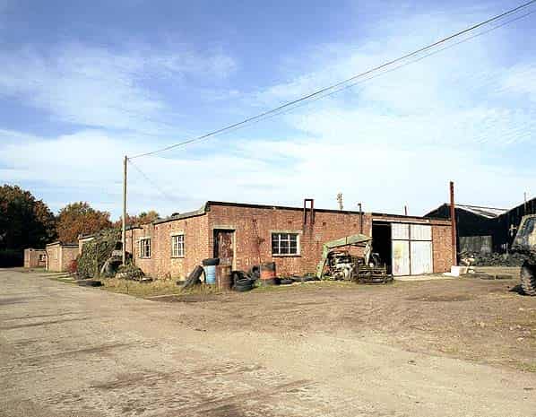
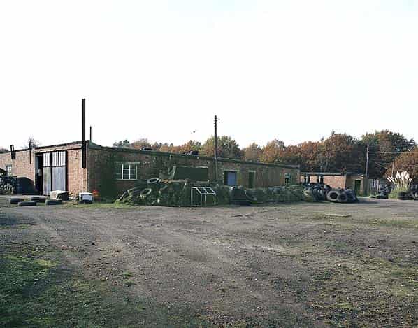
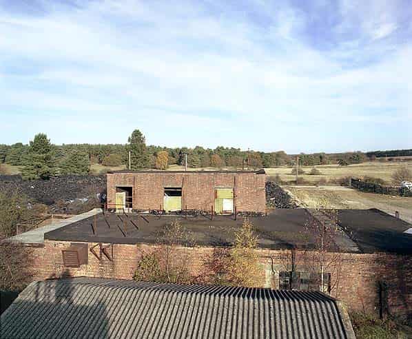
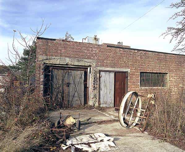
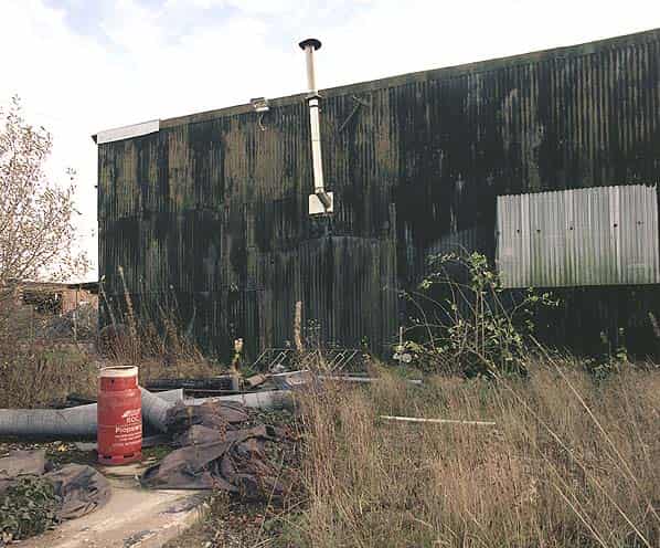
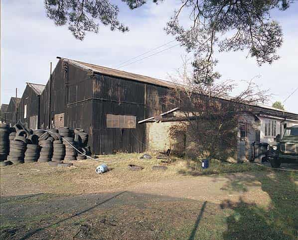
On the right there is a small brick pump house set back from the road and on the left the empty storage sheds which is divided into five bays, each with a hipped roof. Four of the bays are painted black, the western bay is unpainted and the corrugated steel cladding might have been replaced. The storage sheds are all stacked floor to ceiling with old tyres. The brick single storey sub-station is attached to the south east corner of the building but no internal connection to it. It has a brick blast wall protecting the entrance and is divided into two rooms one for the transformer and the other for switchgear. The sub-station is still in use to supplying electricity to the site although the transformer and switchgear are not original. Beyond the sheds there is a brick single storey office which is currently used for storage. The road turns to the left running parallel with the other road as it passes the office.
On the corner, in the undergrowth on the right hand side there is a set of concrete steps up to a series of nissen hut bases in woodland at a higher level. These date from WW1 when the site was part of a tank range. The nissen huts are shown on a 1940’s plan of the site and are labeled ‘to be demolished’.
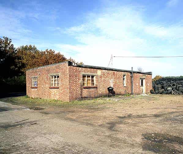
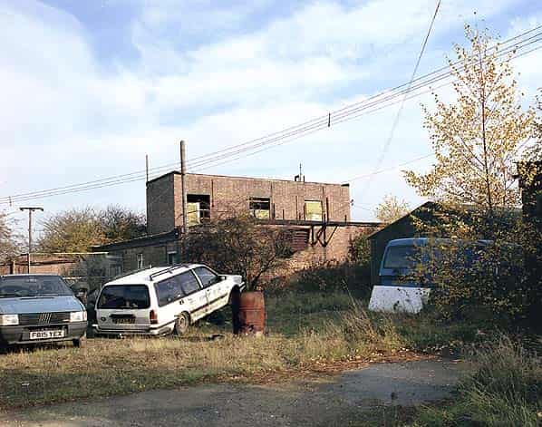
The next building on the left is of similar size to the office and was the mess room. It was originally divided into two separate areas, toxic and non toxic. The next building on the left is much larger and housed the decontamination and changing rooms. The building has a number of rooms accessed from a short corridor. The final building on the left was the workshop and store.
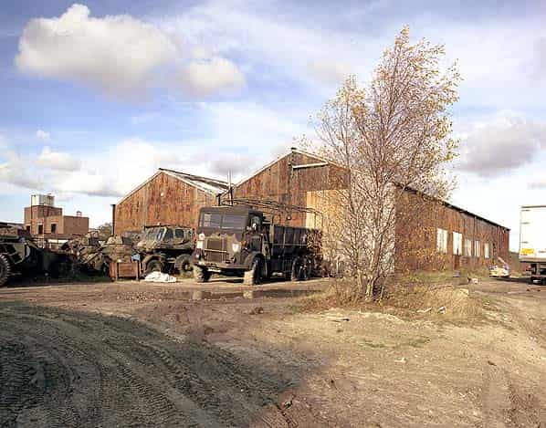
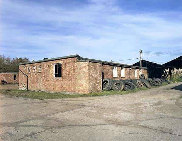
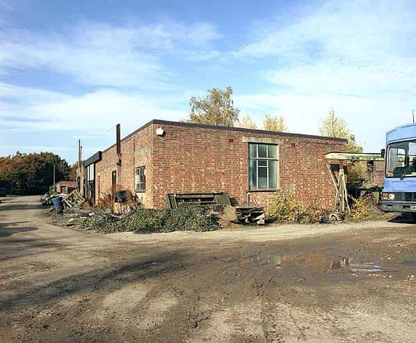
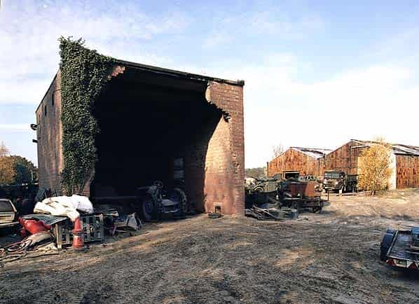
Beyond the workshop the road swings round to the left to the loading dock and bonding building which is a two bay shed of similar construction to the empty storage building. Originally the railway line passed through the building past the loading dock. The door in the west face of the building has been removed and there is no evidence of the railway line on the ground. The door in the east face is still there and there is a short section of standard gauge railway line embedded in the concrete as it enters the building. The shed is currently used as a workshop by the tank museum.
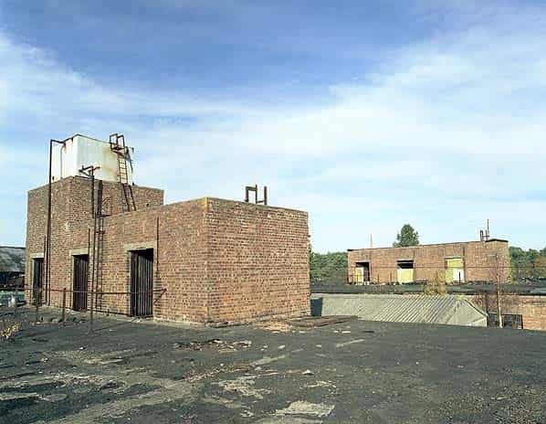
The two charging buildings were located between the bonding building and the empty storage building and were linked to both by a brick built covered way. The covered ways to the bonding building have been removed although there positions are obvious on both buildings. The covered ways to the empty storage building have been partially removed with two short brick stubs protruding from the storage building.
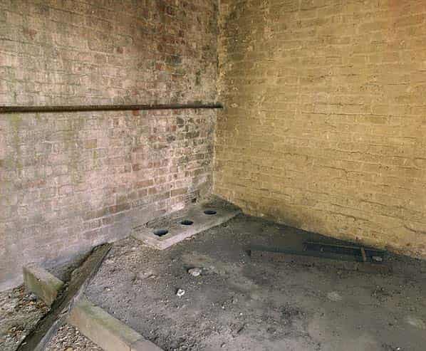
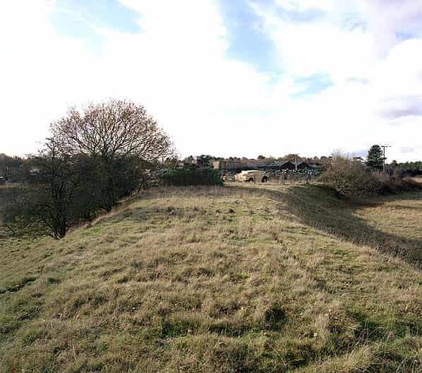
The two charging buildings are similar, the lower floor consisting of one large room with a decontamination room and toilet at one end; there is no internal connection between the two areas. There are three rooms on the roof of each building accessed only by ladder and on the western charging building there is a water tank on top of the three rooms; again accessed by a ladder. There are three holes in the floor that would have taken water from the tank to the ground floor. On the eastern side of the eastern charging building there is a ten foot diameter circular platform raised a foot off the ground; this is the top of an underground emergency water supply (EWS) tank. A rectangular open EWS reservoir is located between the empty storage building and the mess room. The three pots and their instrument houses were located on the eastern side of the site, there is no visible evidence of their existence and much of the area is covered with tyres and shredded tyres.
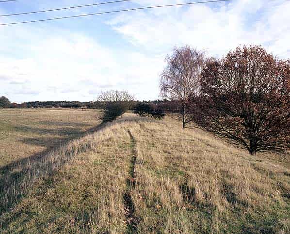
In the field to the east of the main site and outside the inner perimeter fence is the underground mixing tank. There is a raised mounded area in the field with a rectangular brick structure on top that resembles a filter bed. A pipe runs from the main site to this tank and an inspection hatch is covered with concrete slabs. It is unclear exactly what purpose this served but a plan of the Norton Disney FFD shows a network of pipes running to this tank which appears to be a collecting tank for contaminated wash water. The fence posts from the outer perimeter fence can be seen crossing the field.
The railway line diverges from the Thetford - Bury St. Edmunds 400 yards north of the site and is carried on an embankment across the field towards the depot where there is a junction, one branch running into the bonding building and the other running along the eastern perimeter of the site. Close to the entrance gate the railway line slews across the road running parallel with the road for a short distance before crossing the other branch of the perimeter roads terminating behind the entrance guardhouse. The track has been lifted but its position is clearly visible where it slews across the eastern road.
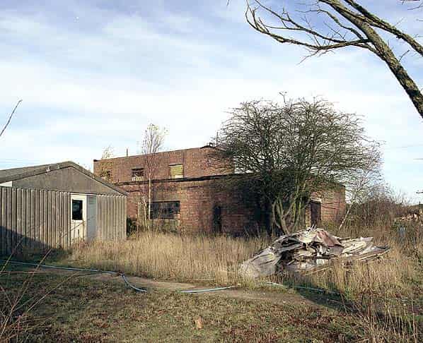
Two other buildings still stand on the site; one is the boiler house which is south west of the bonding building, outside the perimeter road. This is a large brick building now open at is southern end and used by the tank museum as a paint shop. A smaller building stands alongside the railway line a little to the east of the bonding building. It has a vehicle door at each end and opens onto a raised concrete platform at its eastern end. It’s unclear what this building was used for.
The buildings and access road are not shown on any maps until 1968 after which they appear on all editions. The Thetford - Bury St. Edmunds railway line was closed in 1953 and the track has been lifted, its course however is clearly visible in the vicinity of the depot.
Sources:
- Bob Jenner
- David Farrant
- The X Site (Valley Works Rhydymwyn) by Tim Jones ISBN 0 9522755 54
- Declaration for chemical weapns production facilities (UK Government report - United Kingdom of Great Britain and Northern Ireland declaration of past activities realting to its former offensive chemical weapons programme)
- After the Battle No 79, Pages 12 - 33 " Poison Gas manufacture in the UK"