The final stage of the ROTOR Programme (Rotor 3) was to provide radar cover for the north and west of the British Isles which were still exposed to attack and to give low and surface level cover over the Atlantic, the absence of which prevented effective action against low flying enemy aircraft. Three new CEW stations were to be built at Aird Uig, Faraid Head and Saxa Vord equipped with Type 80 Mk 2 and Type 13 radars. The new CEW operations buildings were to be above ground, heavily built and designated R10, similar in internal layout to the underground R1 bunkers.
Rotor 3 included five new Chain Home Extra Low (CHEL) stations equipped with Stage 1 radar equipment to enable detection and tracking of low flying aircraft. (Stage 1 comprised Type 7 Early Warning [E/W] GCI, Type 14 E/W search radar E/W or Fighter Control [CEW station], Type 13 H/F and a Type 15 [mobile Type 7] - radars from this list were installed as required) The proposed stations were at Kilchiaran, Murlough Bay, Prestatyn, Snaefell and West Myne (demolished). These were to be heavily built operations blocks, designated R11; the above ground version of an R2 bunker.
Two new GCI stations were also proposed as part of the Rotor 3 programme, each equipped with a Type 80 radar and R8 ops block. One at Ballywooden (Killard Point) in Northern Ireland and the other at Wick on the Scottish east coast. It was hoped that The ROTOR 3 programme would be complete by 1957 and all technical aspects were classified as ‘Super Priority’. Until they were completed arrangements were made to use mobile equipment in an emergency.
The ROTOR 3 programme necessitated some changes in the Control and Reporting organisation. The CEW stations at Aird Uig, Saxa Vord and Faraid Head and the Chain Home stations at Sango and Netherbutton would come under a new Sector to be known as the Sector of the Isles with an SOC to be established at Inverness (not built). Additionally a new sub-sector of Western Sector was to be established in Northern Ireland to control the air defence units in the area including the new GCI at Killard Point, the existing CH station at Castle Rock and the new CH station at Murlough Bay.
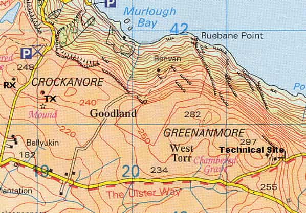
The site chosen for RAF Murlough Bay (Rotor code URB) was a green field site on a plateau overlooking the sea one and a half miles south west of Murlough Bay on the Antrim coast in Northern Ireland. An above ground R11 technical block was chosen because of the adverse weather conditions; a prefabricated R8 SECO block would have been the preferred option. Two radars were to be provided, one Type 14 Mk. IX search radar on a gantry and one Type 13 Mk. VII height finder on a plinth. A standby set house was to be located alongside the technical block. The station was to be equipped with six 60A consoles, one 61 console and two video map un its. The proposed completion date for the station was April 1956.
A ‘small’ VHF transmitter block with a 90' tower was to be built at ID191413 with a ‘small’ VHF receiver block with a 90' tower at ID187415 at Crockanore one and a half miles west of the technical site. There were to be no married quarters or camp with personnel being billeted in hotels in Ballycastle.
Despite the large outlay, the station had a very short operational life being reduced to inactive status by 1958.
RAF MURLOUGH BAY TODAY
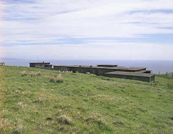
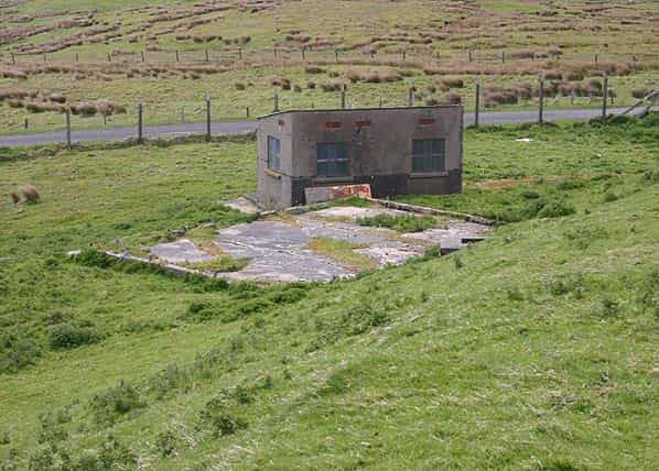
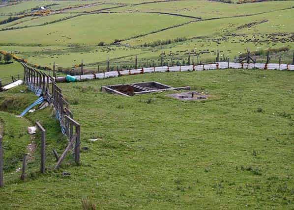
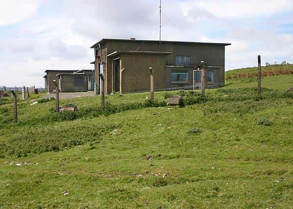
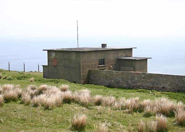
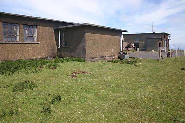
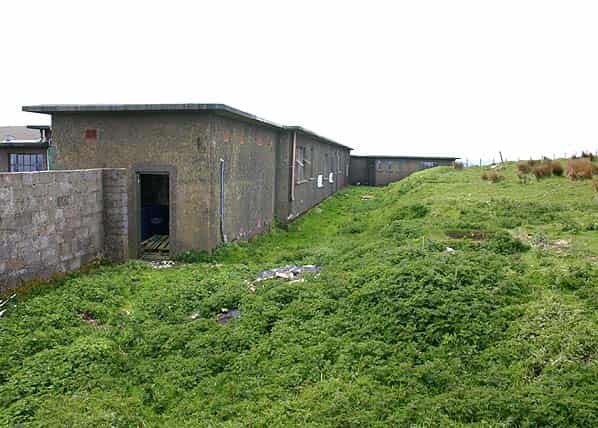
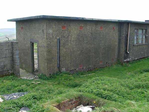
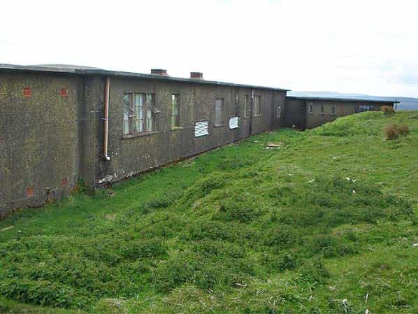
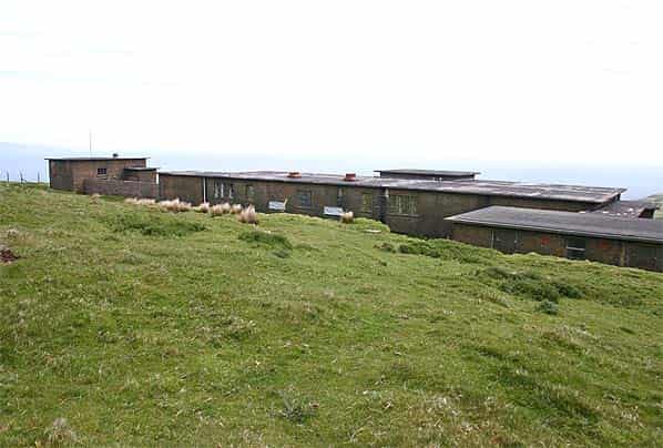
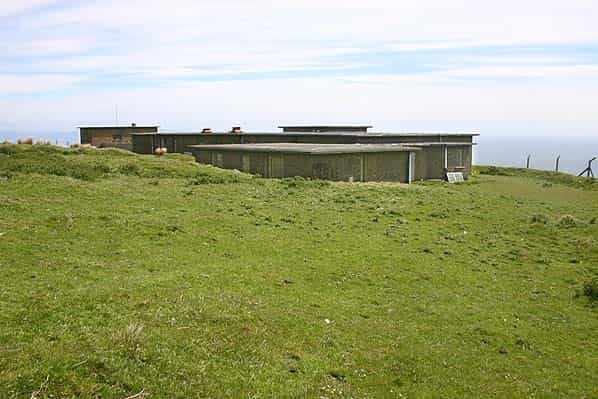
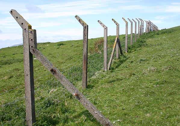
The technical block at RAF Murlough Bay is located half a mile inland from the Antrim coast at a height of 290 metres with the land dropping off steeply towards the sea. A steep access road runs north from Torr Road to an artificial plateau excavated below the highest point. The entire hill was surrounded by chain link fencing running down to the road, although the fencing has now been removed all the concrete fence posts remain.
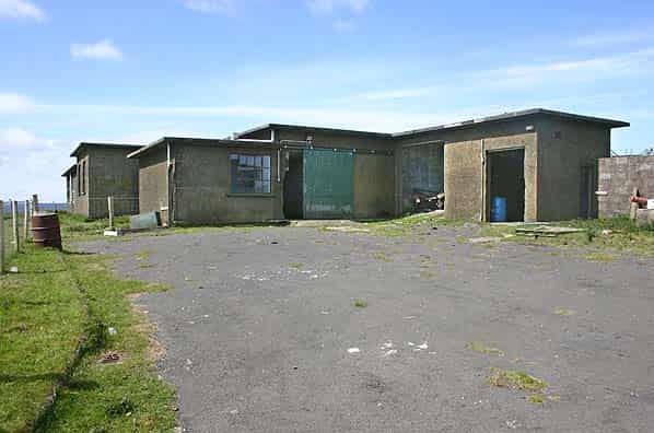
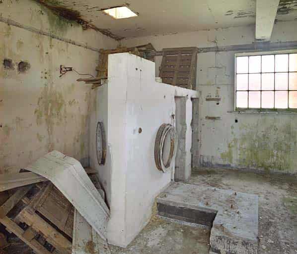
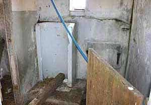
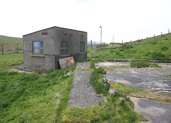
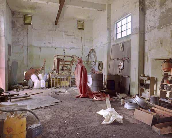
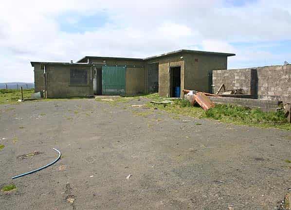
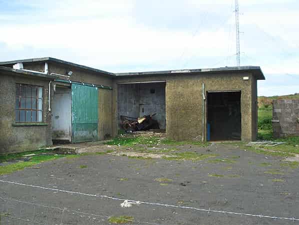
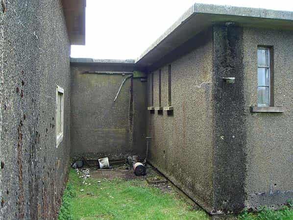
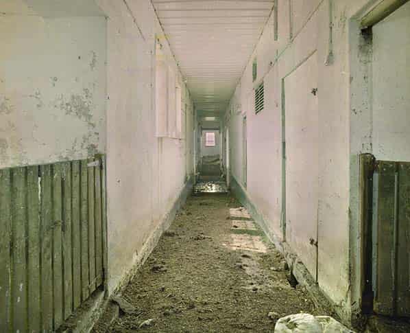
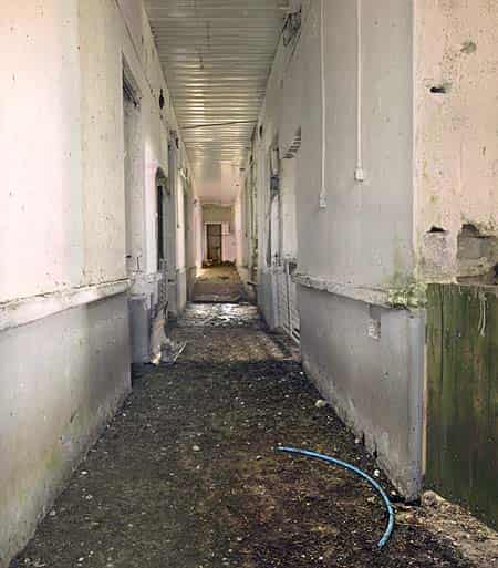
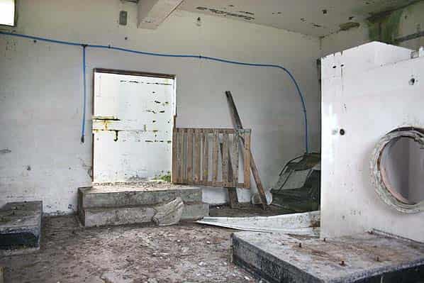
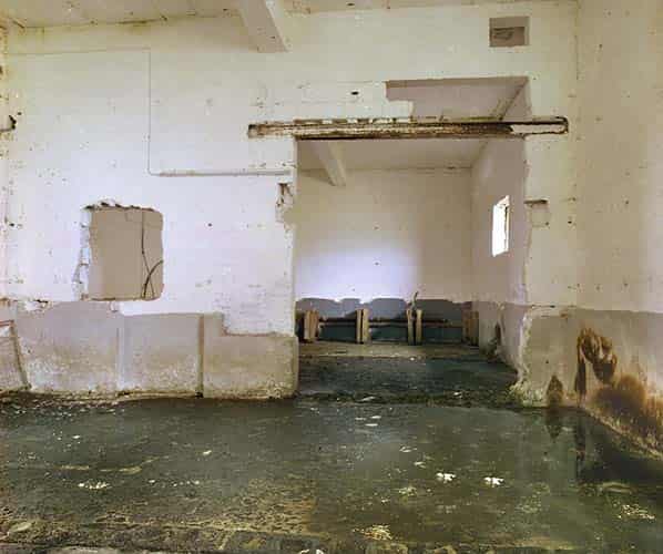
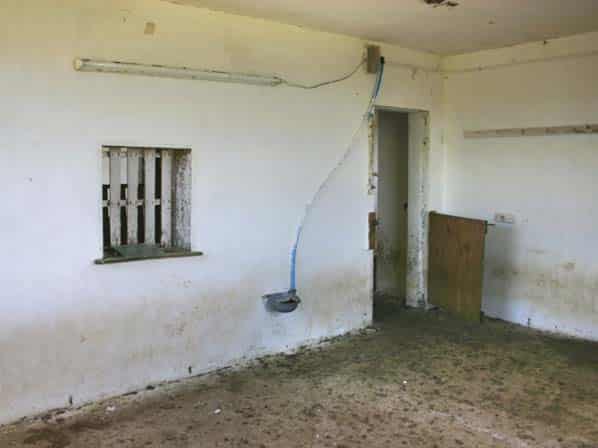
Externally, the R11 technical block is in fair condition with open doors and windows, many with their glass still intact; it has now been put to agricultural use. Internally the building has been almost completely gutted; the false teak flooring in the spine corridor and all the rooms has been removed. As built all the cables were sited beneath this floor which was raised approximately 3' above the ground floor throughout much of the building. Within the main part of the building only the air conditioning plant room does not have a false floor with steps down from the raised corridor.
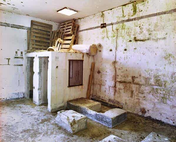
In this room all the plant and switchgear has been stripped out leaving four small brick built rooms that held banks of filters. A number of concrete mountings and engine beds are still in situ.
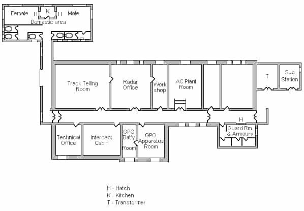
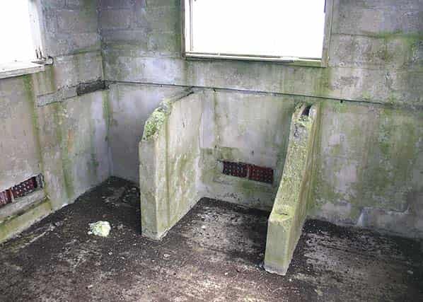
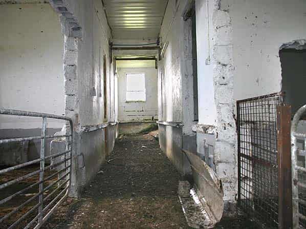
The domestic rooms are located at the north end of the building, at the end of a short side corridor. This area comprises male and female toilet cubicles and a male and female rest room, each with a serving hatch into the tiny kitchen. The kitchen like the rest of the building has been completely stripped of its fixtures and fittings; the serving hatches are still there but one has been boarded up. A single male urinal can still be seen in the toilet. This part of the building has a solid concrete floor. This part of the building has been adapted for animals with hoses and drinking troughs. At the south end of the main spine corridor, close to the entrance is a guard room with a hatch into the corridor, contained within this is an armoury and store room; these rooms also have a solid concrete floor. A wing at the east end of the building housed a sub-station but again this has been stripped with external doors removed.
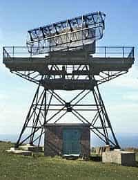
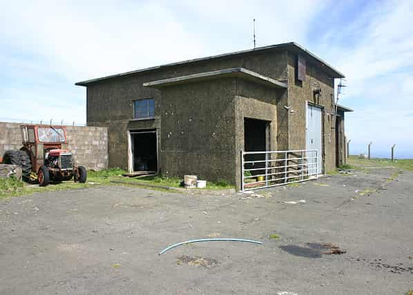
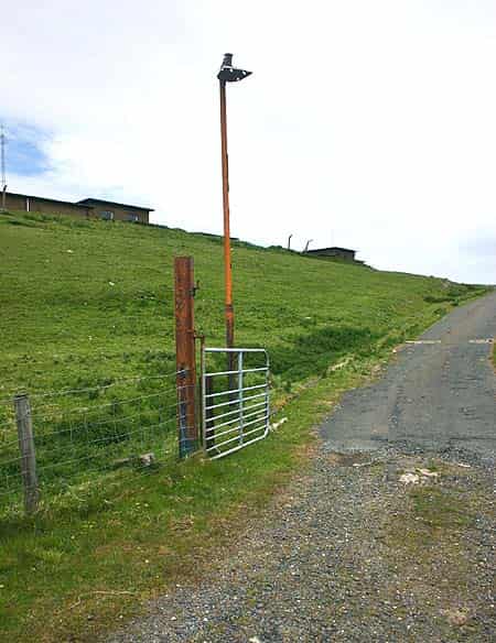
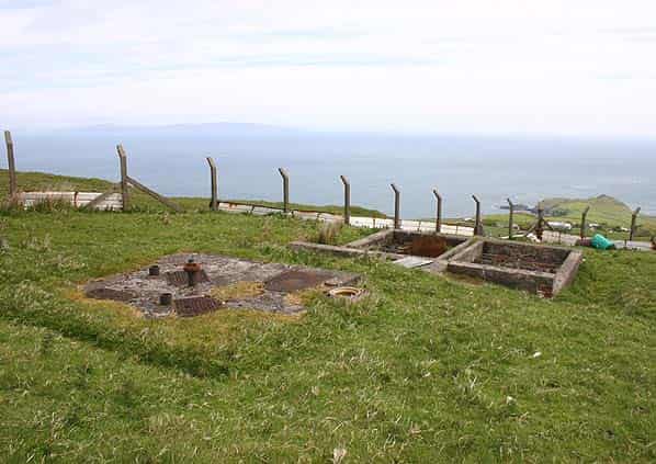
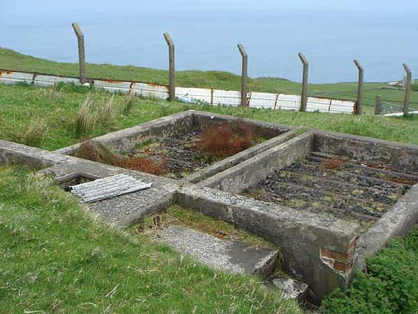
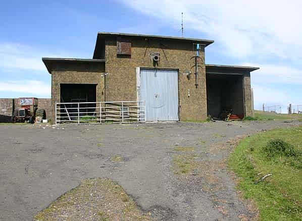
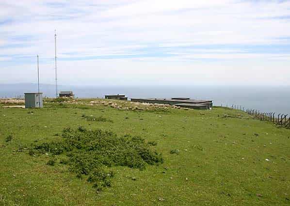
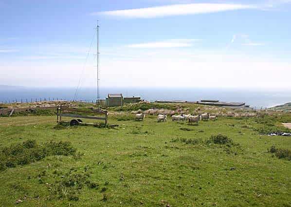
A single brick radar plinth with four concrete blocks around it still stands on the hilltop above the technical block. The blocks would have supported a 25' gantry for the Type 14 search radar above the plinth; there is no evidence of a second plinth for the Type 13 height finder.. The standby set house is sited at the east end of the technical block again this has been stripped of original fixtures and fittings and put to agricultural use. A girder running the length of the building at ceiling level would have been for a movable hoist. The building has two wings from which there is no access to the main part of the building; one of these has been fitted out as an office and/or domestic use with furniture, fridge, cooker, sink etc..
Two modern radio masts are now sited on the hilltop overlooking the technical block and within the original Rotor enclosure.
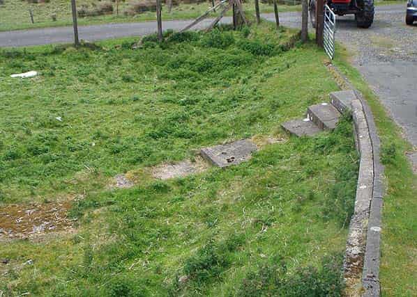
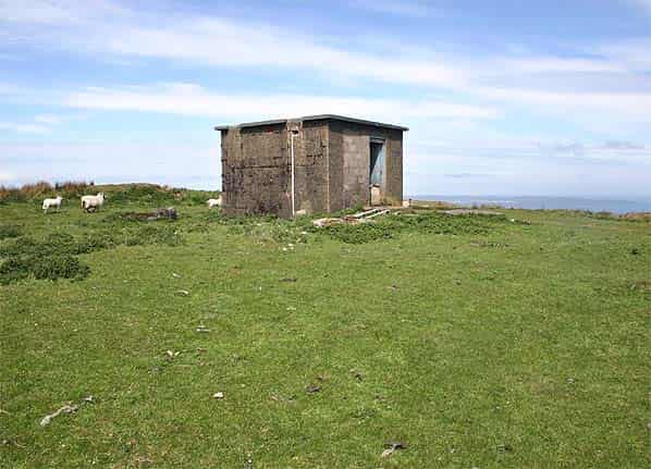
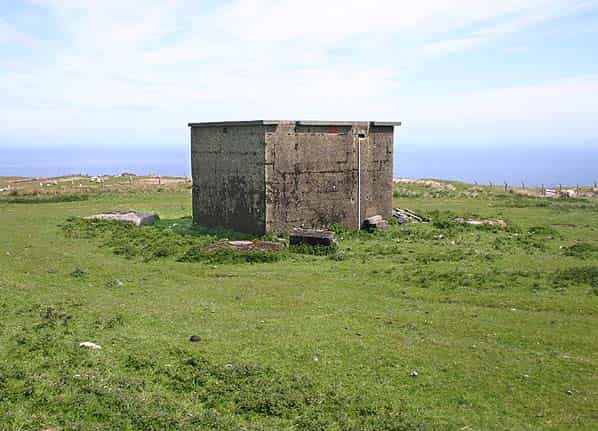
Close to the road, concrete steps lead down to the base of a demolished building, which was the guardhouse. A smaller extant building alongside was for the police dogs. Internally this building has a number of half height partition walls which was the dog food preparation area. The filter beds for the sewage works can also still be seen close to the boundary.
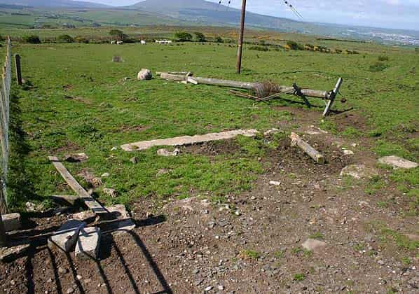
The VHF receiver block was located on a field boundary 100 yards west of a minor road at Crockanore, one and a half miles west of the technical site. Although the building has been demolished some fence posts and foundations can still be seen. The VHF transmitter block was located on a hilltop on the east side of the same road; no evidence of which remains.
Those members of Subterranea Britannica taking part in this visit were Nick Catford, Bob Jenner and Keith Ward.
Sources:
- Bob Jenner
- Keith Ward
- PRO File Air 8/1630
- A view of Air Defence Planning by R H G Martin 2003 ISBN 0-954601 7-0-X